Yorkshire Canals 2001 (Page 1)
Sunday 7 October - Calder & Hebble Navigation
We picked up our boat ("Worcester") from Sowerby Bridge in West
Yorkshire on Saturday afternoon, and travelled down the Calder & Hebble Navigation,
stopping just east of Elland for the night.
Sunday began pleasantly, though gradually clouded over, and it rained in
late afternoon.
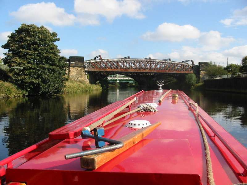
The Calder & Hebble consists of a number of artificial cuts varying from half a mile
to six or more miles, bypassing parts of the River Calder, between which the navigation is
the river itself. Here we are on the river, travelling east.
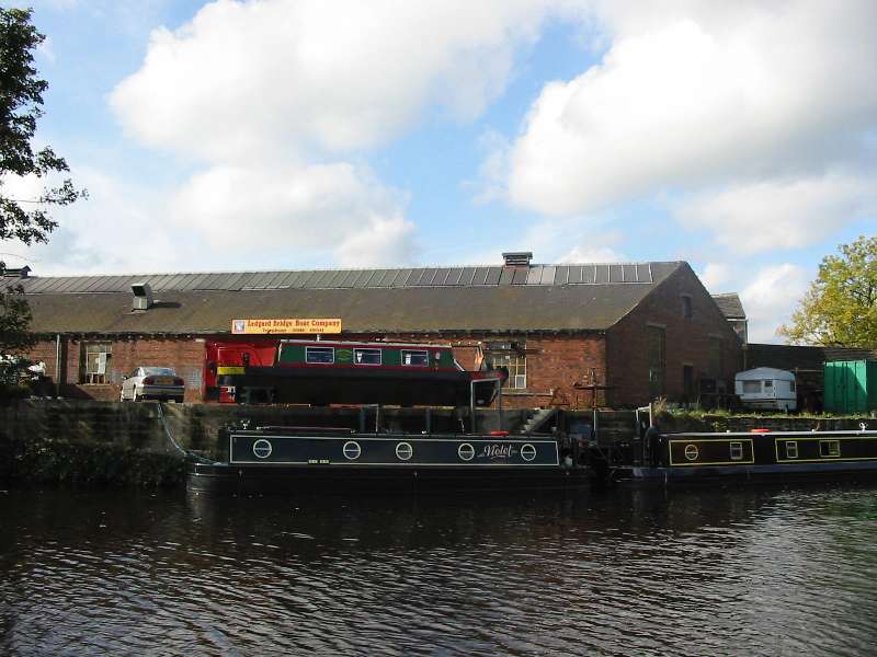
An interesting juxtaposition of boats.
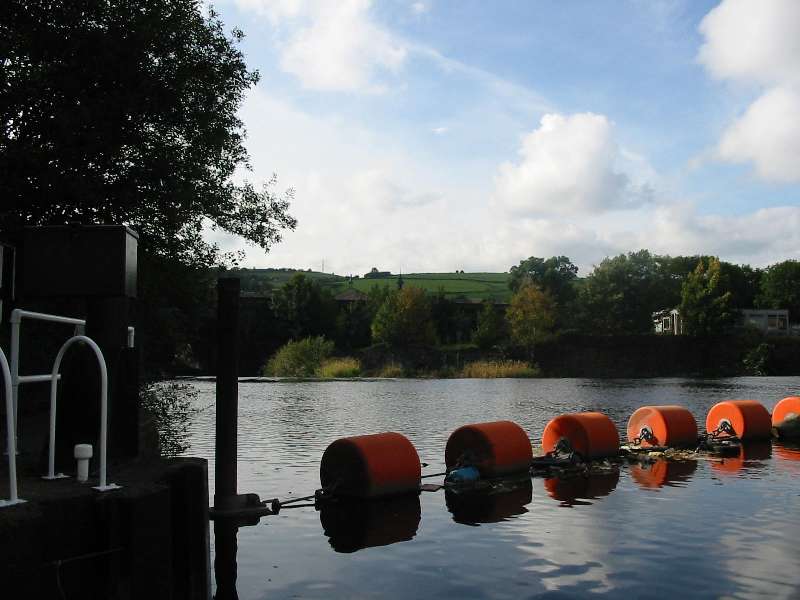
Greenwood wier, between Mirfield and Dewsbury. Each wier is protected by a string of these
orange cylinders. The artificial cut running to the left of picture is protected from
rising river levels by a flood lock, the gate of which is partly visible on the left - the
gates are normally left open top and bottom, but when the river rises, the gates are shut
to maintain the water level inside the manmade length.
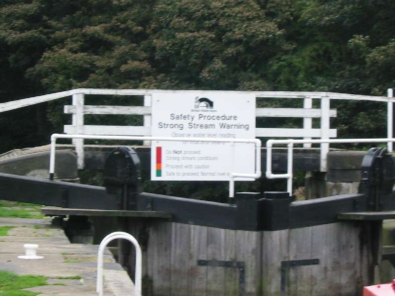
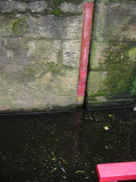
At the tail of each lock which leads from an artificial cut back onto
the river, there is a flood warning board (above), together with a level indicator (below)
- fortunately this one shows green, allowing us to proceed.
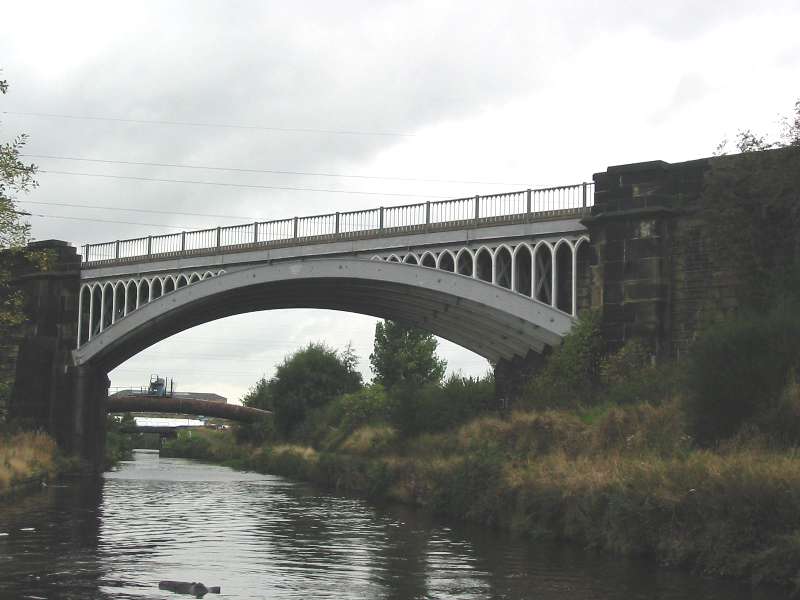
The handsome 1847 cast-iron span of the London & North Western Railway crossing the
Thornhill cut, which bypasses a long loop of the Calder, the river itself passing through
Dewsbury.
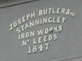
The bridge records that it was built by Joseph Butler (1797-1870) who founded the
Stanningley Iron Works, near Leeds, the buildings of which still stand.
We moored for the night south of Horbury, just west of Calder
Grove, with heavy rain falling through much of the night.
|