 by
by In which: the weather is glorious ● the marshes are flooded ● there is a mixture of life and death ● the delightful Porlock Weir is visited ● Somerset provides a thatched toll-house and the smallest church ● I take an alternative route (possibly) ● I change to a single t-shirt ● I go for a ride on a cliff railway
Date: 11 April 2009
Time of walk: 0905 to 1650
Today’s walking: 25.3 km
Progress along SWCP: 22.6 km
Estimated ascent: 1360 metres
Breakfast was better than yesterday, with good bacon and sausages, and excellent freshly squeezed orange juice, plus a newspaper to read. I left my suitcase in the hall as requested and set off for what was to be the longest walk of the holiday. The bread shop I’d identified yesterday, “open from 9am” was only just being unlocked at 9.05am, with no bread on display, so I continued along to the supermarket I’d got my ice-cream from, but they had no bread left either, so I retraced my steps almost to the B&B to the other shop, where I got some nice bread rolls and some ham.
I then walked back to the marshes along that footpath for the third time. With six gates on it, that means I’d carried out 36 opening and latching operations since yesterday lunchtime – no wonder I was glad to emerge from it.
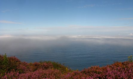
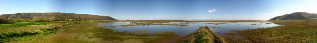
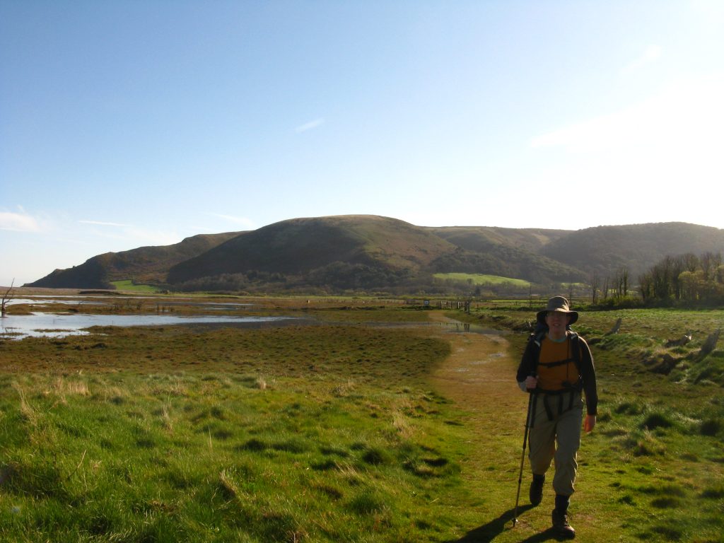
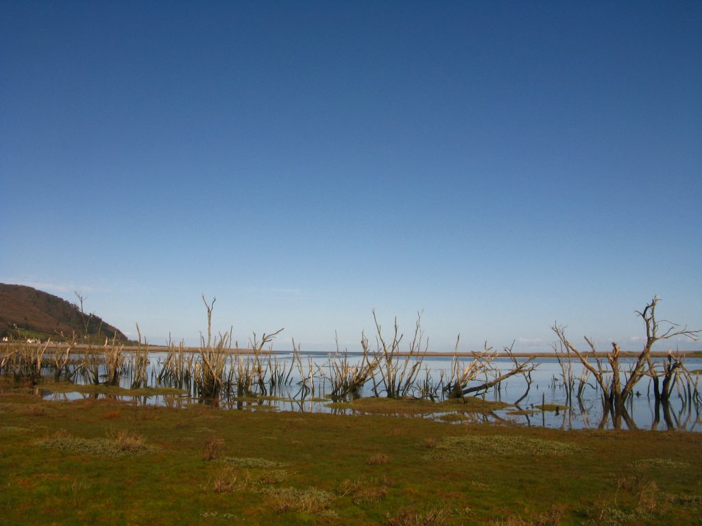
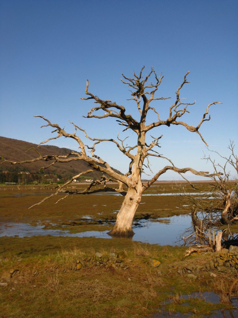
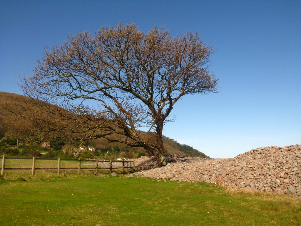
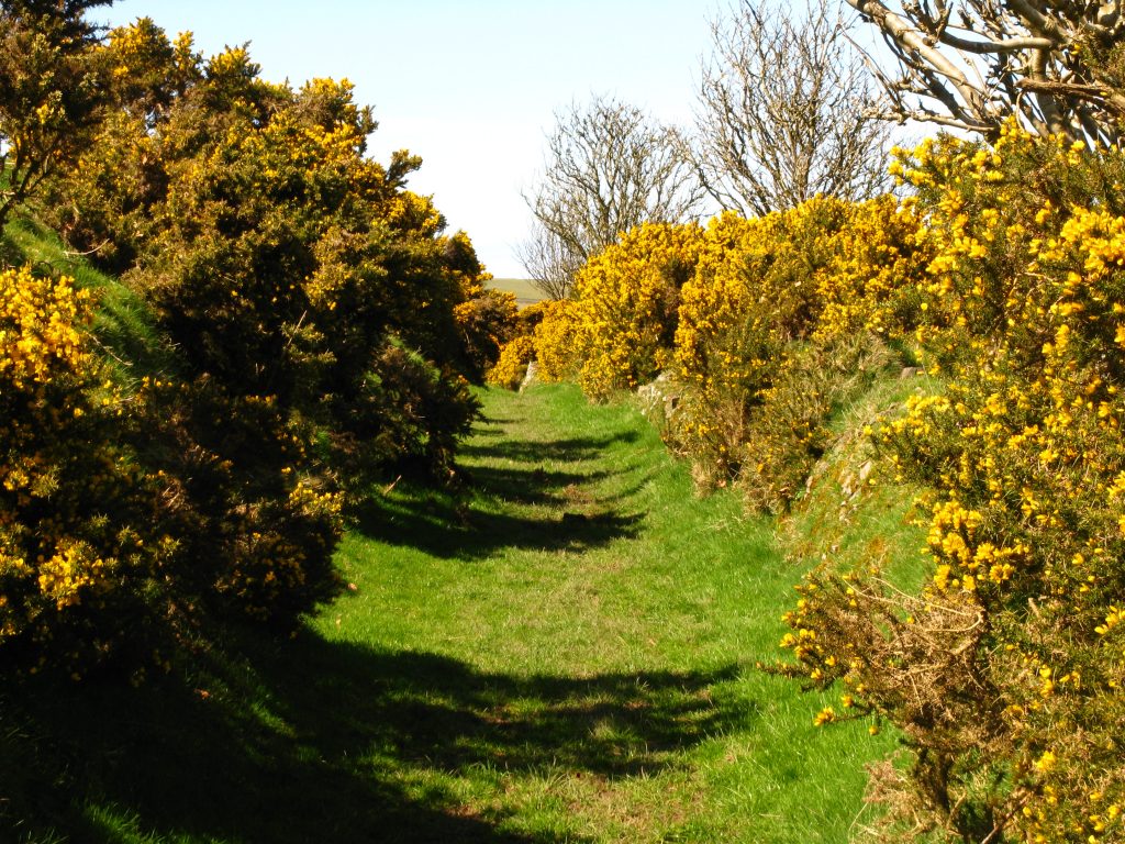
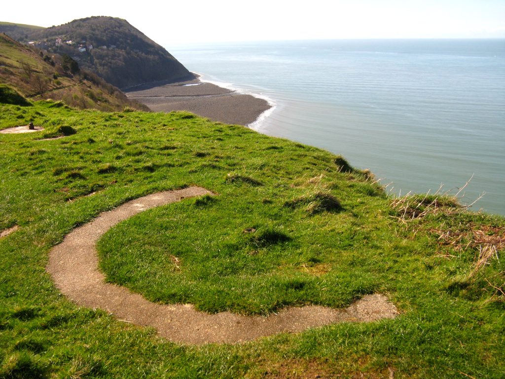
It was a gloriously sunny morning, and the tide was up – my route to the beach yesterday afternoon was completely under water. The Coast Path was just passable, and skirted the edge of the marsh first south-west and then north-west. The marshes were beautiful today, but also rather stark. As well as attracting new wildlife to the salt marsh, they are filled with dead hedges and trees whose bare branches point to the skies as if in a death agony.
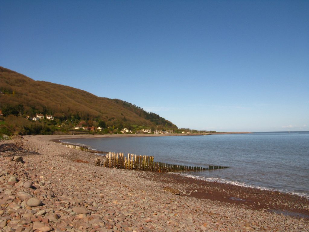
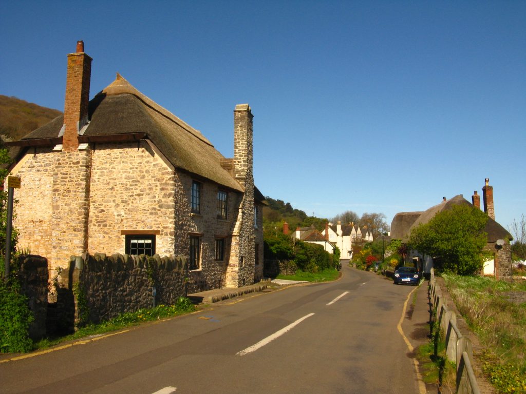
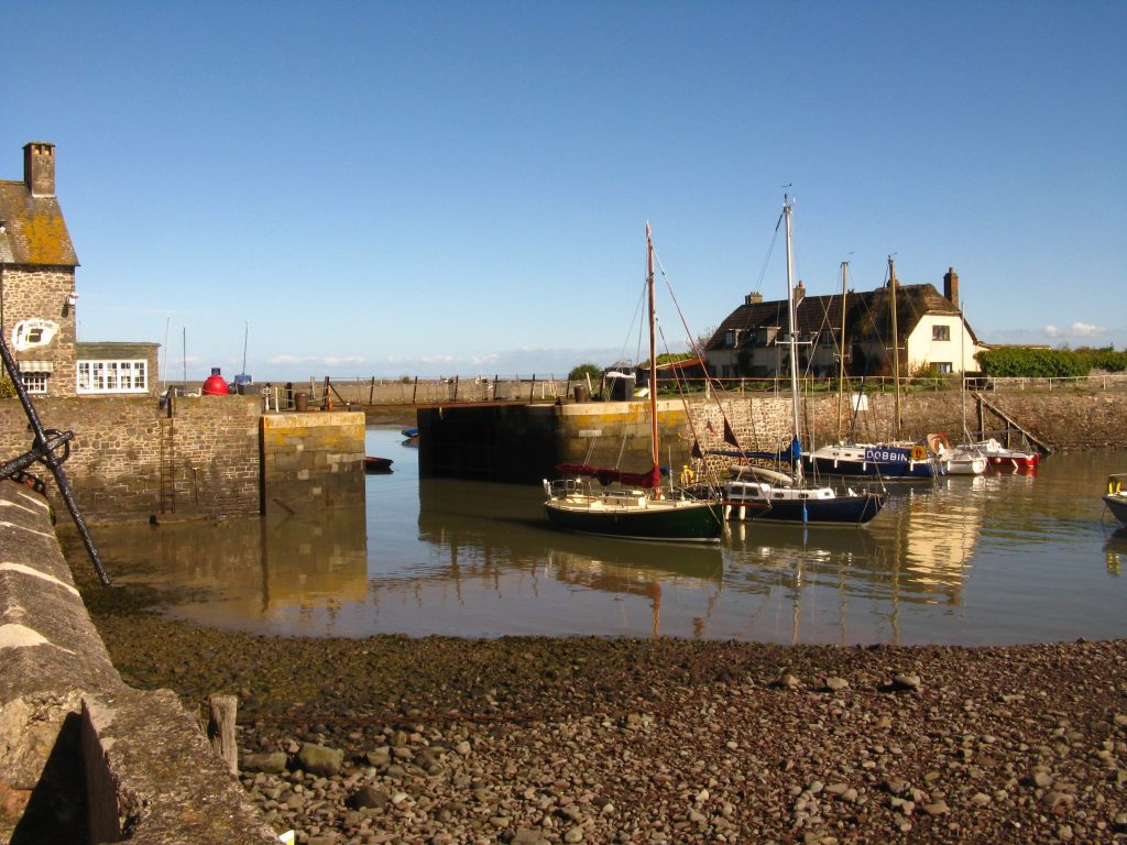
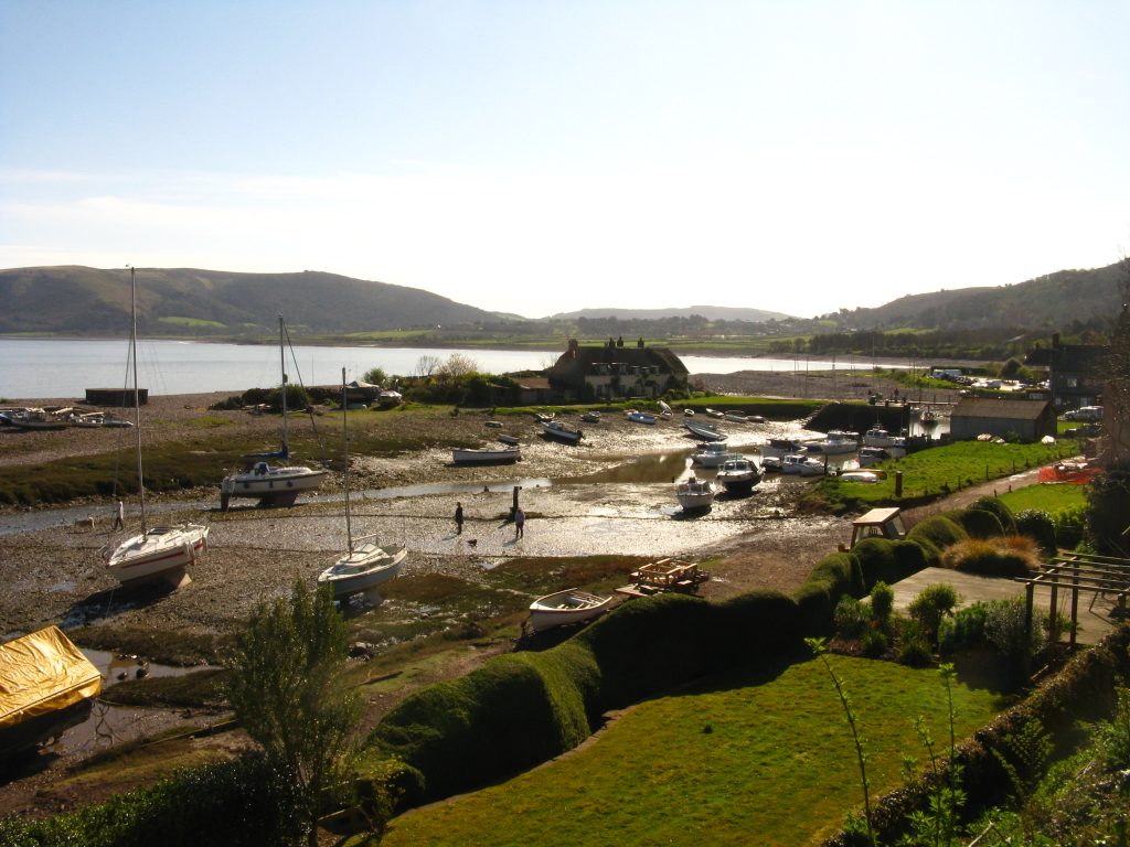
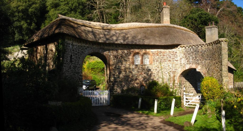
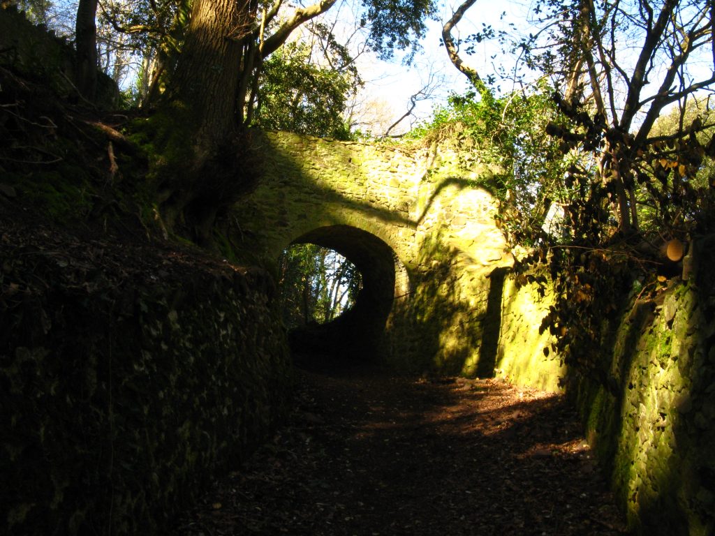
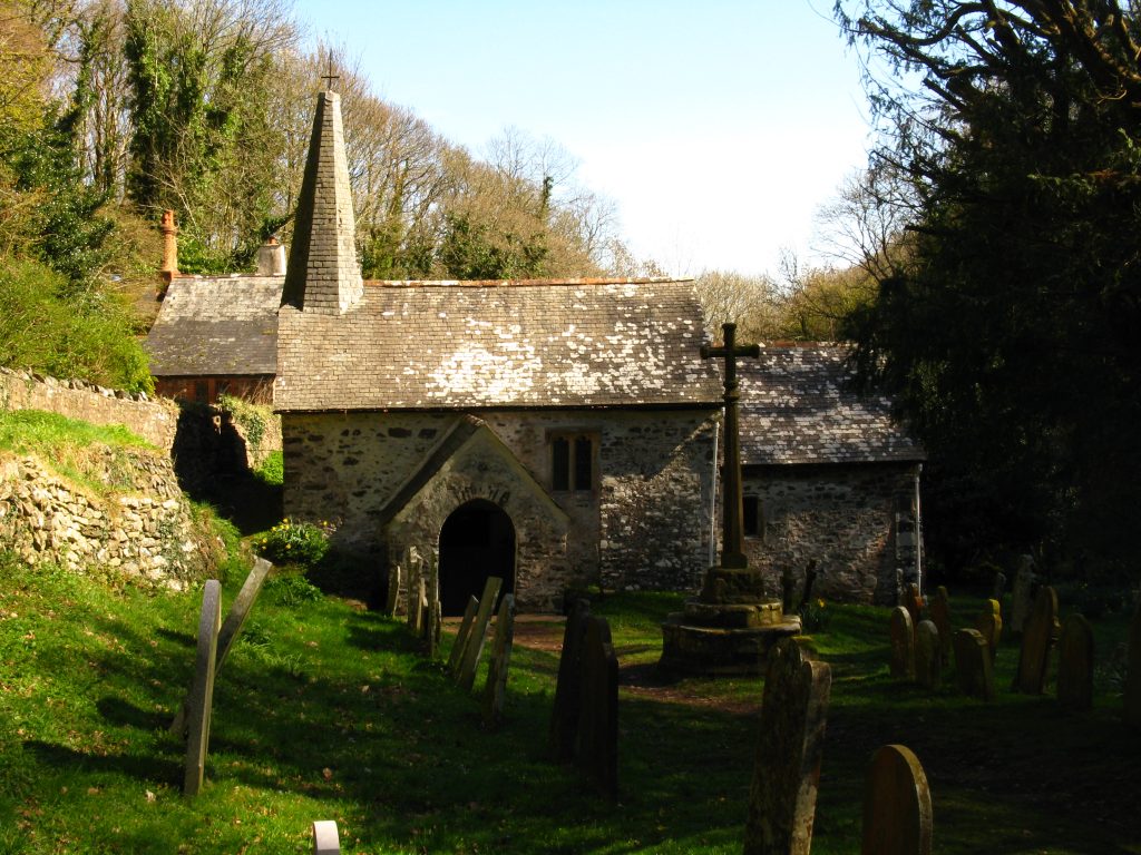
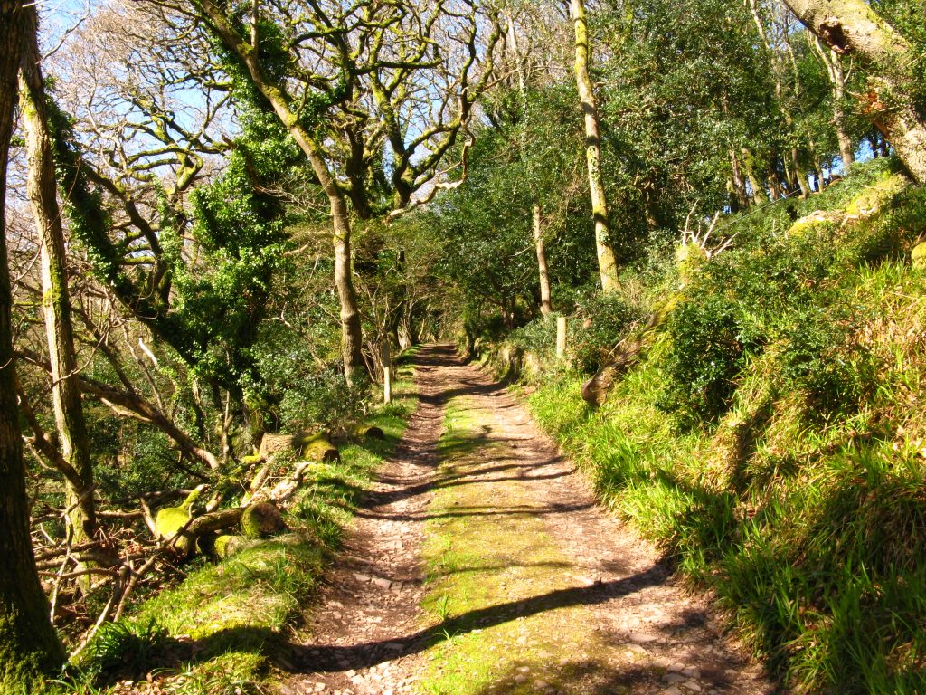
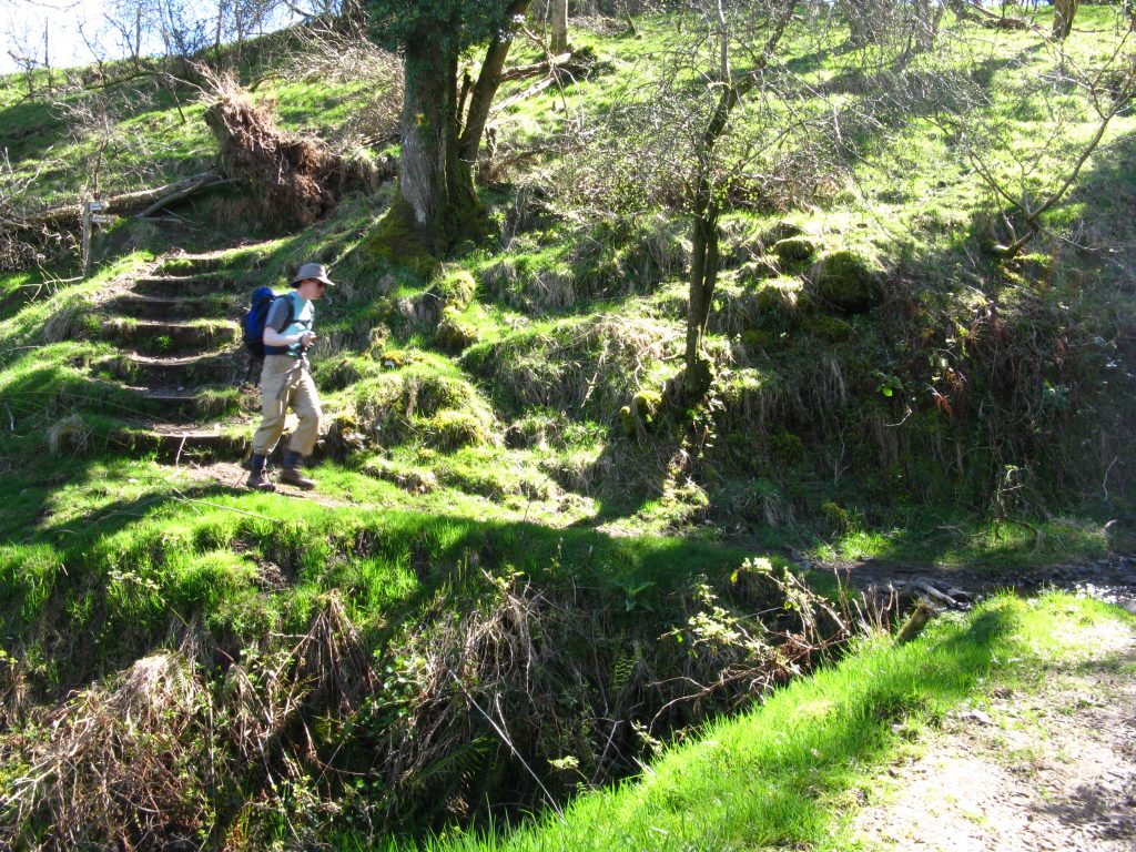
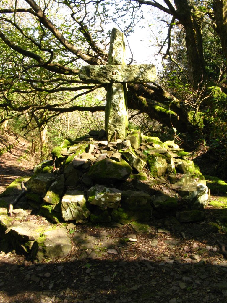
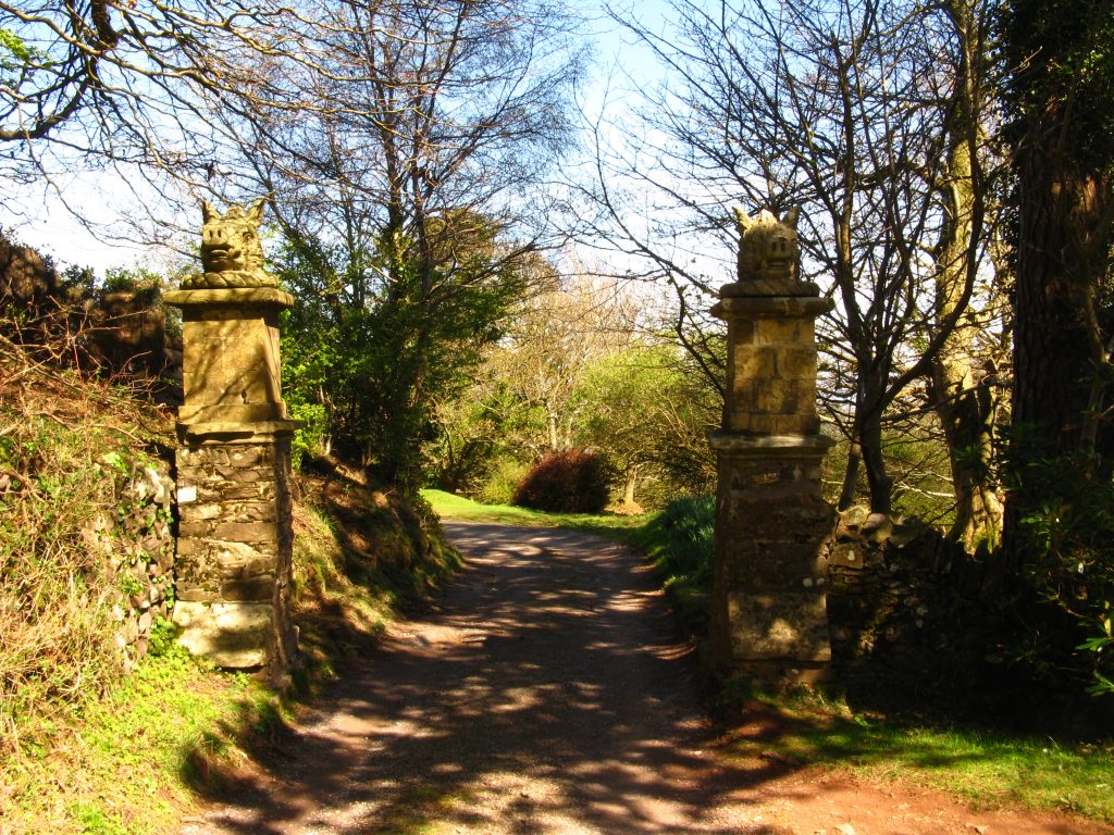
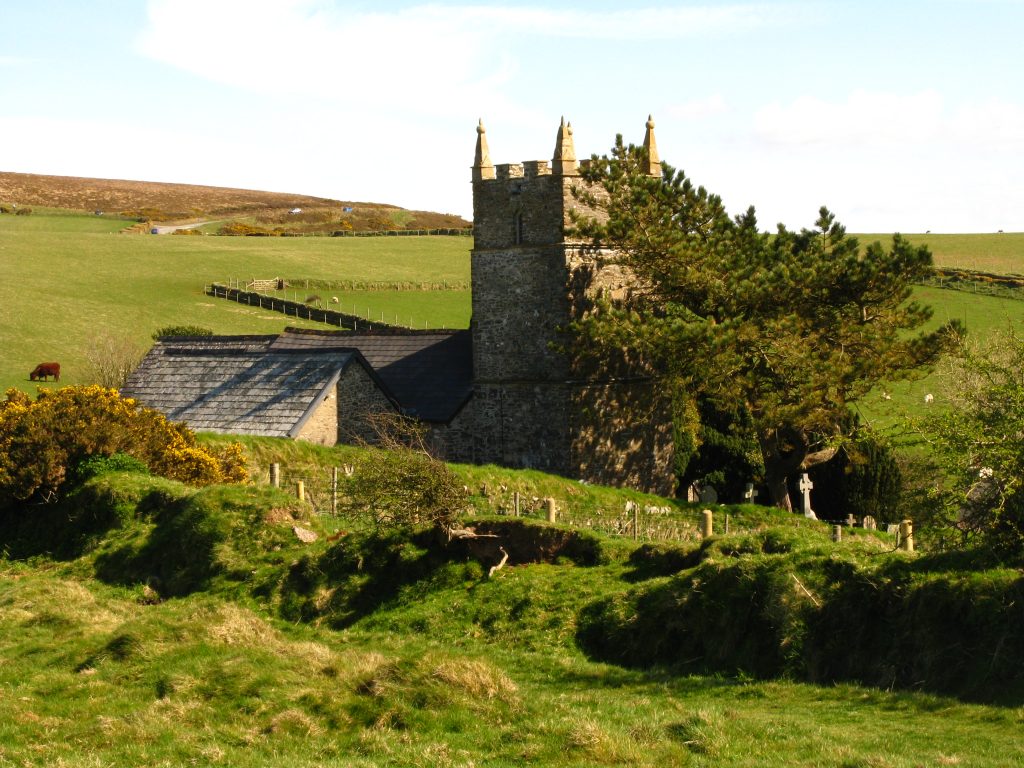
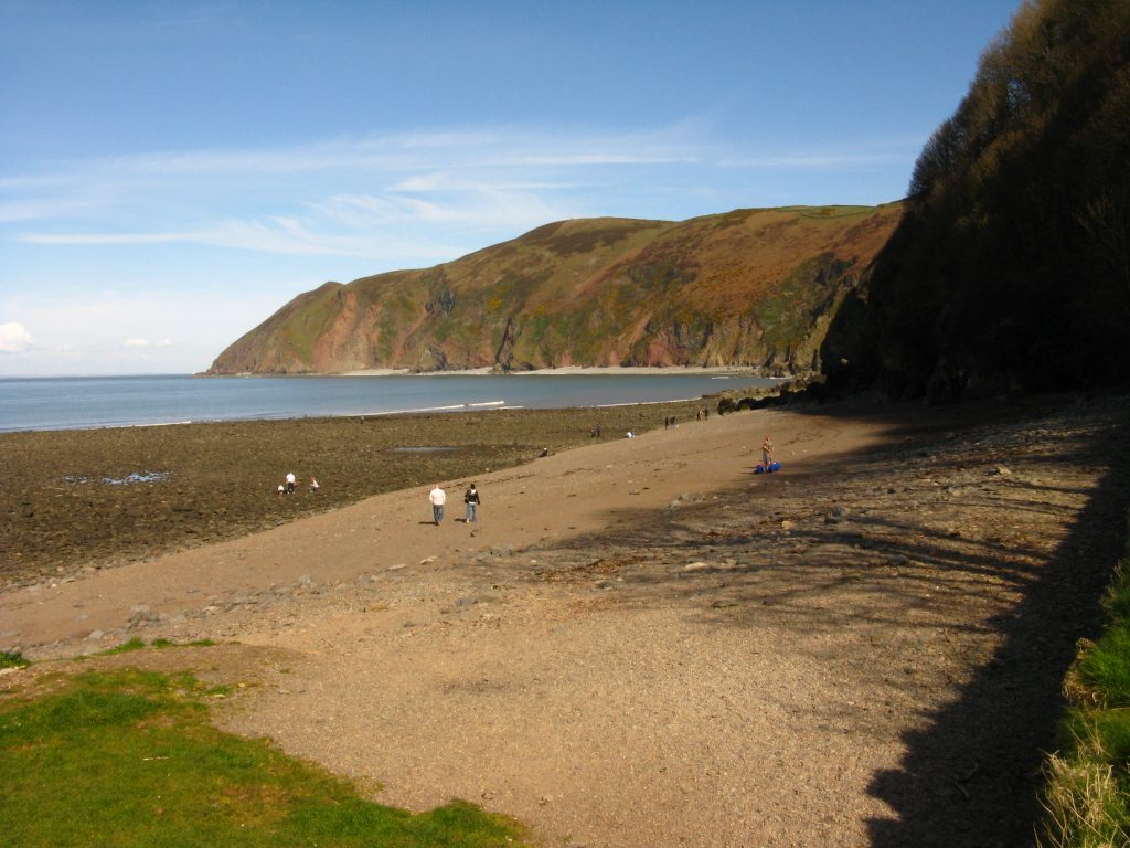
The route eventually reached the shingle of Porlock Beach, which it then follows rather awkwardly for a while before climbing steps onto the Porlock to Porlock Weir road. I followed the road into Porlock Weir and had a look around the little harbour, then set off uphill. At Worthy there was a beautiful thatched toll house, while my route lay through Yeanor Wood, zigzagging up the hill, through a couple of tunnels – part of the romantic landscaping given to the slopes by a previous owner. Woodland walking brought me to Culbone church, said to be the smallest “complete” church in England. The porch outside takes up more than a third of the length of the nave, which is only 12 metres long and wide enough for three to sit comfortably.
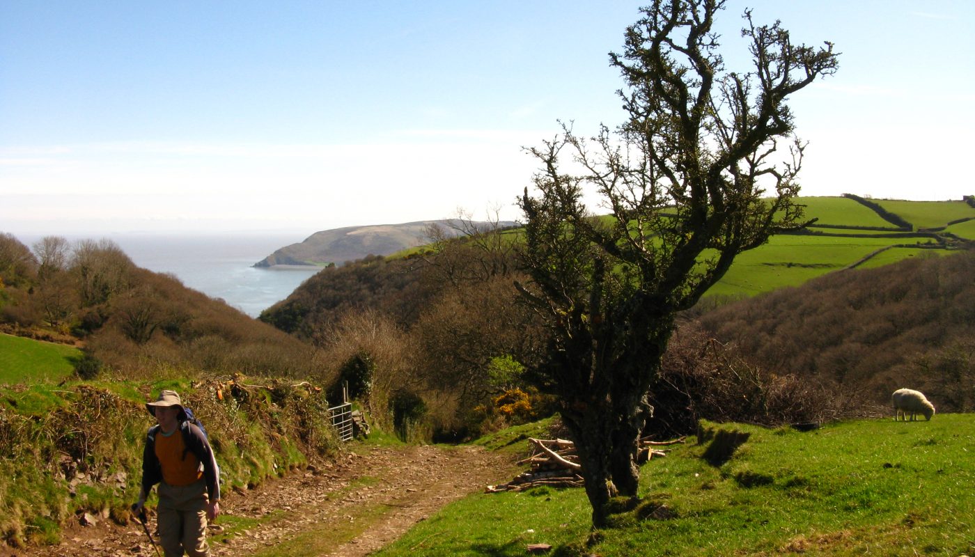
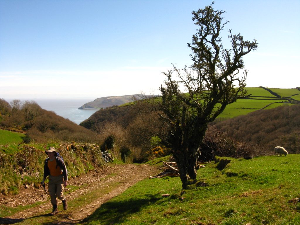
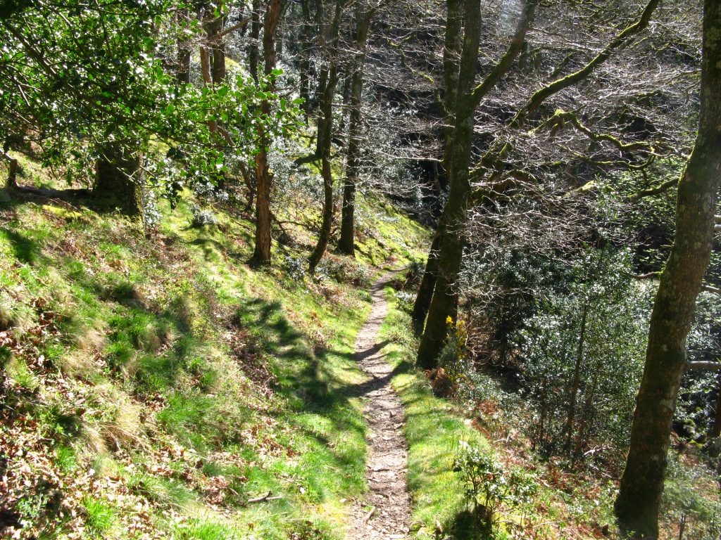
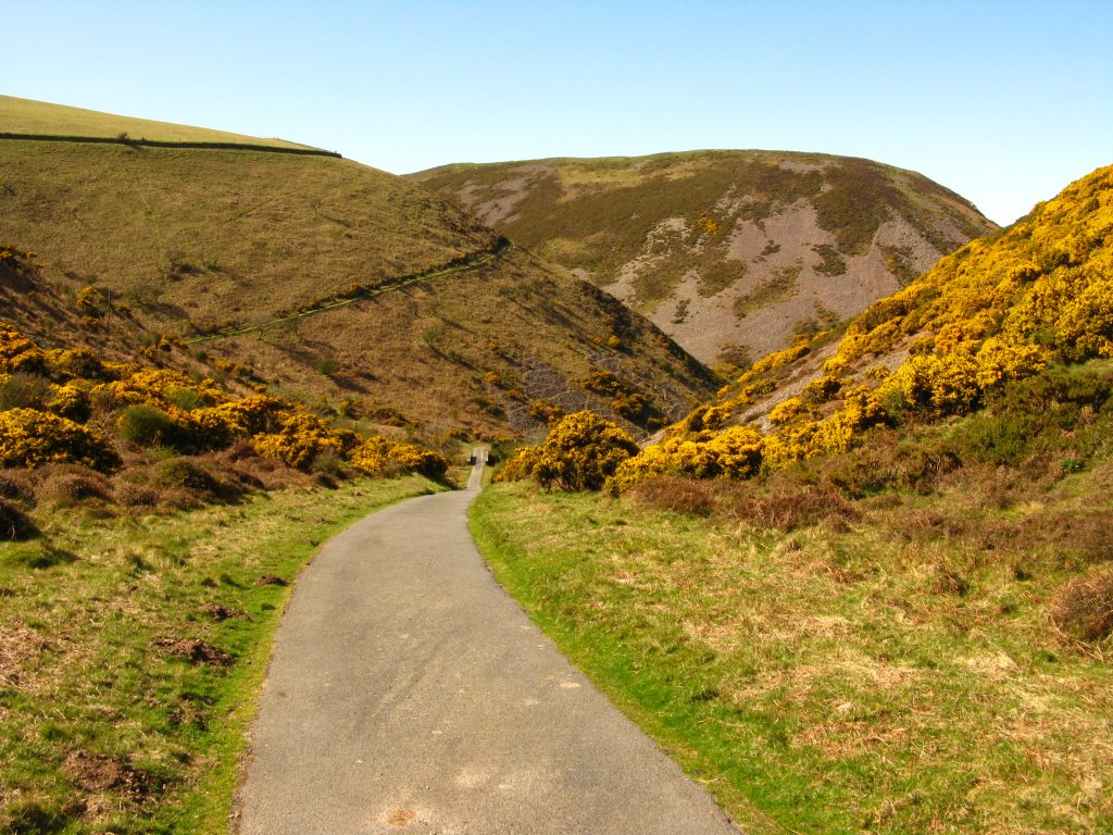
From here there are two possible routes: a coastal one continuing through Culbone Wood, and a higher inland one through farmland. One map called the coast route the “alternative” route, one map showed both the inland and coastal route simply as the “South West Coast Path”, and the most recent guidebook talked about the likelihood of the coastal route imminently being designated as the “official” route. I was in two minds about which to take: the coastal route seemed purer, as well as being shorter and involving less ascent, but it also looked as though I might yearn for a change from woodland walking by the end of the day. In the end, when I reached the point of divergence, the sign showed the coastal route as “alternative” and I let that decide for me, and climbed steeply up the slopes of Withy Combe to emerge from woodland with glorious views.
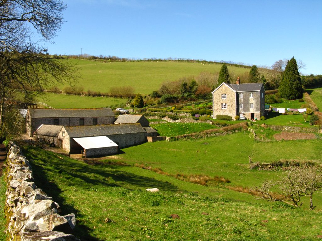
The path from Silcombe Farm to Broomstreet Farm was along a twisting and turning narrow lane, muddy in places, but with lovely views inland over the farms of Exmoor, and across the Bristol Channel to the coast of south Wales. I had lunch before beginning the descent of Wheatham Combe and re-entering woodland. In Yenworthy Wood I rejoined the coastal route – and at this end, the higher inland route was signed as the “alternative” route, which summed up the choices nicely!
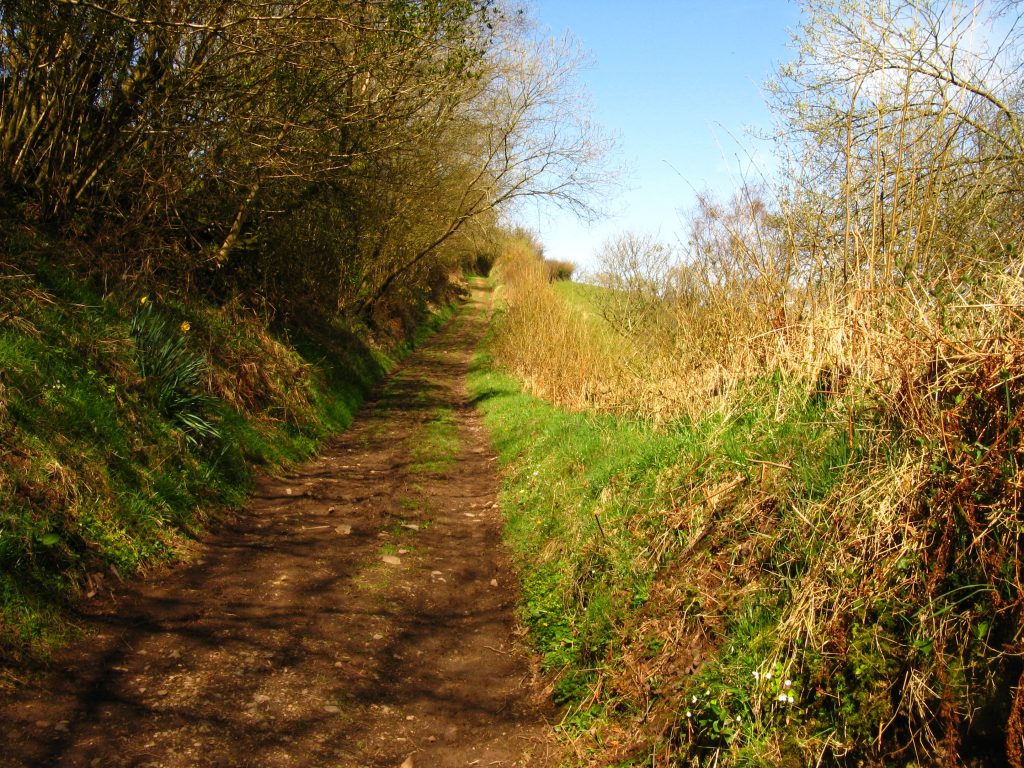
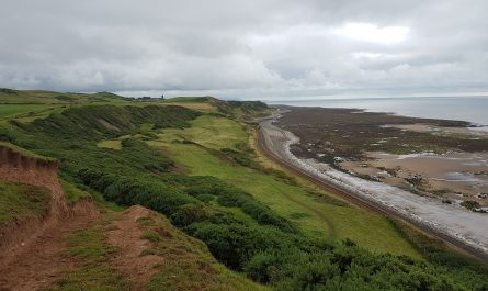
The woodland walking continued, usually with the sea visible through the trees on the steep slopes, eventually emerging from the Glenthorne Plantations with the rest of the afternoon on more exposed slopes.
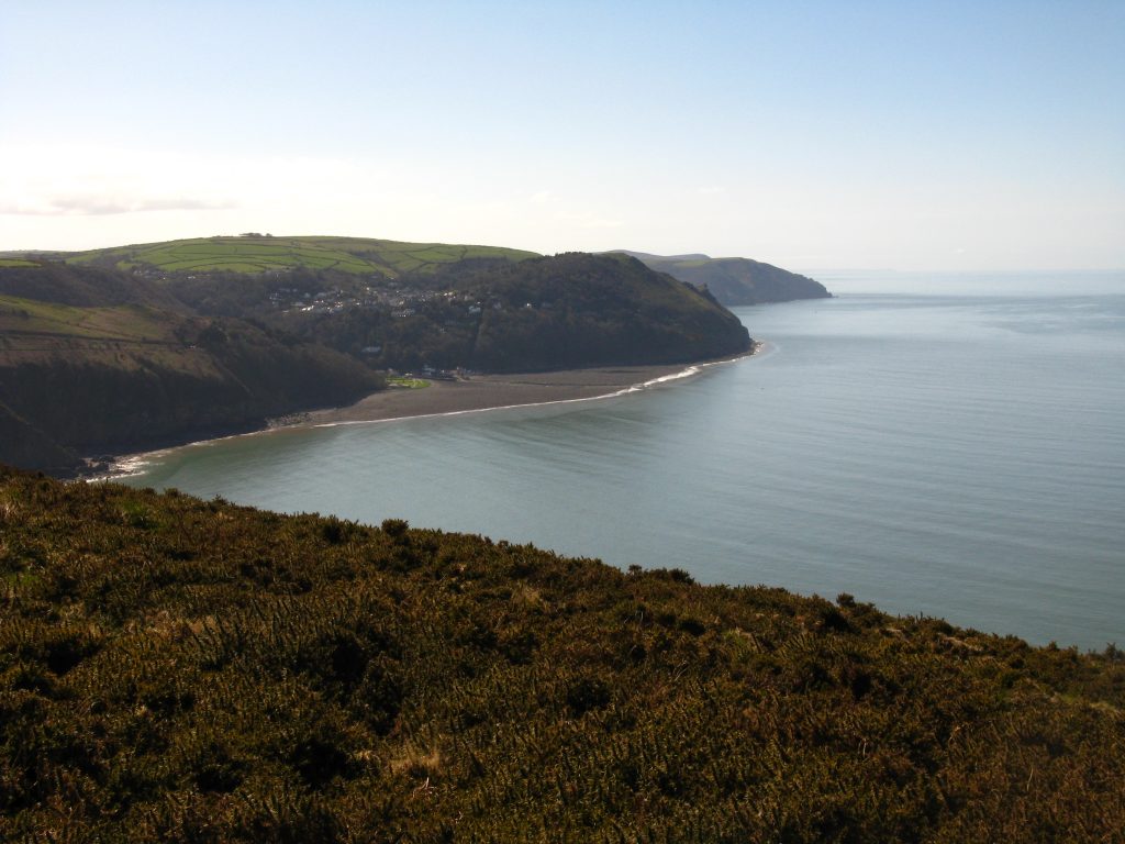
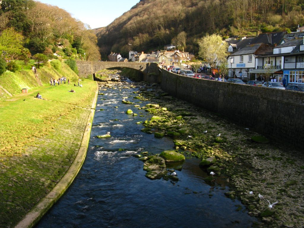
From the rather oddly named Kipscombe Combe, there was a steep descent on a tarmacked road that leads to the lighthouse at Foreland Point, followed immediately by a long final ascent. I found myself a nice spot just short of Countisbury church to rest and admire the view of Lynmouth, before picking myself up for the final stretch, which parallels the road into the town.
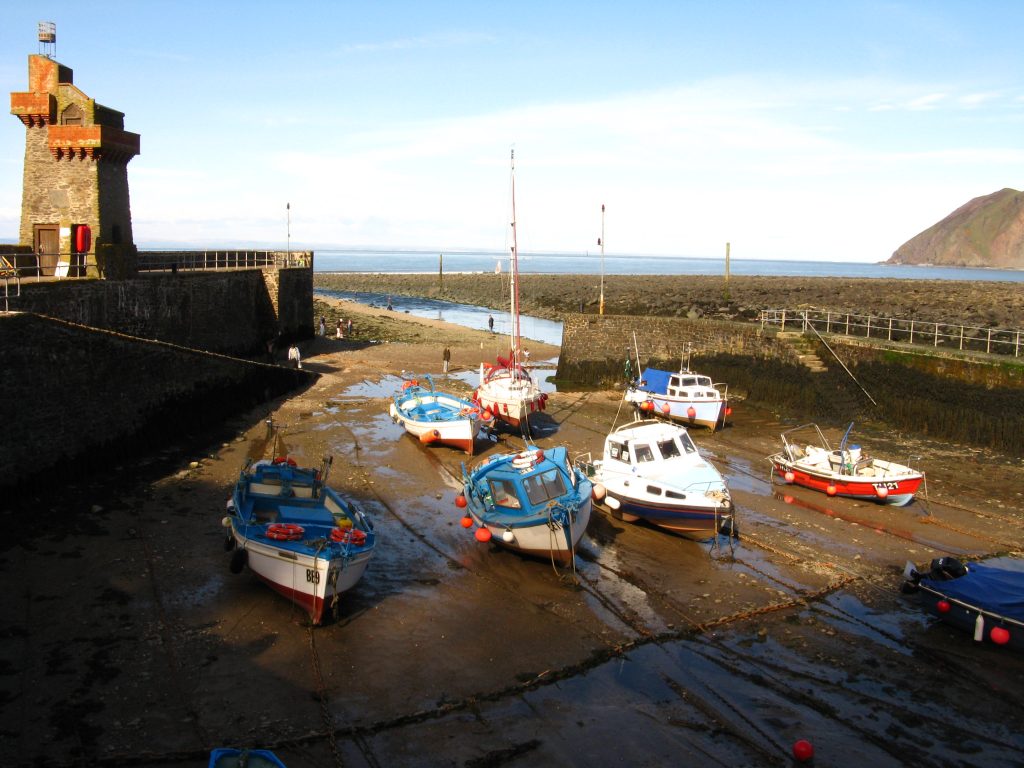
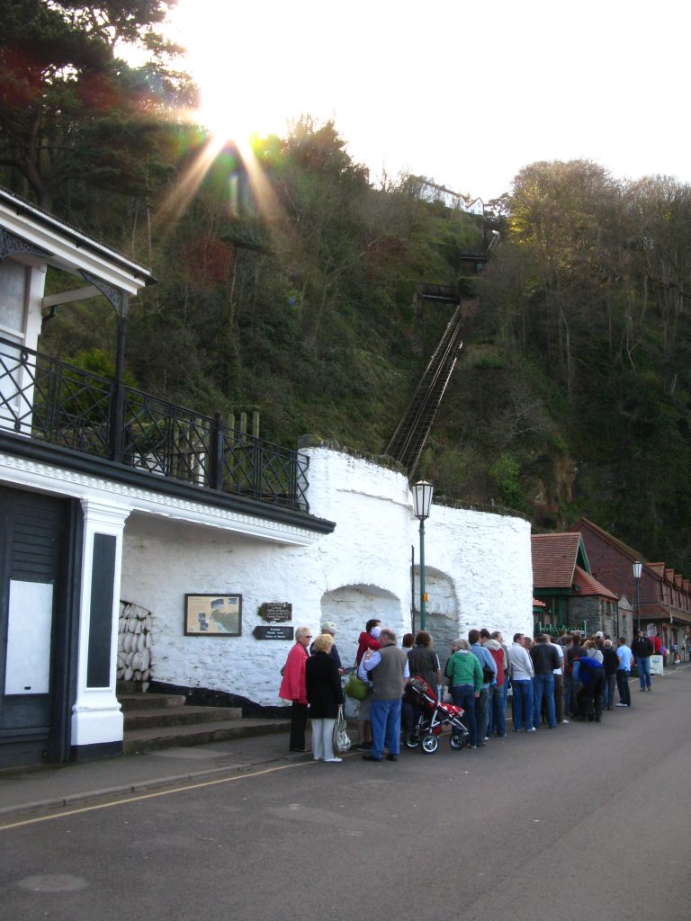
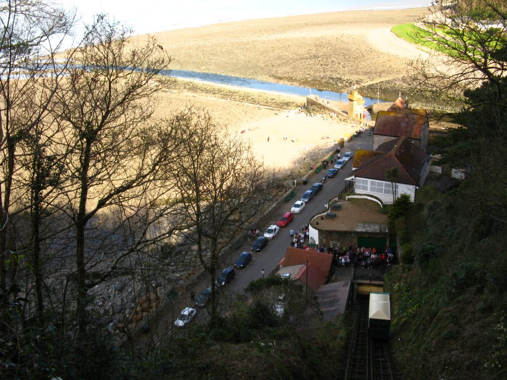
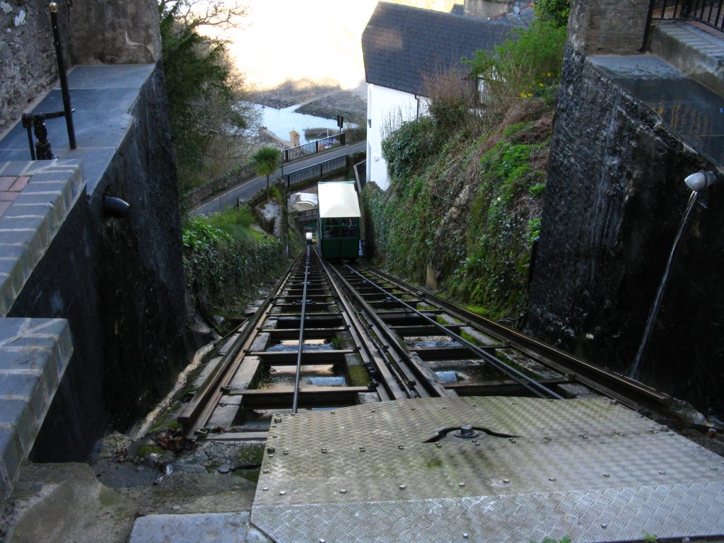
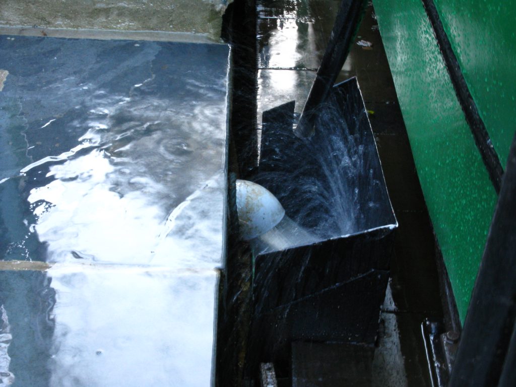
I got myself an ice-cream and watched the Easter crowds for a while, then crossed the wide space now given to the river after the flood disaster of 1952, and went to the cliff railway. This water-powered railway carries people up the very steep slope between Lynmouth (by the sea) and Lynton (on top of the hill). The queue was not something I fancied joining, though, so I strode off up the steep zigzagging path up the hill, pausing to watch the railway cars as they passed beneath the path.
The directions to the B&B were a little confusing, relying as they did on street names when I could find none at critical times, but I soon got myself oriented and checked in. My room even had its own door to the outside.
Later, I walked through Lynton back to the cliff railway: I was keen to have a ride, and having now walked up the hill, knew that it wouldn’t be “cheating” as I had now walked the route of the Coast Path up the hill so wouldn’t be skipping any as I would if I’d used the railway up the hill earlier. There were only a couple of other people wanting to go down, so we were soon underway – very enjoyable, especially as I was able to stand at the front for the best view.
I had a wander around Lynmouth looking for likely eating places, eventually settling on a pub where I ordered a pizza and settled myself by the fire. With the railway closing at seven o’clock, another ascent of that hill awaited me, but it was easier with a pizza inside me. Later, I had a dark wander around Lynton trying to find a mobile phone signal to contact Lucy, but failed.