In which: the Devon coast beckons once again ● I depart from Woolacombe after a three-year gap ● sand fills much of my day ● I keep clear of the Royal Marines ● I gaze across 1200 metres of water to Saturday afternoon’s return to the sea ● I encounter the Ilfracombe branch line, 32 years too late for a train ● fish and chips are popular
Date: 6 April 2012 Time of walk: 0845 to 1545 Today’s walking: 27.9 km Progress along SWCP: 25.2 km Estimated ascent: 460 metres
Day 5 of the South West Coast Path is the first of another four-day holiday on the path, having walked parts of the Cornish coast since I reached Woolacombe in 2009. Once again I was staying at the B&B called Bellacombe – and the moment I was in the door it appeared that I’d been recognised and I was asked in a slightly puzzled tone if I’d stayed there before. Puzzled, because coastal path walkers don’t normally come back, but I was an exception because this was the end of one year and the start of another. I had the same very pleasant bedroom as before, and following advice from Julia I went to Bar Electric for dinner, where I had a lovely pizza, looking out at the sea and Lundy with the sun gradually setting, with a good book, a nice drop of wine, and eventually some superb ice-cream to wrap up a very pleasant evening.
In the morning it was a gentle start to the day with a slowish breakfast as I chatted with Julia. She advised me to try Squires in Braunton tonight for fish and chips, though warned me that it was very popular. The weather this morning was lovely, and it was a great view over the valley down to the sea from the breakfast table.
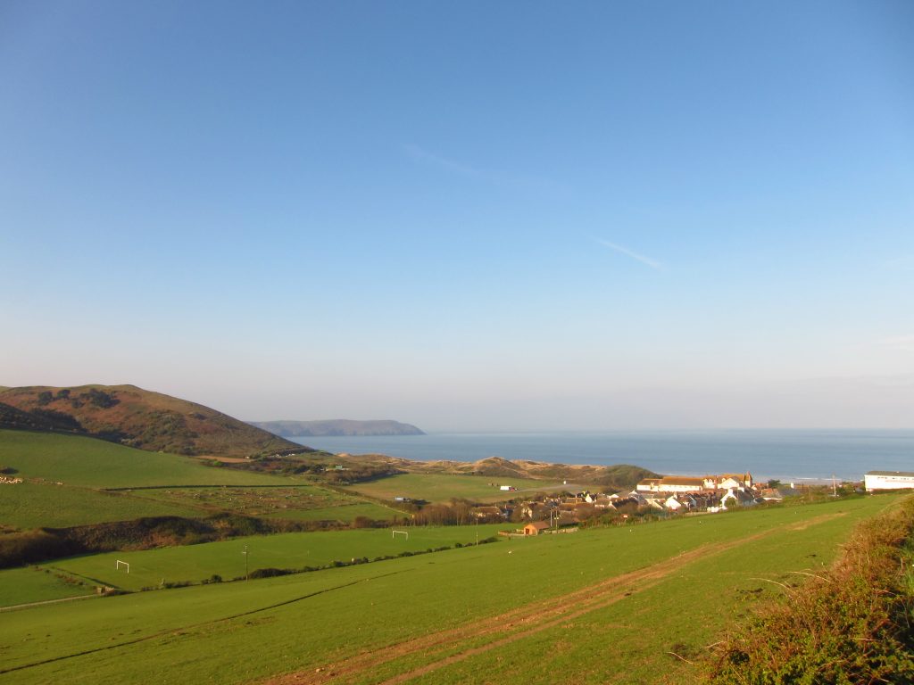
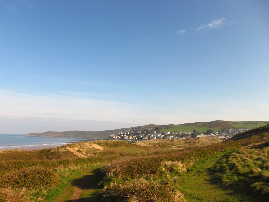
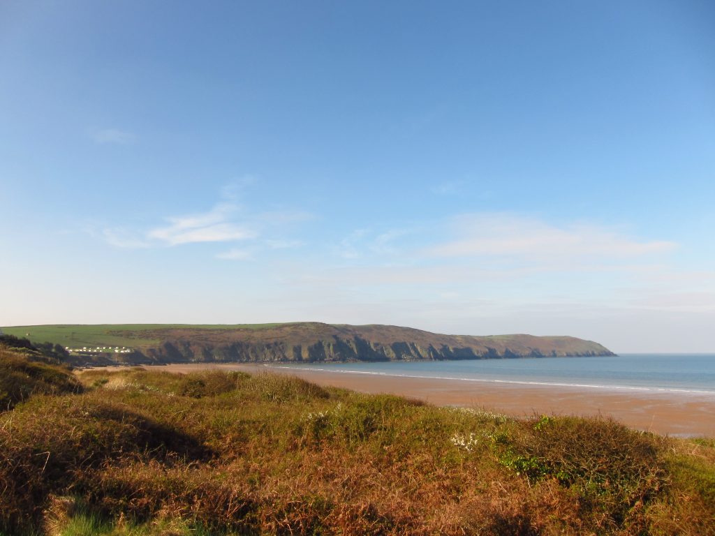
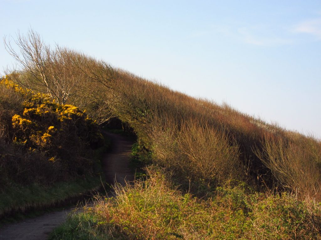
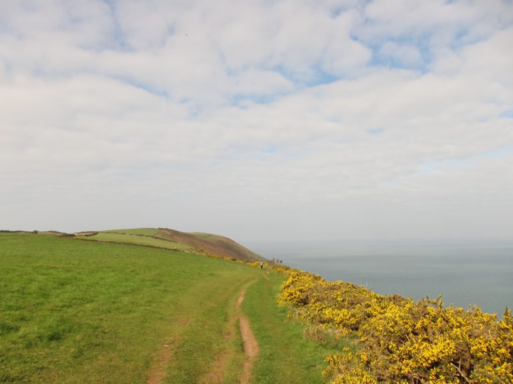
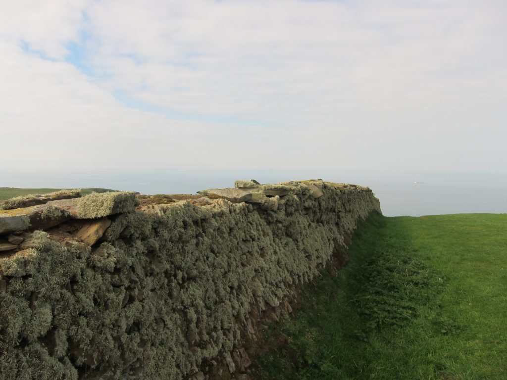
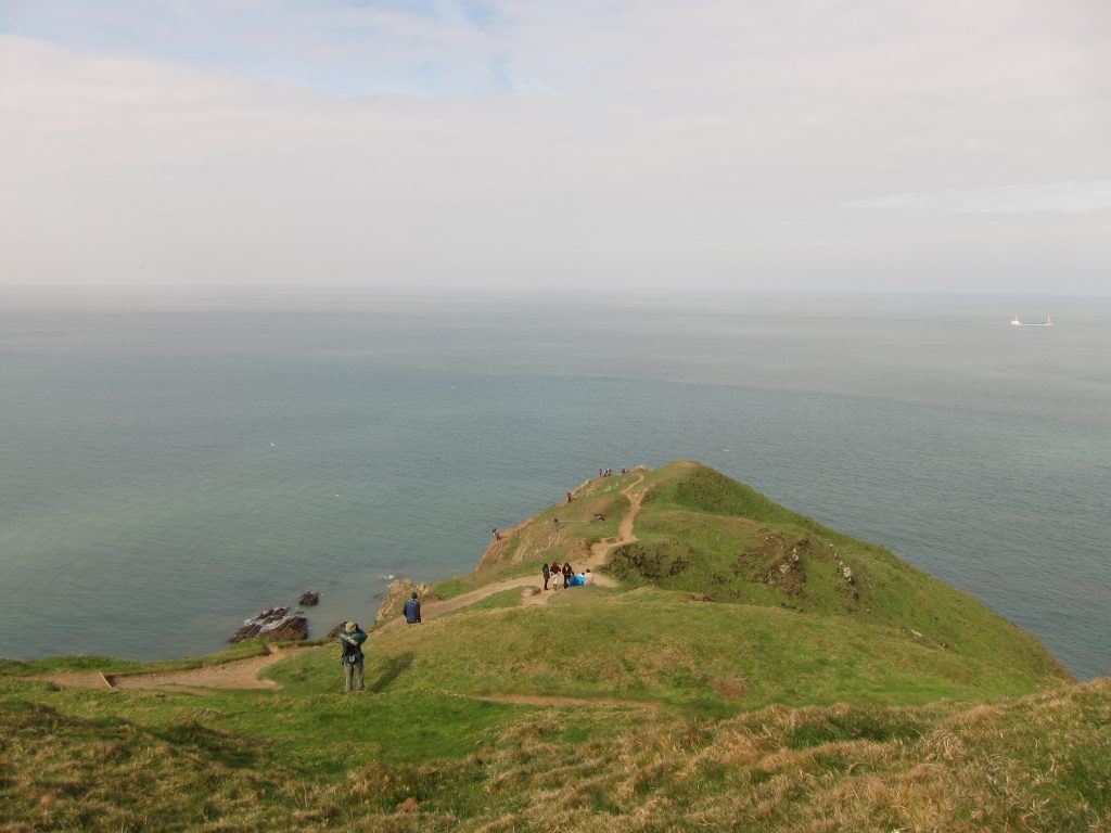
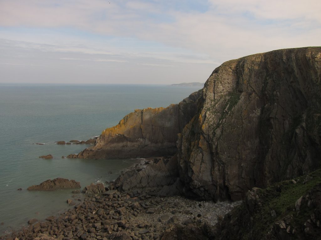
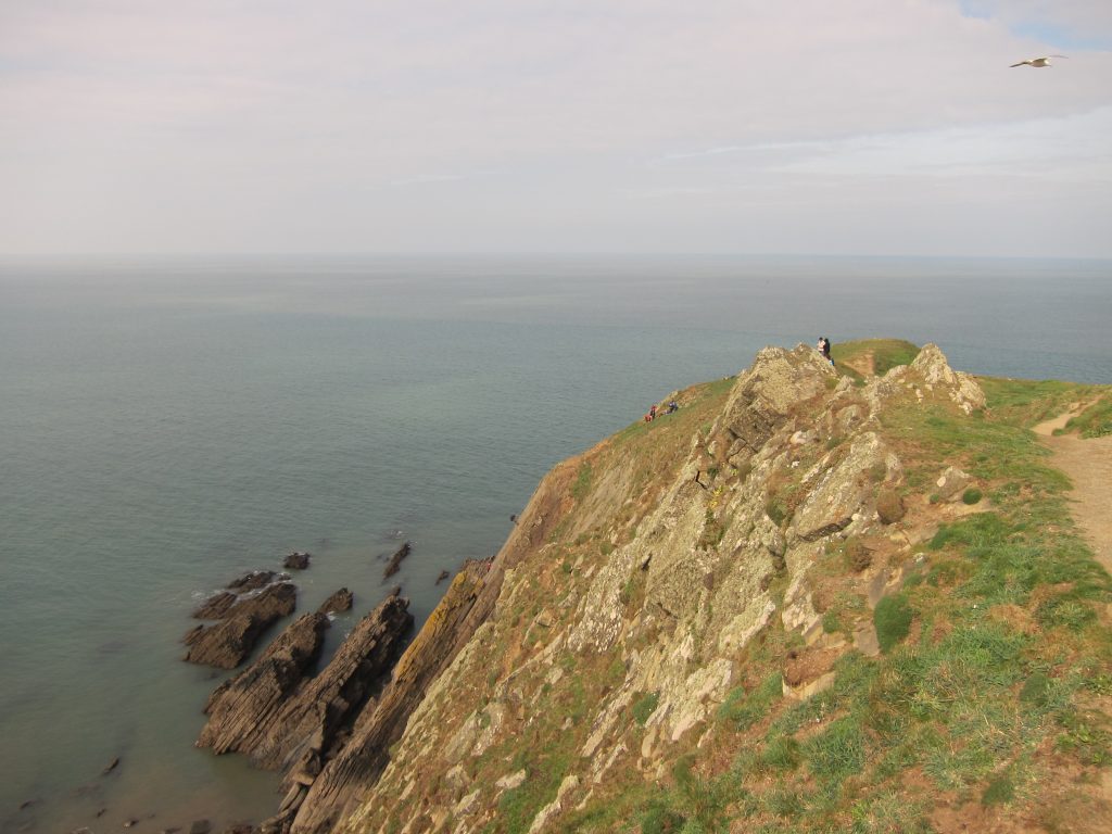
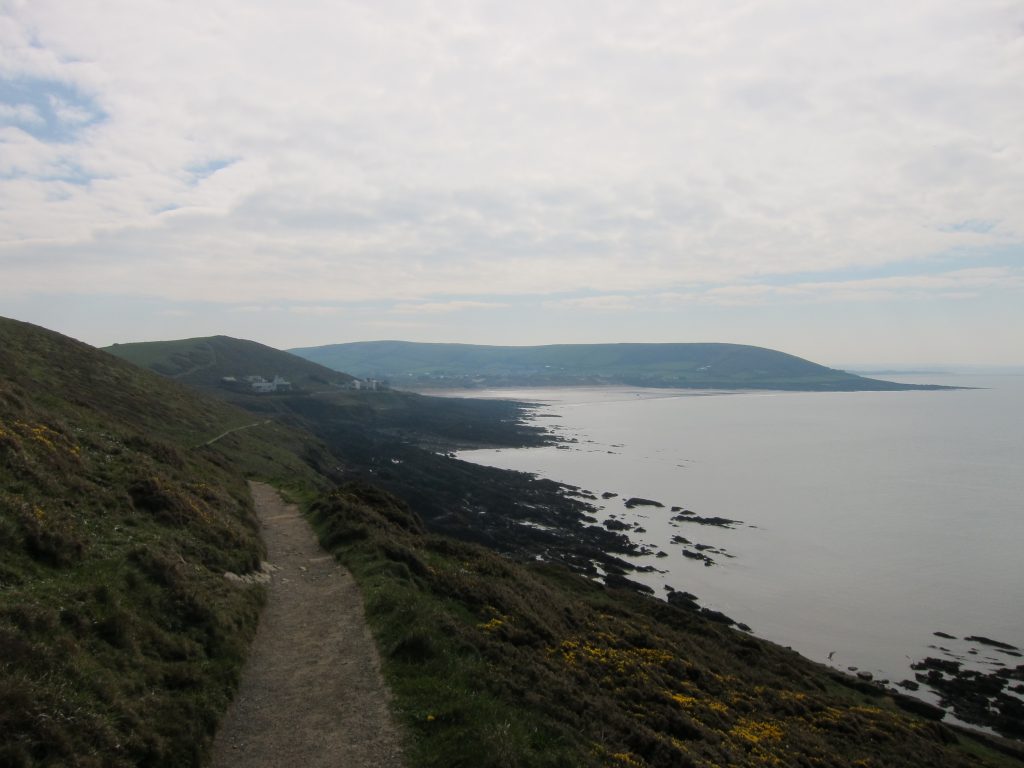
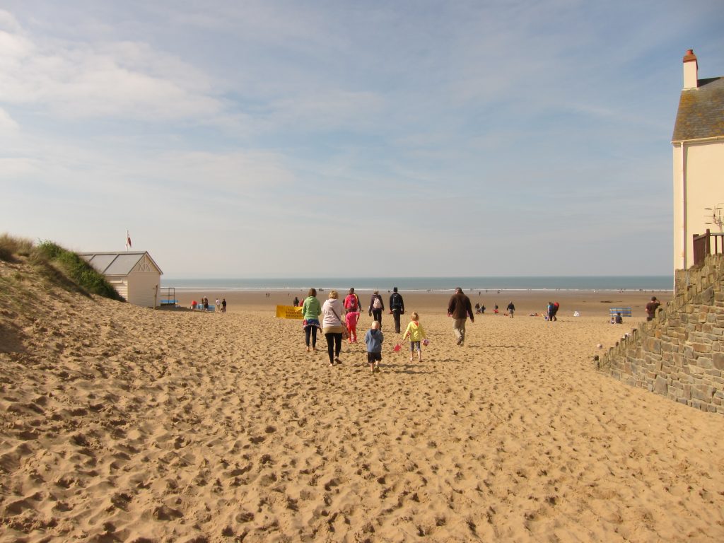
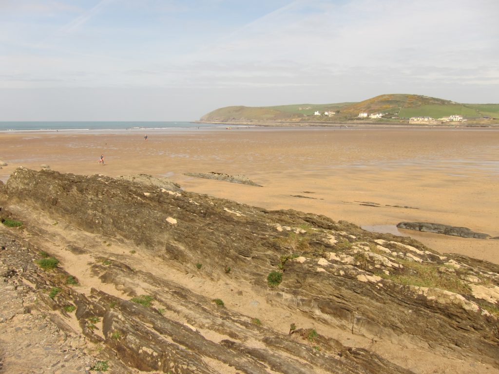
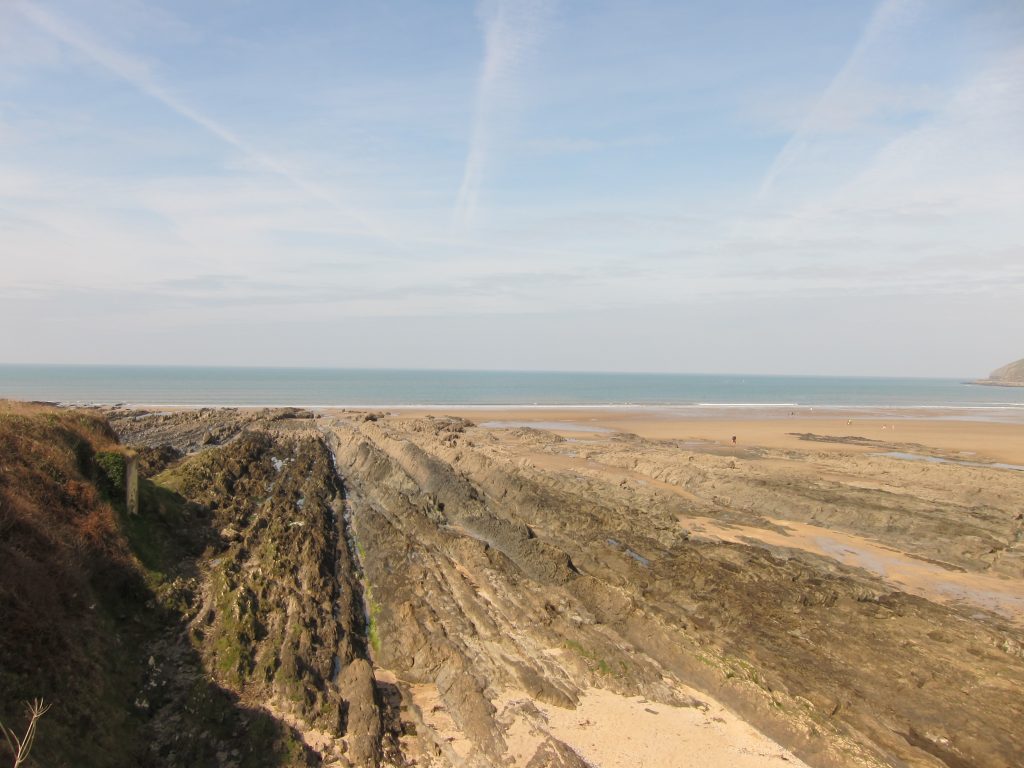
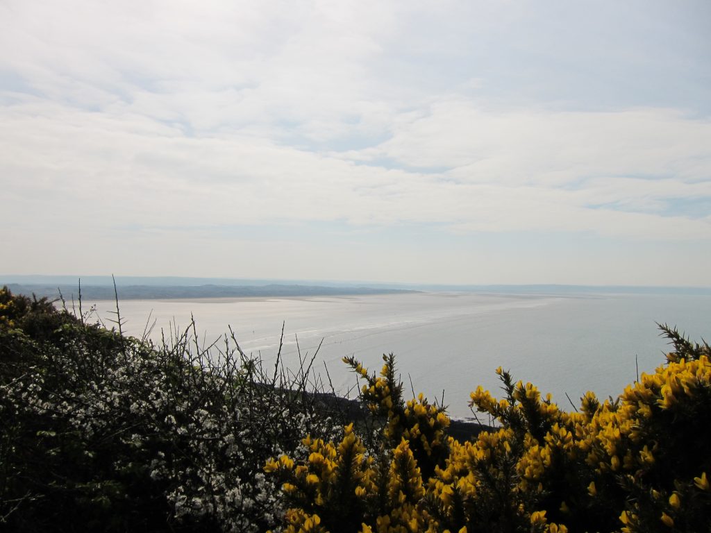
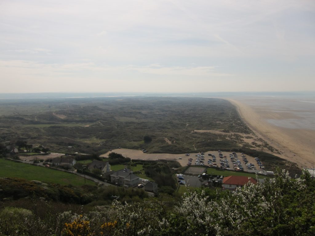
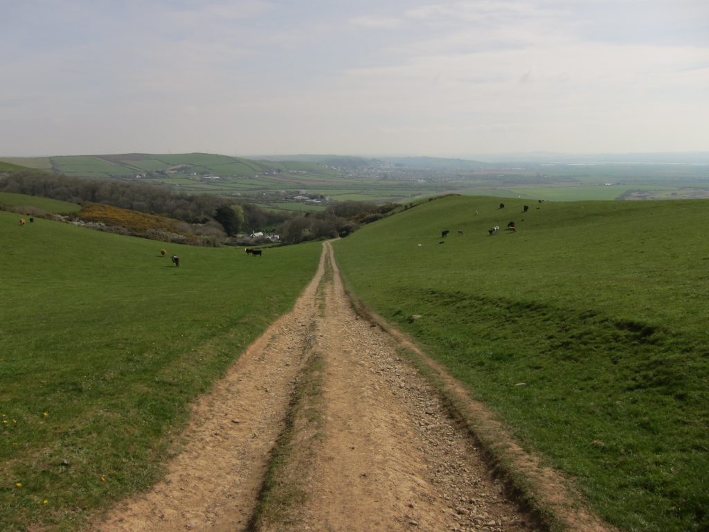
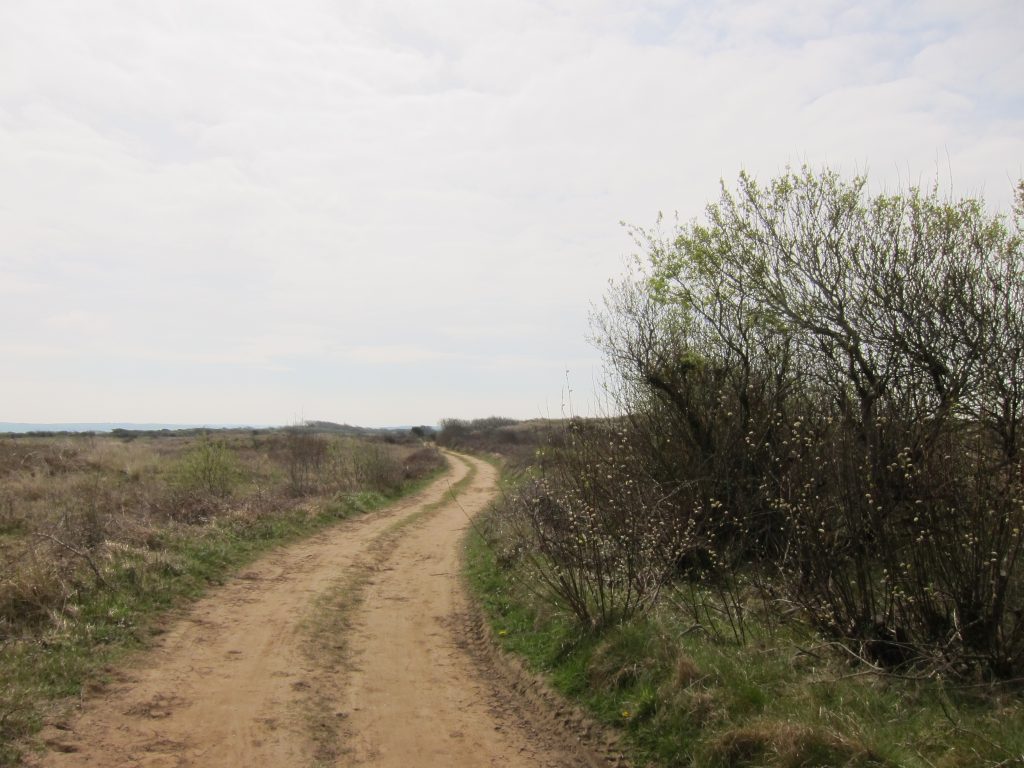
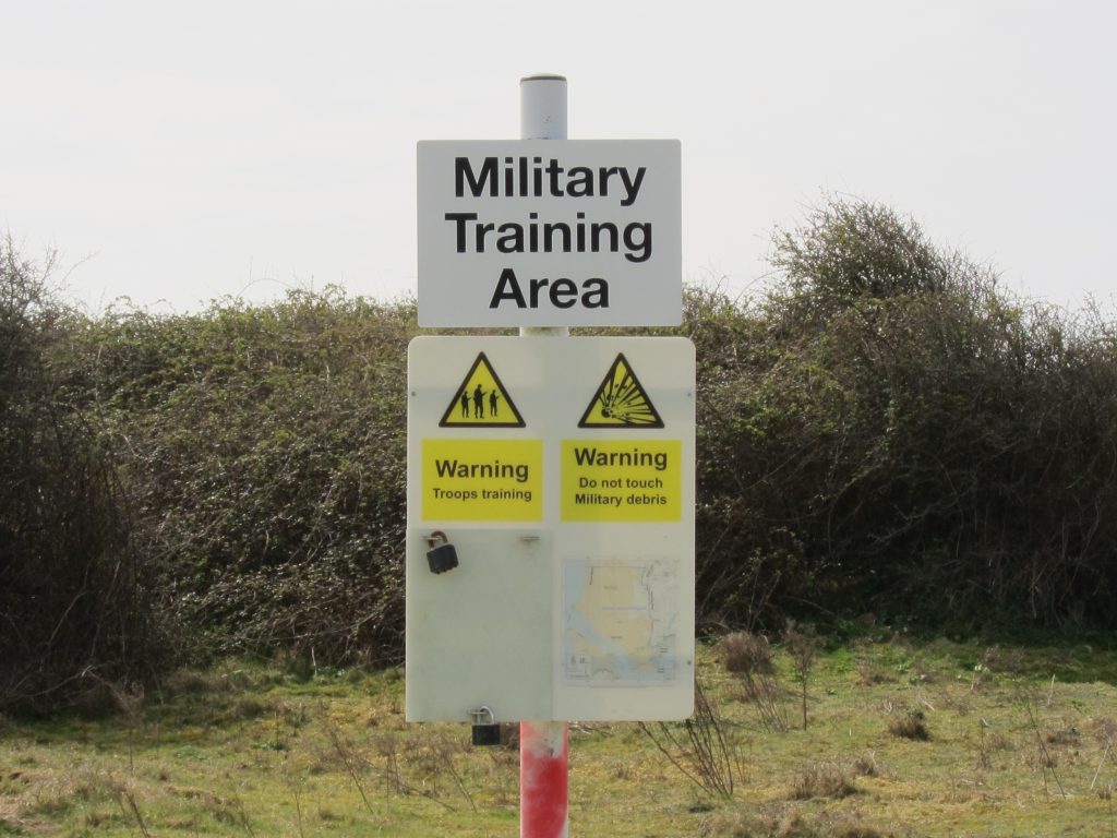
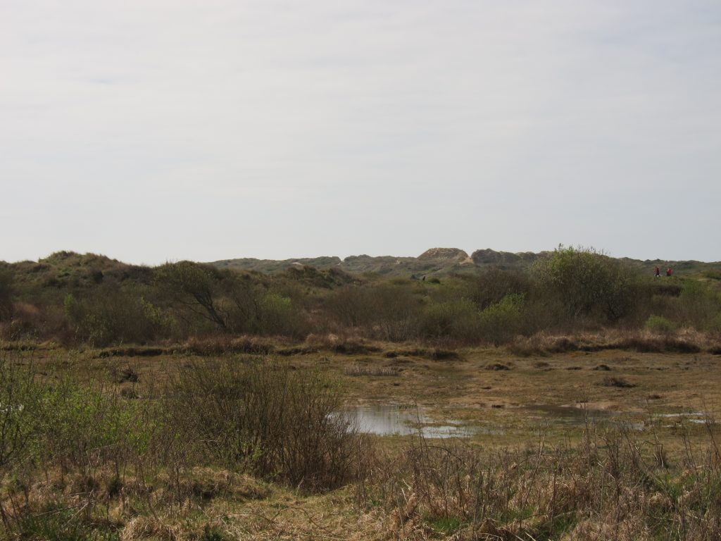
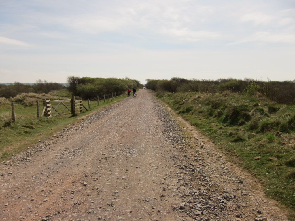
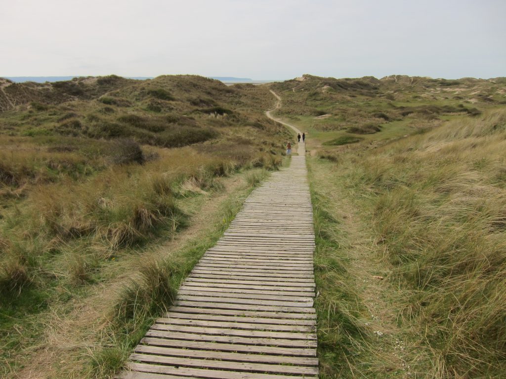
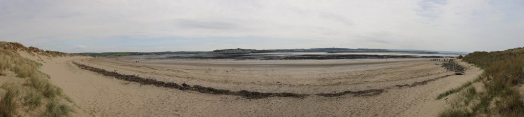
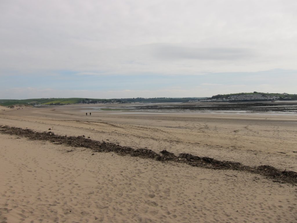
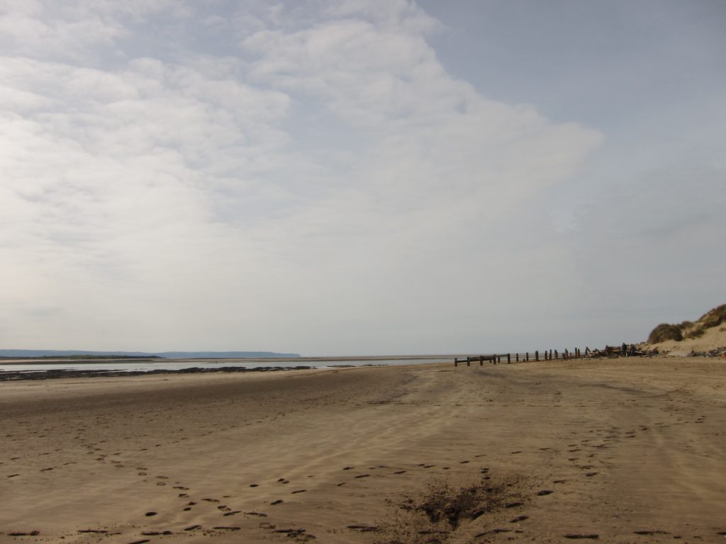
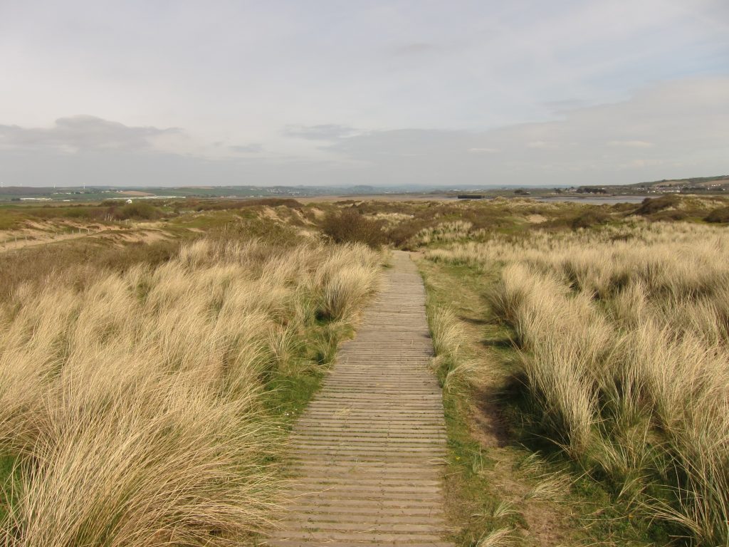
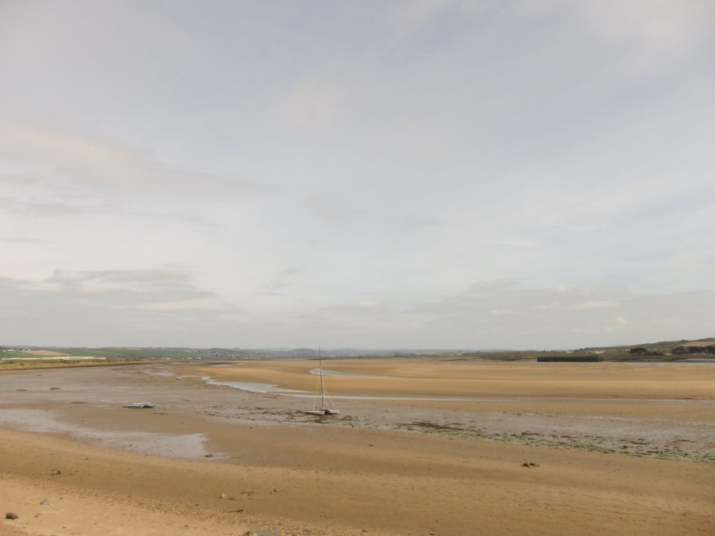
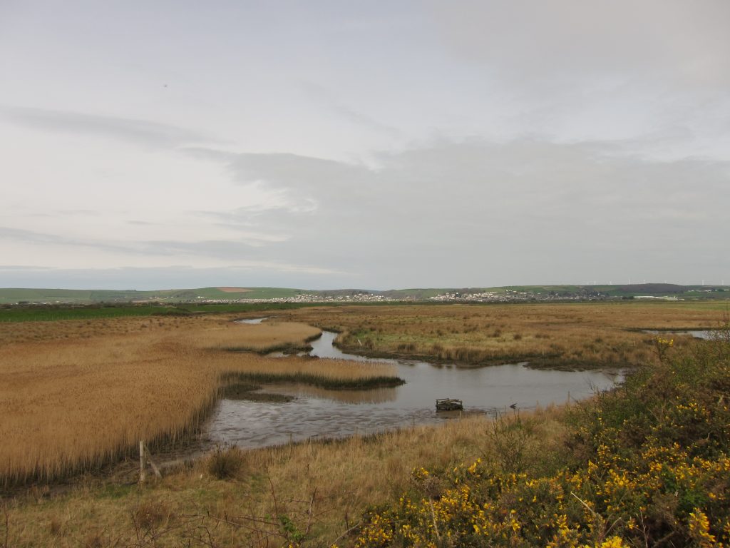
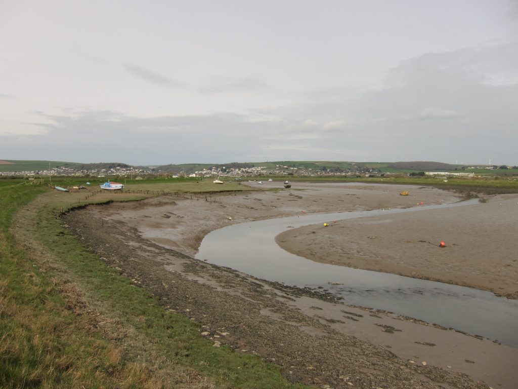
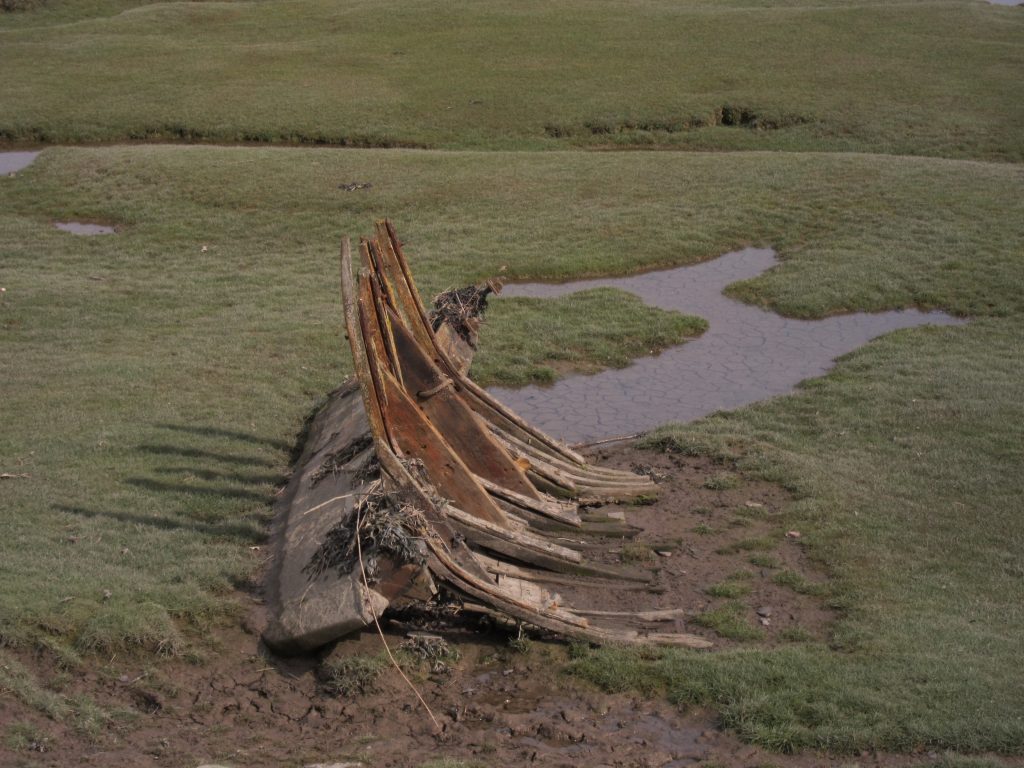
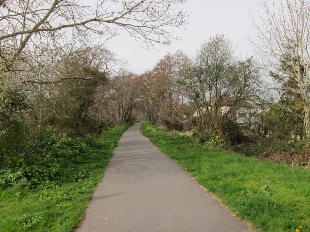
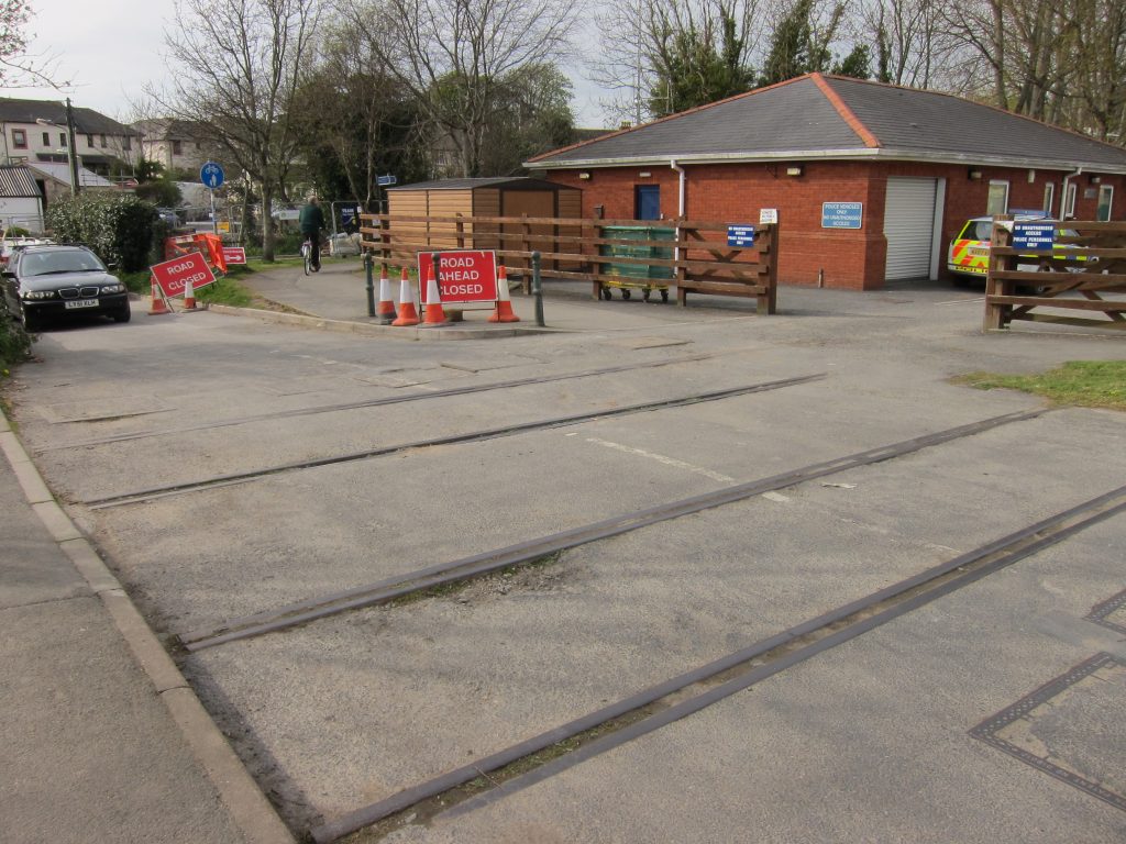
Not quite the view at breakfast, but jolly close, this is the view as I reach the road after descending the steps from Bellacombe. It was a glorious start to the day, and better weather than I’d expected. The road was very quiet as I descended the hill into the town, but the town was stiring into life with a surf shop putting out their racks of wetsuits, another vendor putting up their marquee, and some minor maintenance being done on the pitch-and-putt course. I stopped in a little shop to get some food for the day.A look back at Woolacombe and my route behind the sand dunes of Woolacombe Warren. Although it looks grassy here, there was a good deal of soft sand to walk on too, before the path took an abrupt turn to the left and up the slope.Ahead, the view to the first proper cliffs of the day, with Baggy Point just round the cornerAll the trees were bent back by the wind, including those growing over the path, but the uniform level of the ground had produced a remarkably uniform level for the tops of the trees.A look back across Woolacombe Sand and Morte Bay to Woolacombe and round to Morte Point. This beach has reportedly been voted the best beach in Britain, and even one of the best ten beaches in the world, but I haven’t been able to identify a source for such reports other than businesses promoting Woolacombe – but it’s certainly a lovely bit of sand.Ahead there is some cliff-top walking. I caught up the woman in front by a bench, where I stopped for a quick drink and she continued. I caught her again at Baggy Point.About to round the corner: what a wonderful collection of lichen on this wall.Looking down on Baggy Point. Having been almost alone for the first part of the walk, suddenly there were lots of people, the walk along the other side of the peninsula, from the car parks at Croyde Bay, clearly being a popular outing. This morning, as well as the lovely scenery on a glorious Good Friday morning, there were climbers on Baggy Point to watch.Cliffs north of Baggy PointBaggy Point, with climber part way downThe delightfully easy footpath to (or from) Croyde BayAt Croyde Bay I was tempted by a café which on closer inspection turned out to be closed (why, on such a busy and clement day?), but I found a drink and a muffin at the bucket-and-spade shop underneath the café and rested my legs for a few minutes after the first ten kilometres of today’s walk. The South West Coast Path then takes to the beach, always a fun thing to do (especially when they aren’t too busy), and it was a delightful walk across the firmer sands, with a brief fording of a stream as it crossed the beach, heading towards an old gun emplacement that had guarded the beach from German invaders that never came.From the gun emplacement, looking back across Croyde Sand.The rock formations, lined up to the sea, were fascinating, the result of differential erosion on folded layers of rock.Around the corner, and after a few metres along a busy road, the path parallels the road just far enough above it to be reasonably peaceful. Ahead is the extensive beach of Saunton Sands, with the equally extensive dune system of Braunton Burrows behind.Looking down on the dune system of Braunton Burrows, the largest sand dune system in England, and home to over 400 flowering plant species, 14 of them sufficiently important to have Biodiversity Action Plans, as well as 33 species of butterfly. The importance of the site is illustrated by its status as a Site of Special Scientific Interest, UNESCO Biosphere Reserve, Ramsar site, Special Area of Conservation, and of course like almost all of this part of the walk forming part of the North Devon Area of Outstanding Natural Beauty.But first there is a slight diversion away from the coast, using the alternative inland route to avoid some road-walking.Returning close to sea-level, the path winds its way along the back of the dune system, almost two kilometres from the sea (more at the moment because it is low tide).A sign reminds us that part of Braunton Burrows is given over to military training, including the Royal Marines. Like quite a few areas in the country, it was used in the Second World War, particularly from 1942 by the Americans in training for Normandy beach landings, and that use has continued to the present day. Here, as in other areas, the net result of military use and exclusion of the public is found to be beneficial to wildlife.Looking across some of the UNESCO Biosphere Reserve, showing here both dunes and dune slacks (the wet areas), with pasture behind me.The easy sandy track shown earlier gradually turns into a much stonier track, and as I walked south the proportion of large stones grew much greater: most walkers tried to use the little tracks in the grass at the edges as they are much easier to walk on. I found a couple lifting a push-chair over a wire fence and was appealed to for assistance. They’d got rather lost on the beach and had been through the military training area before emerging onto this track, unsure where they were. I was able to tell them that their car was about two kilometres north, but pushing the chair along this track, particularly further south where it was stonier, would be a little tedious. Presumably the resurfacing has been done in connection with military activities, but it’s a shame it couldn’t have been done in a way that lends itself to being friendlier to the many people walking and cycling along here.At the far end of the path, I took a little diversion away from the SWCP, walking along this lengthy boardwalk to get a view of the Taw Torridge estuaryEventually cresting the dunes, this is the view that greeted me.Looking a little closer, the River Taw comes in from the left, meeting the River Torridge coming in straight ahead, the two combined then flowing out to the right past the town of Appledore.To my right, the view out to sea, with Hartland Point (about three days from here) visible. Just on the other side of the water from here is Northam Burrows with the South West Coast Path running around it. It looks close but is actually about 1200 metres away. But to walk there is a 41 kilometre walk for me, and I won’t cover that 1.2km gap until about 27 hours from now.So, back along the boardwalk towards the SWCP proper, and ahead you can see glimpses of the River Taw as we look upriver towards Barnstaple.On the river wall, looking up the Taw. It looks almost as though you could walk and paddle across, but almost hidden in front of that large jetty is the main stream of the river.The walk then takes me along two sides of Horsey Island, with views inland to today’s destination of Braunton.Getting closer to Braunton as I walk along the River CaenNot much left of this one other than its substantial keelAnd suddenly the nature of the walk changes as I arrive in the moderately substantial town of Braunton (population 7500). My route towards the centre lies along the Ilfracombe branch line from Barnstaple. The line was closed in 1970 and now provides a pleasant footpath and cycle route, more of which I’ll be exploring tomorrow.A signal, restored in 2009A row of houses has been built on the section from the signal onwards, but at their end, by the police station, the twin lines remain embedded in the road surface.
From here it was a short walk to North Cottage where I was staying for the night. Two rings on the doorbell provoked no reaction; the third resulted in a guest appearing at the door, but she said she was going out shortly. I was content to drop my bag and go for a wander in the town, but she didn’t feel comfortable doing that. She thought the owner might be in the garden, so I found another door and went through to the garden where I found Mrs Watkins cutting the lawn. It struck me that it wasn’t a terribly satisfactory arrangement to be unable to know when booked (or unbooked) guests arrive at your door – particularly as I had, as requested, provided 24 hours’ notice of my expected time of arrival and was only 15 minutes early.
Anyway, I was shown to my room where I had a nap for a while before going out to explore the town. I rejected a few places before coming across Squires, the fish and chips shop recommended by Julia in Woolacombe, but there was a very long queue outside, so I kept looking, soon coming across a less popular fish and chip shop that also offered tables. The food was good if not spectacular, and I took my time over it before heading back to North Cottage.

 by
by