In which: a lejogger puts things in perspective ● crabs are available but not water ● cattle congregate ● the watery balance is restored ● quiet and cliffs are exchanged for crowds and beaches ● a ferry finishes another journey ● it is a day of two ice-creams
Date: 26 August 2013 Time of walk: 0845 to 1645 Today’s walking: 22.8 km Progress along SWCP: 20.7 km Estimated ascent: 780 metres
I had a decent breakfast, during which the chap looking after my early morning food needs told me of the person in the tent in the garden – a Lands End to John O’Groats (LEJOG) walker who was planning to take in Snowdon, Scafell Pike and Ben Nevis en route. It rather puts into perspective my tiredness after three days walking.
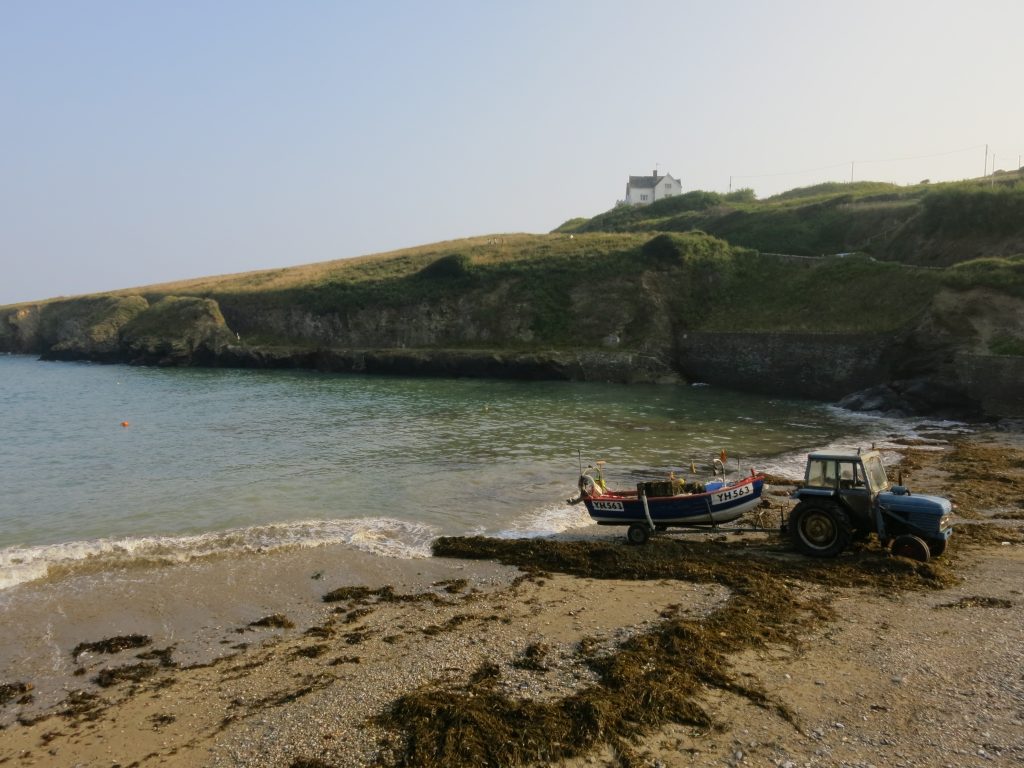
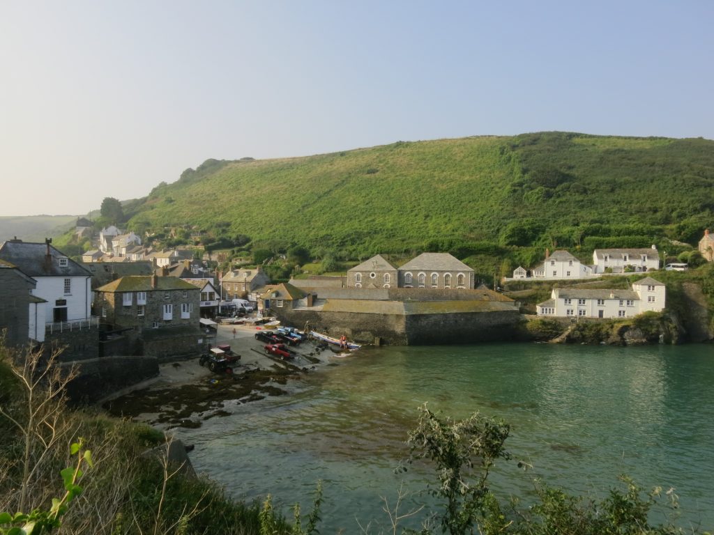
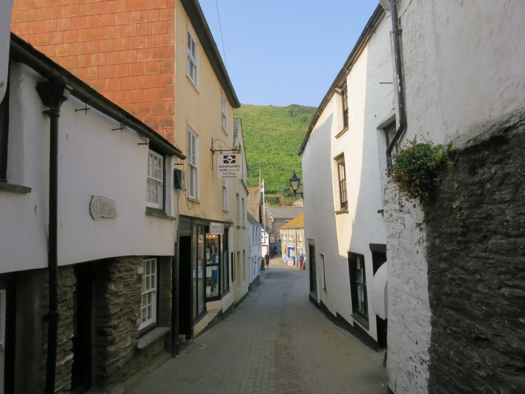
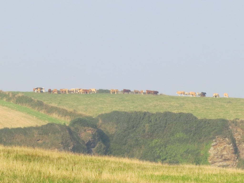
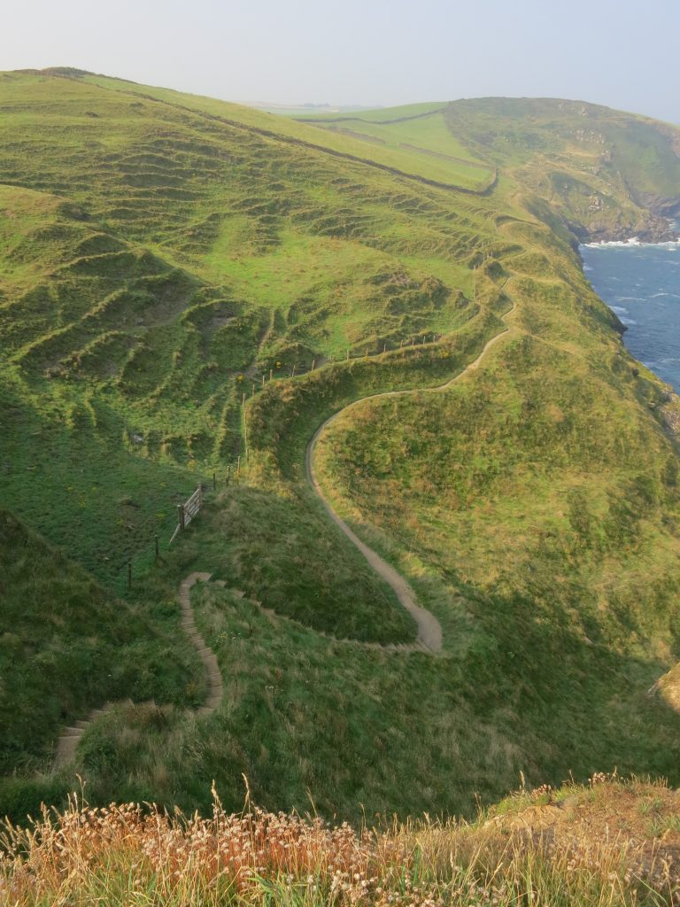
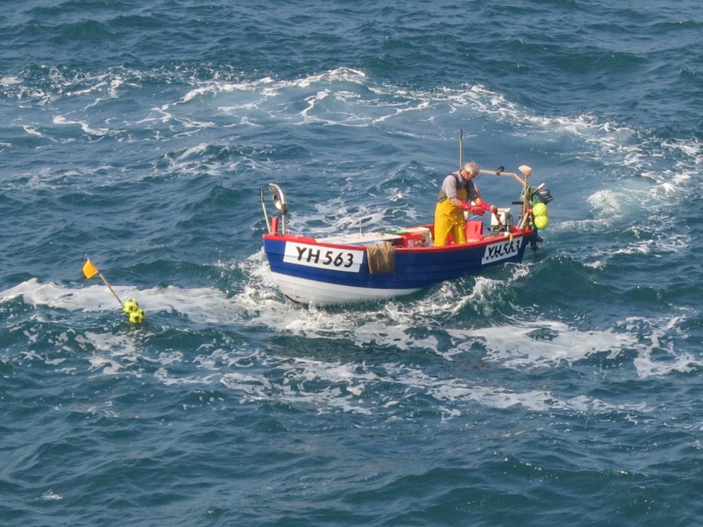
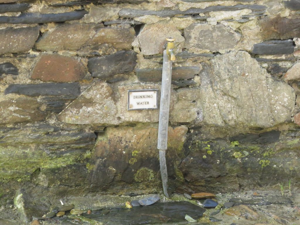
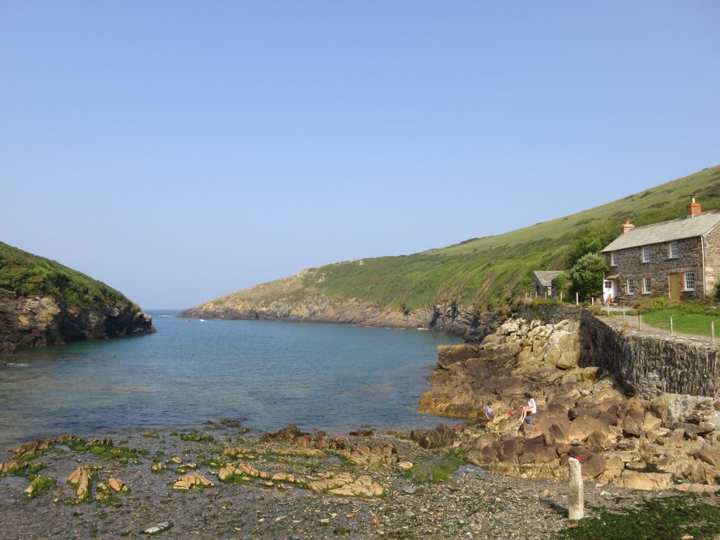
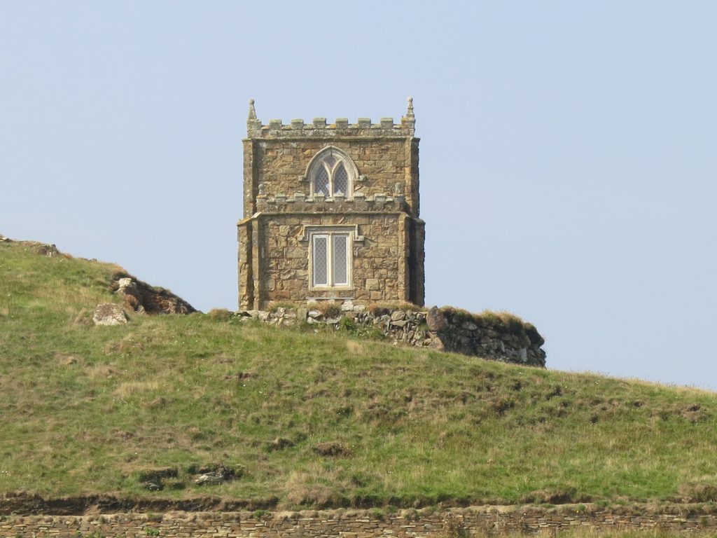
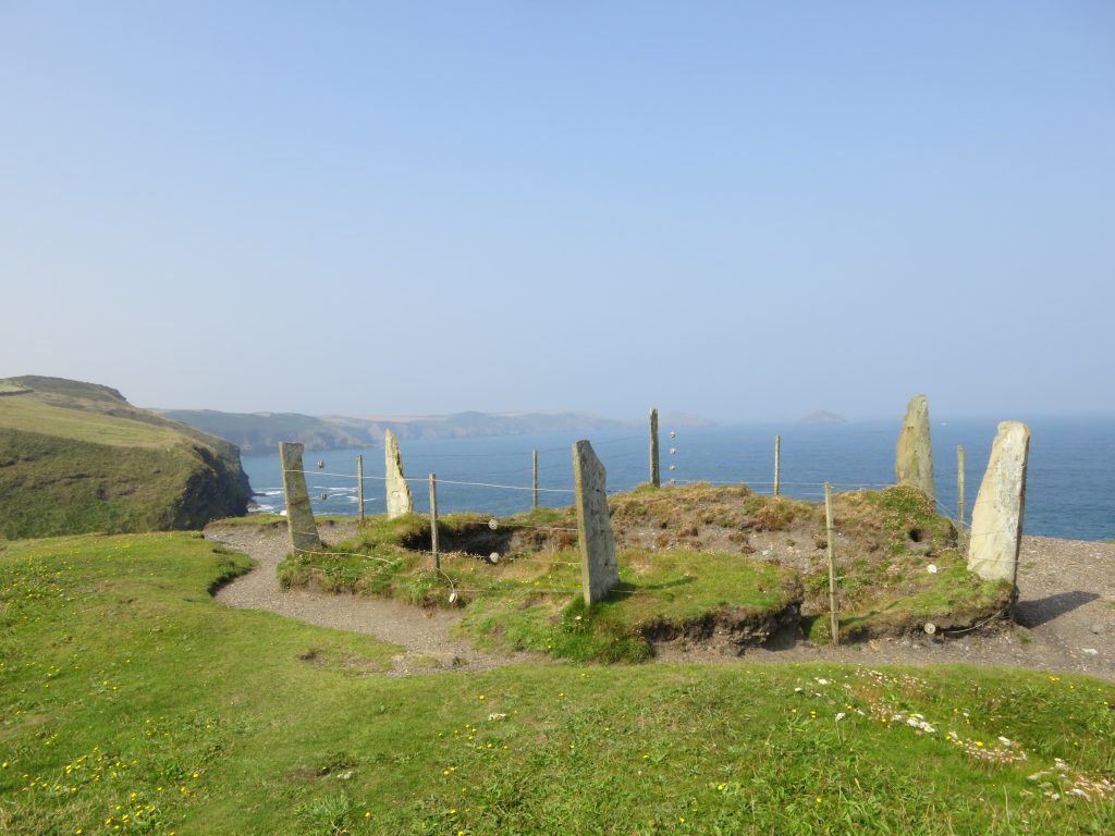
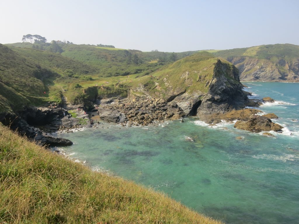
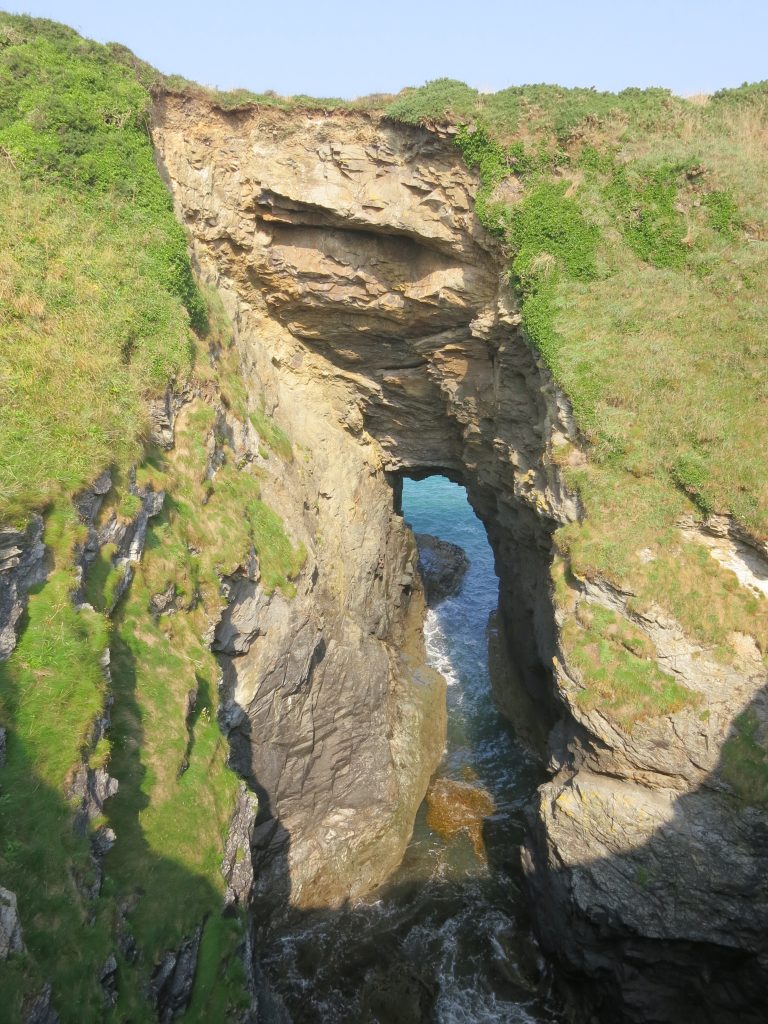
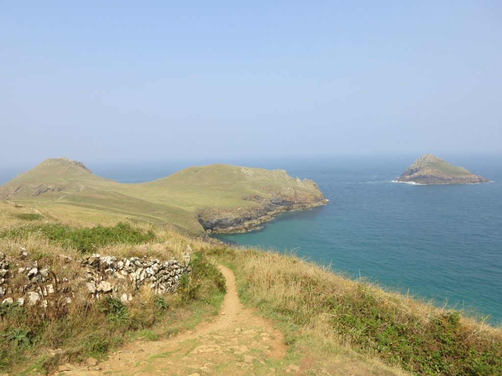
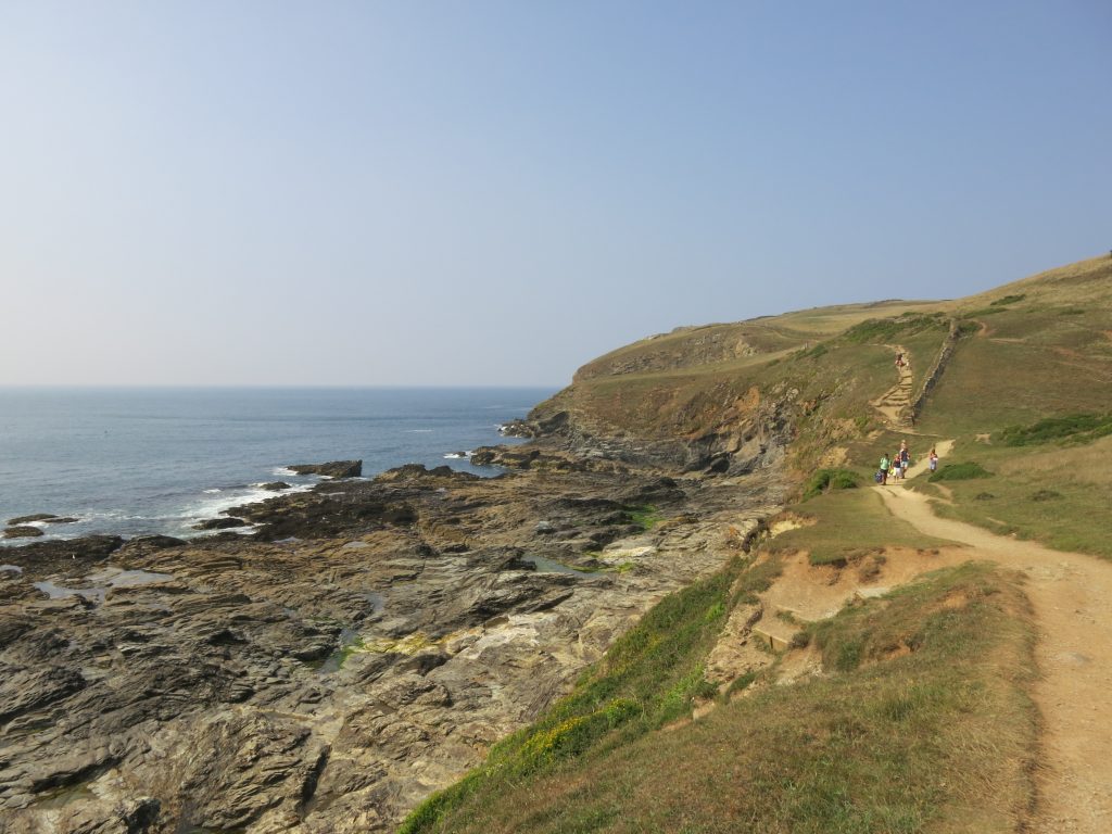
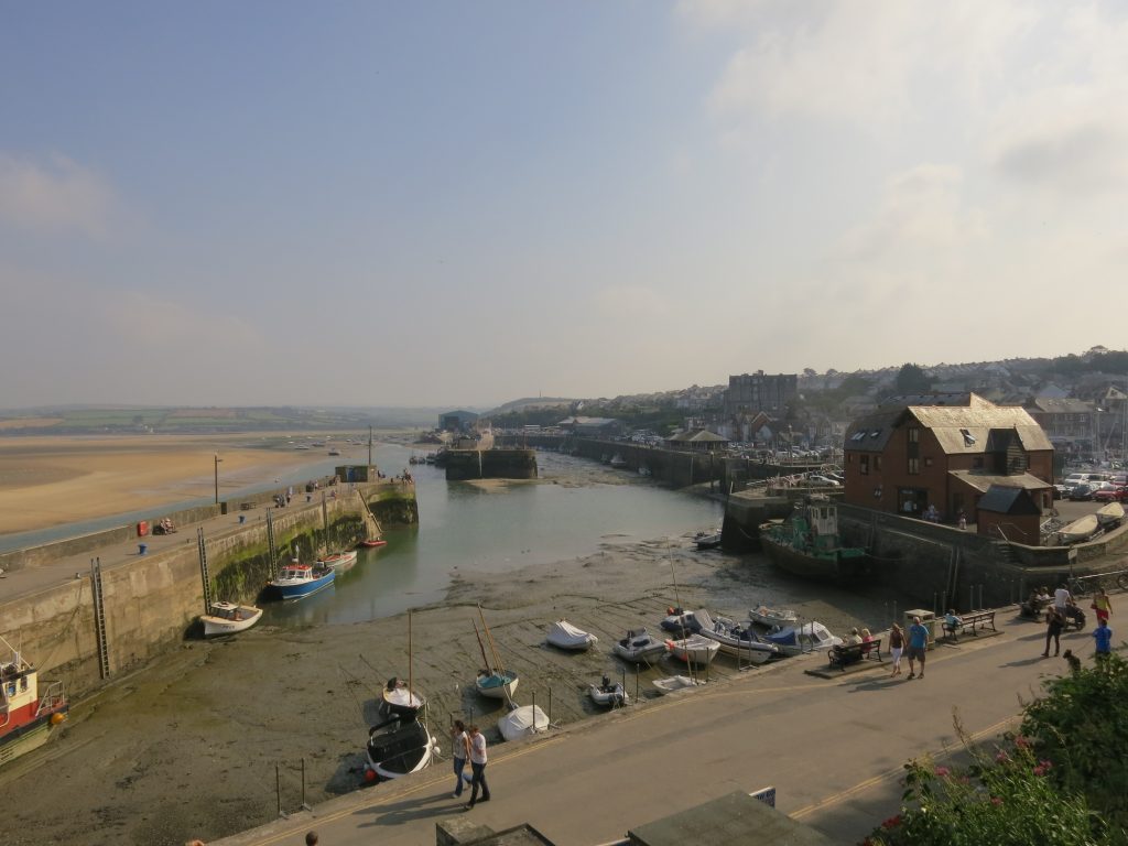
I retraced my steps of late yesterday afternoon, going down the hill to Port Gaverne, along a very dew-y path, to the cove where a tractor on the beach was backing a fishing boat into the water. The descent was followed, as so many others, by an ascent straight back up a hill to Port Isaac. The path followed a coastal route to harbour, a natural inlet protected by two breakwaters well out in the cove, overlooked by steep cliffs and with sea caves to add interest. It was an attractive place, if in danger of being a bit twee, and well provided with cafés, restaurants, pubs, and shops selling fish, crabs and fudge (all mostly shut at 9.10 on a bank holiday). However, I found no “ordinary” shops – presumably there was one somewhere, but I was disinclined to start walking back up hills, and I decided to press on, albeit with some slight anxiety about the fact that I was carrying only 1.25 litres of water, and hoped that the reference in my guide book to their being a water tap in Port Quin was accurate – and that I would be able to locate it. So I climbed away from Port Isaac, initially on a road to guesthouses, then on small granite steps up the cliff edge – most steps on the coast path tend to have very big rises, but these were very small by comparison. It was a warm, sunny but hazy morning, making for lots of sweating and poor photography. Heading round Pine Haven, my eyes were drawn to a field on the other side of the combe, where for some reason the cattle had all congregated on the ridge line. The twisty path as I walk past Downgate CoveComing around Kellan Head, a fisherman was out picking up pots. Port Quin was once a thriving fishing village on a par with Port Isaac, but in the great storm of 1698 the entire fishing fleet was destroyed, none of the fishermen of Port Quin returned alive, creating many widows. The families that were left all moved from Port Quin to Port Isaac, leaving the place deserted. Nowadays it is little more than a hamlet with a long natural cove: the path along the northern side was a long gentle descent towards the dwellings, with Doyden Castle and Doyden Manor looking down from the other side. By the time I reached Port Quin, there had already been several steep descents and re-ascents on a warm morning, and I had drunk 0.75 of my 1.25 litres of water, and knew that if I had to wait till Polzeath, I would be quite thirsty, but as I descended the last alley into the centre of the hamlet, there in front of me was a drinking water tap, helpfully labelled “drinking water”, so I drank my fill and topped up the bottles, giving me ample to reach Polzeath where I knew there would be plenty of facilities. The quiet Port QuinI walked up towards Doyden Point, walking between the prominent white house of Doyden Manor and Doyden Castle. The Castle is a castellated folly built around 1830 for Samuel Symons as somewhere to play cards. As I passed it today a coastguard helicopter went overhead. The remains of antimony mines Epphaven Cove seemed a popular spot with people perched on rocks here there and everywhere, there being very little beach at the current state of the tide; more people were on the grass above the cove, making progress a little tricky, especially with the constant stream of families out walking coming in the opposite direction – quite a contrast from the previous few days where I’d seen very few other people more than a short stagger from a car park or road. In a moment of slight impatience I managed to catch my leg on something, probably a nettle but possibly something else, that irrirated it on and off for the rest of the day.Lundy Hole is a collapsed sea cave which makes for an impressive sight, being right next to the coast path, with a wall having been built to protect walkers, such is the precipitous nature of the fall down to the sea – unfortunately that makes photographing it well a challenge, and I really needed a wider angle lens to do the thing justice.I gradually approached the twin-mounded promontory of The Rumps, with its rows of defensive earthworks, looked over by the nearby rocky island of The Mouls, extra romance to the scene being added by the yacht gradually sliding by on this sunny day – a shame again about the haze.
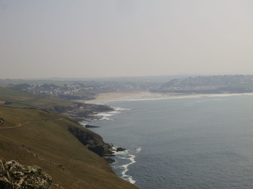
As I headed for Pentire Point, from where I would turn south to walk along the Camel Estuary, I could see over a col and through the haze south to Polzeath – I couldn’t quite see the beaches but I could see row upon row upon row of cars glistening in the bank holiday sunshine. First it was Pentire Point from where there were extensive views down the Camel estuary and across to the day mark on Stepper Point. A couple bearing a striking resemblance to the Duke and Duchess of Cambridge, and with the right accents, were taking photographs of each other.
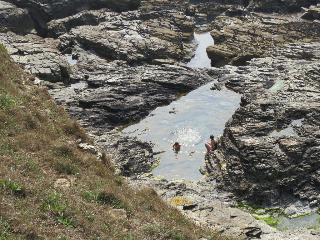
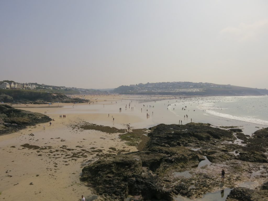
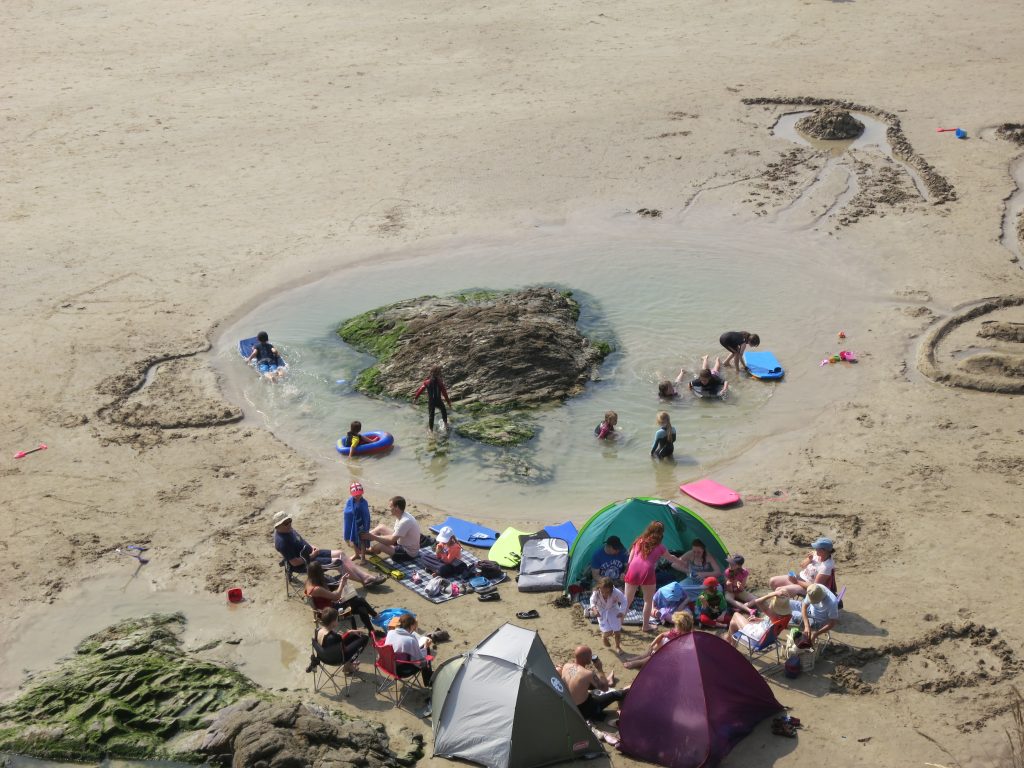
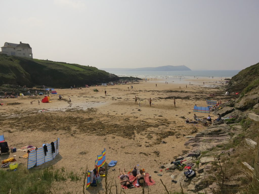
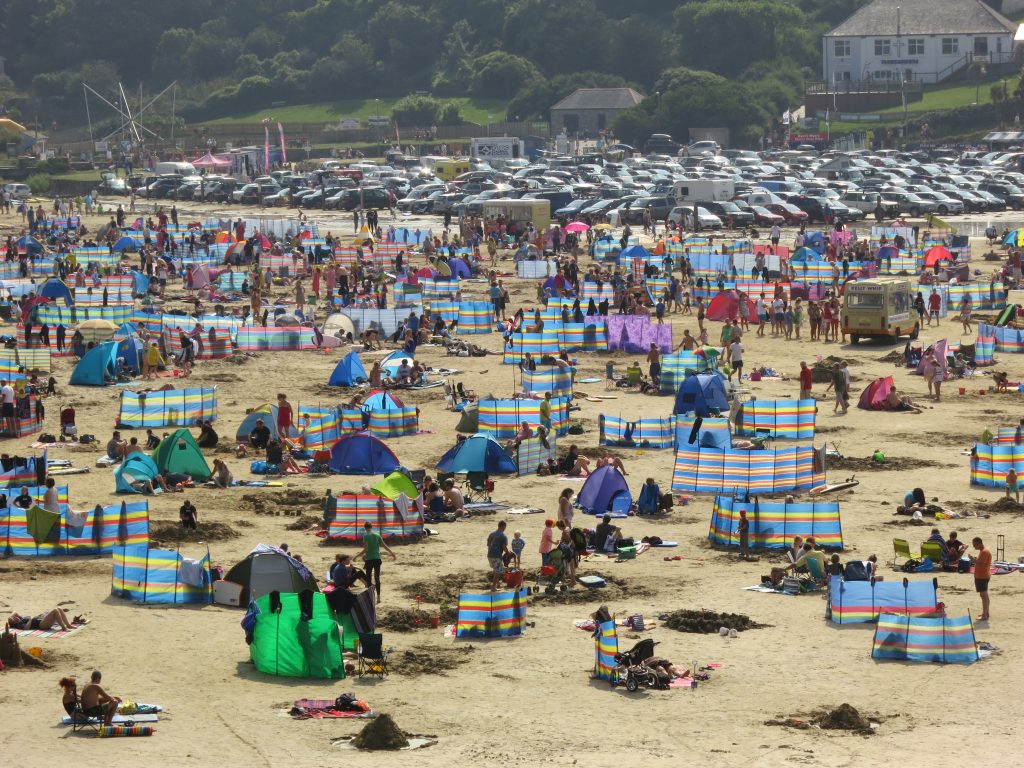
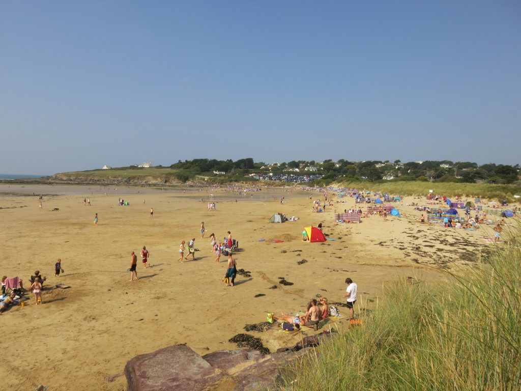
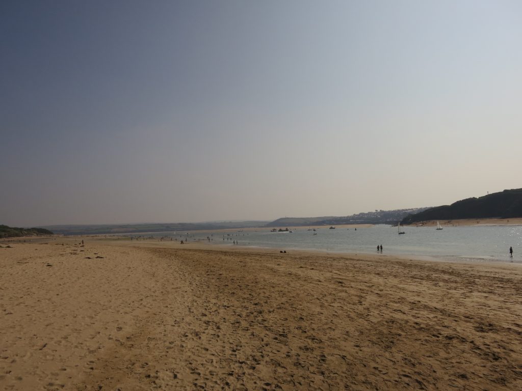
All of the steep ascents and descents were now over for the day, and it was a long pleasant gentle descent to Pentireglaze HavenI went past some delightful rock pools, some bigger than private swimming pools and being used as such. I loved this isolated rock with a ring of water right around it, surrounded in turn by sand, and the whole was being made enthusiastic use of by several children. There were quite a few people on the beach at Pentireglaze Haven……but as I neared Polzeath, the crowds thickened, with a bright array of windbreakers, many clearly bought from the same supplier giving a certain attractive uniformity to the beach decorations. The windbreakers weren’t being used for their traditional English beach purpose of windbreaking, but rather of balkanisation – to divide the great communal location, the beach, into a series of tiny kingdoms. The beach was huge, however, and this seemed to work well, with just enough room between the mini-state for free movement of citizens and two ice-cream vans to be on the sand.
In the town itself I bought myself an ice-cream and a couple of drinks; I ate the ice-cream while walking away from the worst of the crowds towards Broadagogue Cove, where I stopped and had the first drink. The coast path from Polzeath to Daymer Bay was a popular family walk, but broad enough that we were all able to keep out of each other’s way.
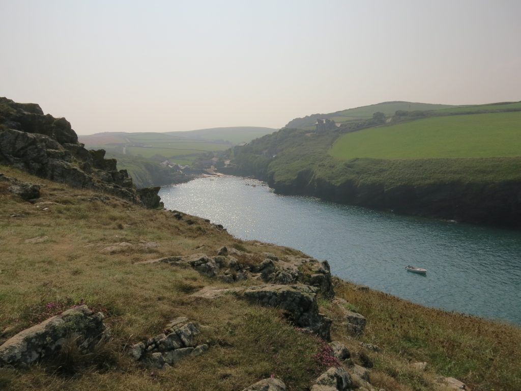
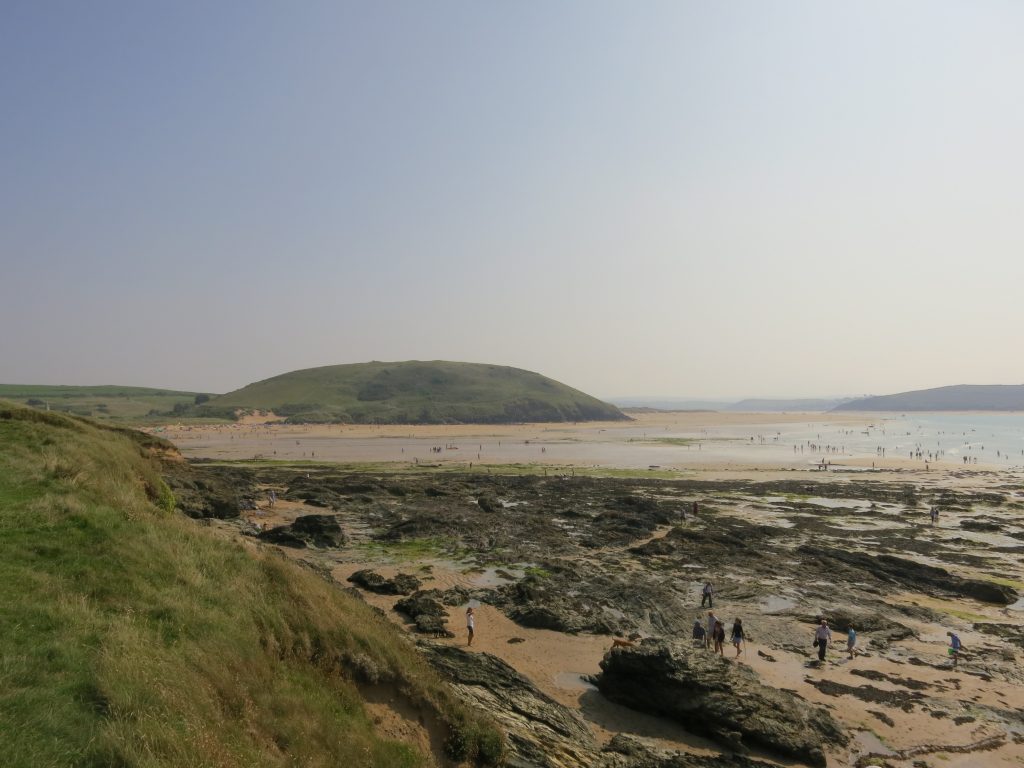
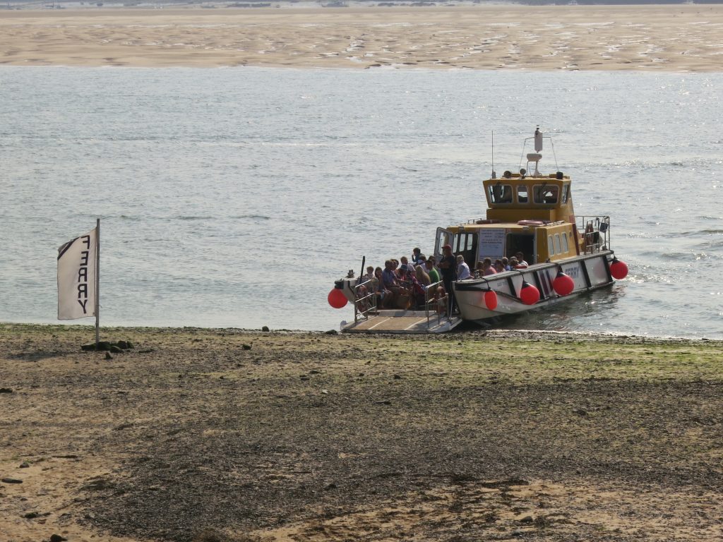
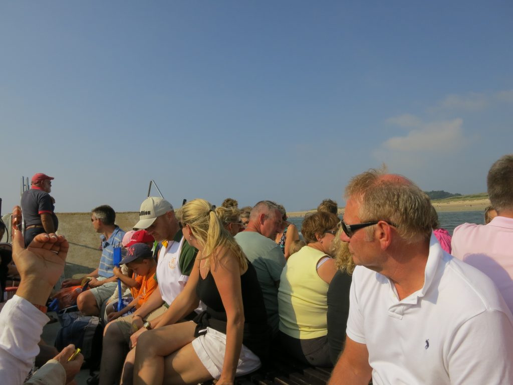
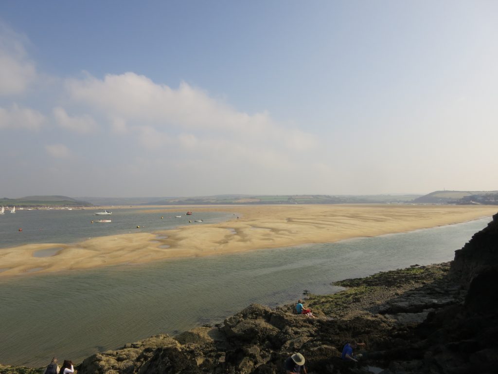
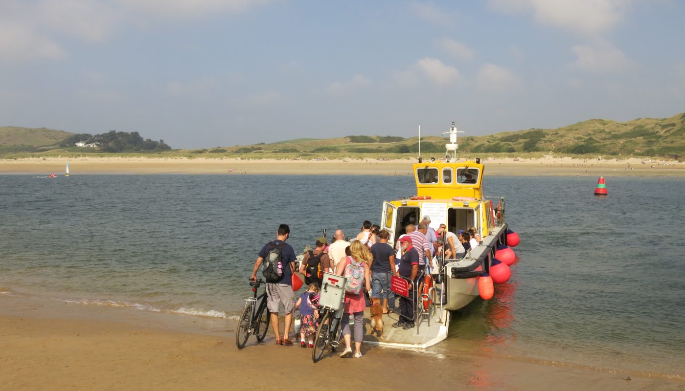
Approaching Daymer BayDaymer Bay I remember as a virtually deserted beach when Lucy and I came here with Henry and George ten years ago, but today it was busy, though still with plenty of room. The official coast path then takes to the side of Brea Hill, which I reached with a scramble up rocks from the beach, though as the tide was close to low I could have continued round on the beach. Once round Brea Hill, the official route heads through the dunes but I took to the firm sand of the quiet beach, swinging out to the west (apparently into the river on my plotted route) to keep to the firmest sand.As I approached Rock, it became a little busier with games of tennis, football and cricket going on. One young lad of about five was clearly a natural with the cricket bat, and I commented to his father that he needed more deep fielders.Approaching the slipway at Rock, I could see that I might just be able to catch the next ferry, but I was in no hurry so perched myself by the slipway and had the second of my drinks from Polzeath, watching the ferry cross the river and come back again.As it was just after low tide, the ferry couldn’t get into Padstow harbour, so it ran north-west to near St Saviour’s Point and put us down on the beach.People board the ferry for the return trip to RockFrom here it was a short walk back to the harbour at Padstow, where I linked up with my previous walk on the SWCP onwards to Porthcothan.I had my second ice-cream of the day by the harbour then walked up to the B&B where I was greeted by the landlady, and rested in my room for a while. Later in the evening I walked back into the town and got some fish and chips, a few provisions for tomorrow, and then to bed.

 by
by