Thames Path - Battersea Park to North Greenwich
9 November 2008
We haven't visited the Thames Path since February. With a fair bit of rain
recently, it seemed like a good opportunity for an urban walk, largely on
pavements. Today we picked up the
route at Battersea Park, which we reached in December last year, and continued through
central London and Greenwich to the Dome at North Greenwich. The Thames Path is actually two paths
for much of London - one on
the north bank and one on the south: we took the southern path for today's walk.
Warning:
What follows is very heavily image-intensive. There was so much to see, of a
wide variety of things and scenes, that I took 236 photos in five hours. I've
pared it back a good deal, but this is the most photos I've ever included for a
single day on this site. Some may say there are too many. But hey, it's our website, and I will if I want to!
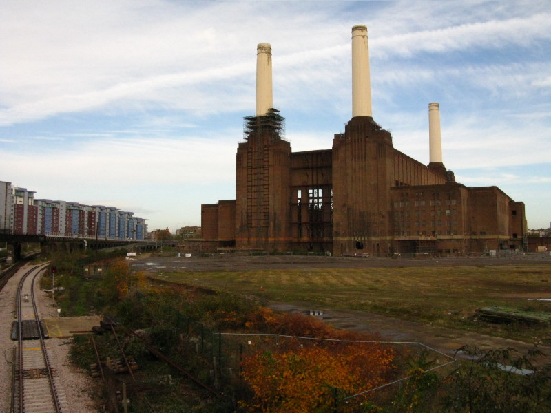
The shell of Battersea Power Station - opened in 1939 it closed in 1983
since when it has been derelict. It is the largest brick-built structure
in Europe.
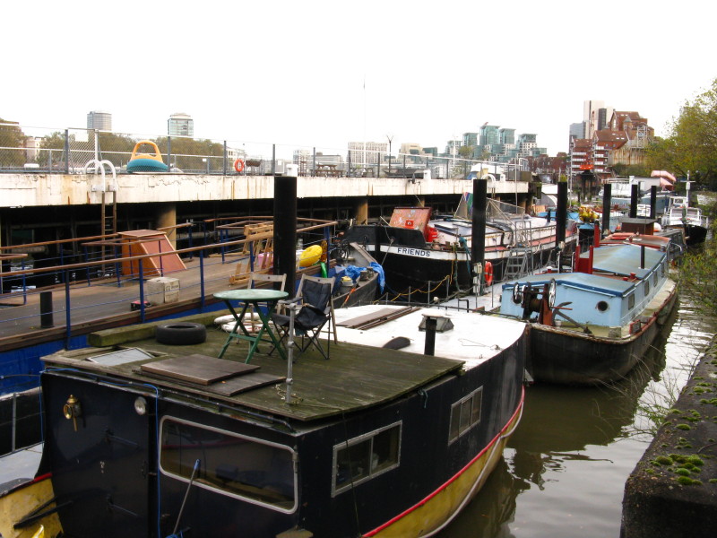
So we reach the Thames after a trudge along Prince of Wales Road, and
find lots of residential boats lurking between the bank and an old
mooring pier
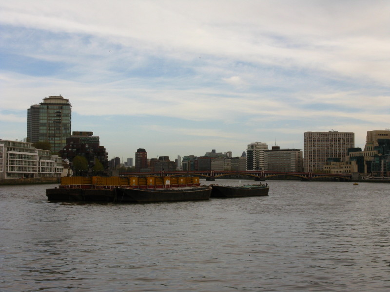
Looking downstream past rubbish barges to Vauxhall Bridge
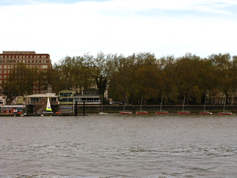
Sailing dinghies line the north bank
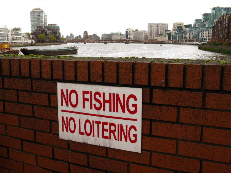
I'm not sure how "no loitering" is to be interpreted, but George and I
took no chances!
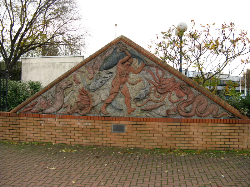
Father Thames - the panel was created by Stephen Duncan and shows him
wrestling with a variety of marine life.
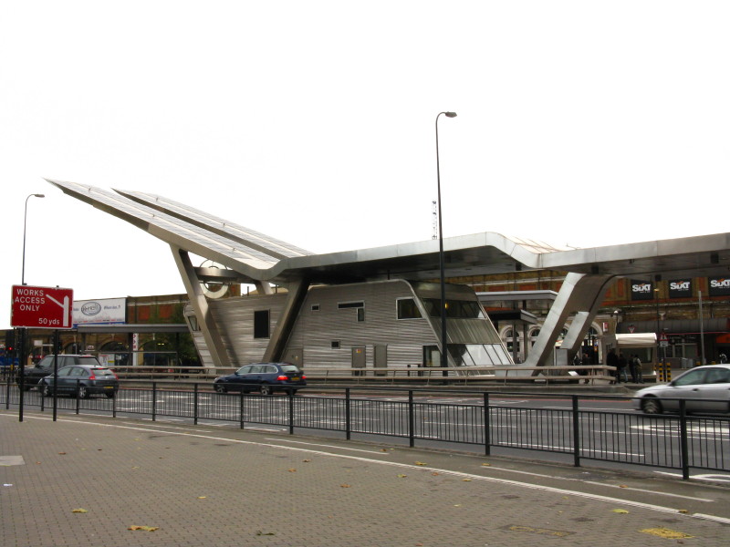
We return to the road for a while, and pass what I've always thought a
bizarre structure - no, it's not a dry ski slope, or a missile launch
pad, it's a bus station. There are solar panels on top which supply
energy for 60% of the station's lighting.
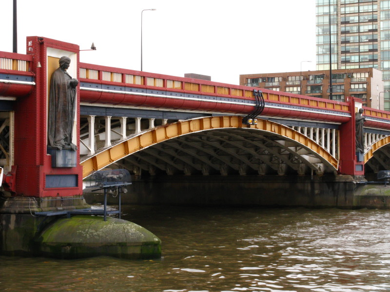
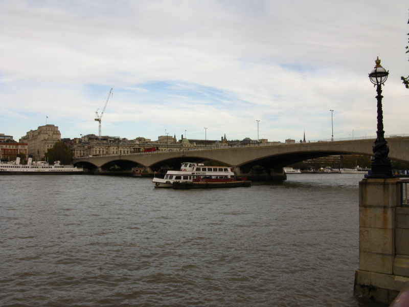
Vauxhall Bridge was completed in 1906, designed by Sir Alexander Binnie.
The figures, two of which are shown here by Alfred Drury, commemorate
the arts and sciences
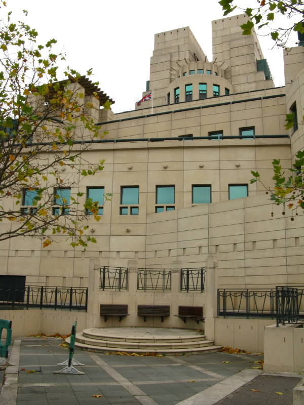
The headquarters of the Secret Intelligence Service, better known as MI6
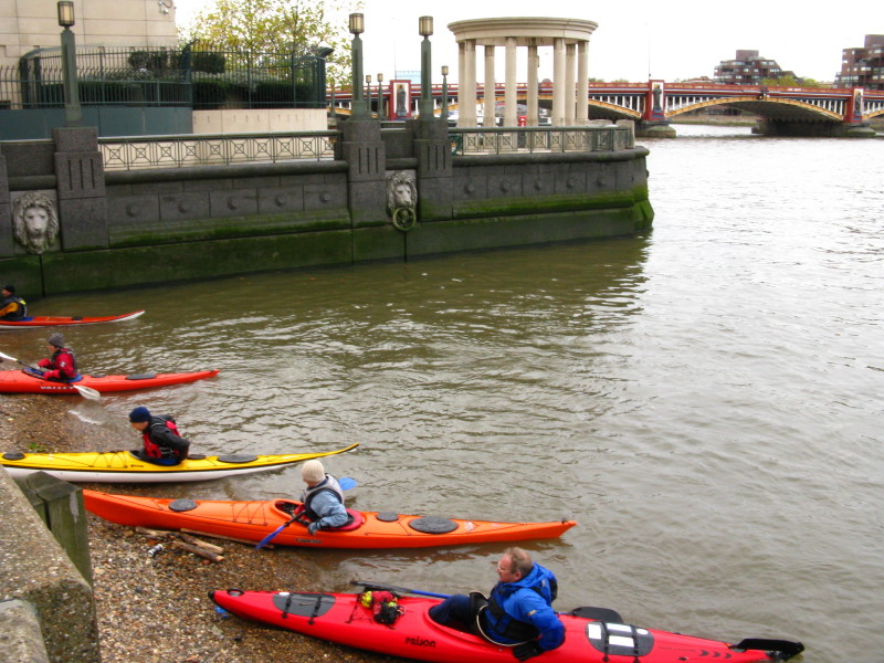
More boats on the river.
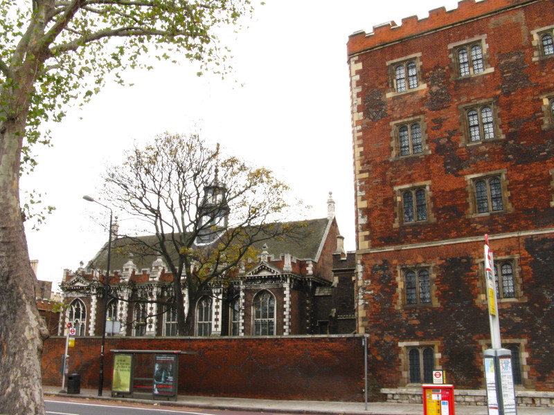
Lambeth Palace, the London home of the Archbishop of Canterbury. On the
right is part of the Lollards Tower gatehouse, dating from the fifteenth
century. The great hall on the left was rebuilt in 1663. The fig tree in
front is believed to date from 1525.
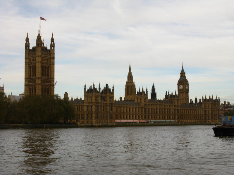
The Palace of Westminster, largely dating from the 19th century.
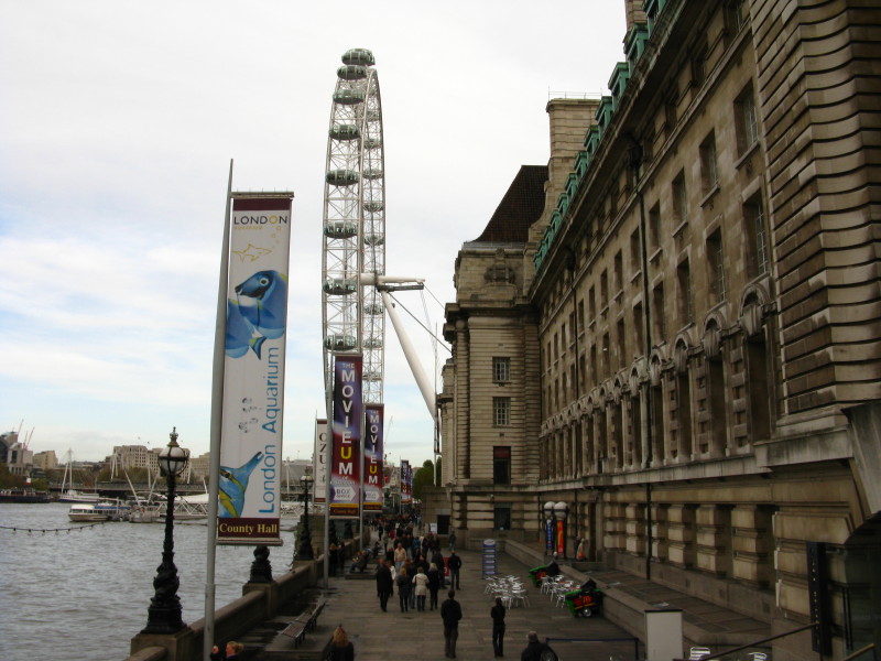
On our side of the river, we pass County Hall, home to the Greater
London Council until 1986 and now hotels, gallery, aquarium, museum and
restaurants. We head towards the London Eye.
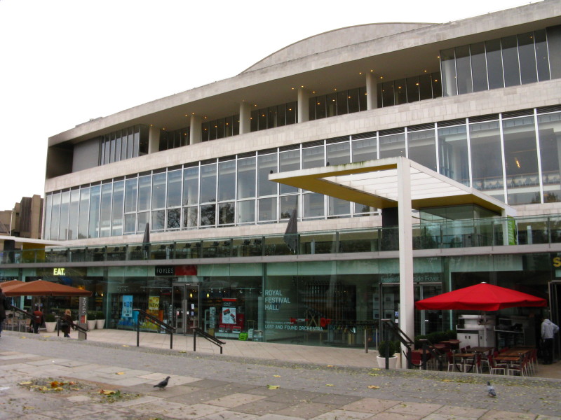
The Royal Festival Hall in the South Bank arts complex. The area around
here was developed for the Festival of Britain in 1951
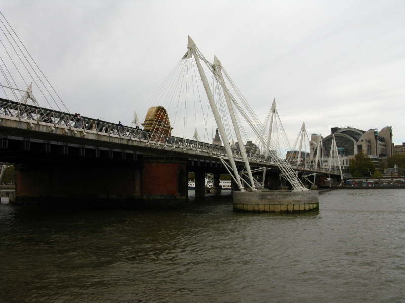
Hungerford Bridge, opened in this form in 1864, carries the railway to
Charing Cross station. The cable-stayed footbridges either side are the
Golden Jubilee Bridges, and were opened in 2002.
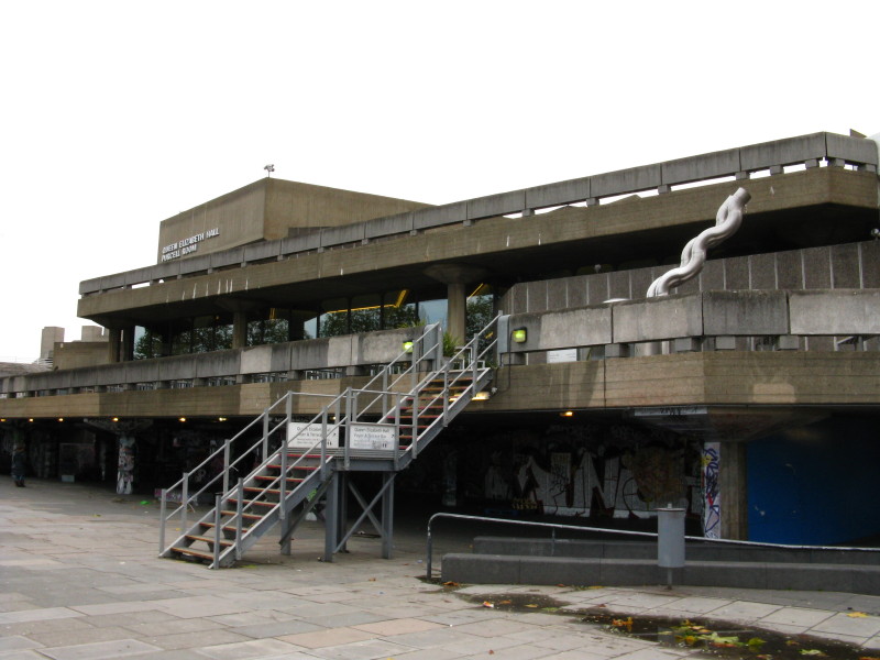
The Queen Elizabeth Hall, continuing the South Bank arts complex.
Waterloo Bridge, opened in 1945, designed by Sir Giles Gilbert Scott.
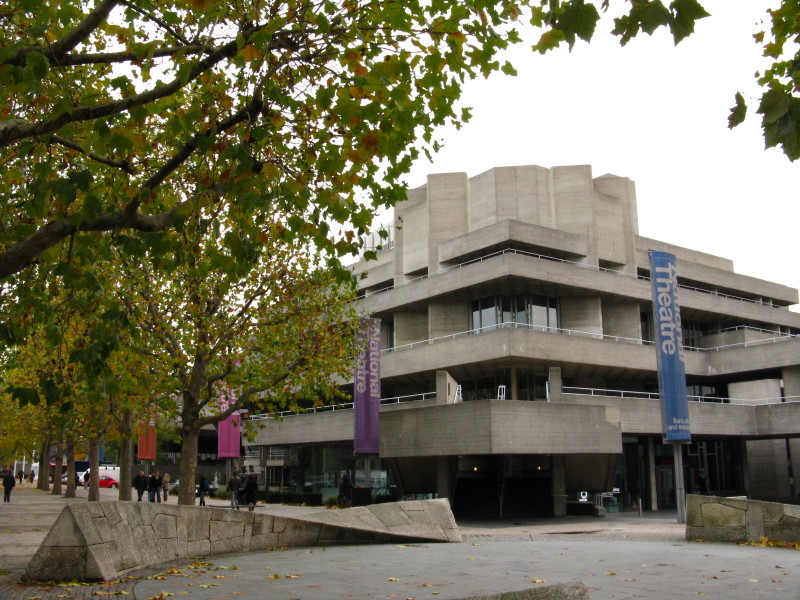
The Royal National Theatre, opened in 1976/77.
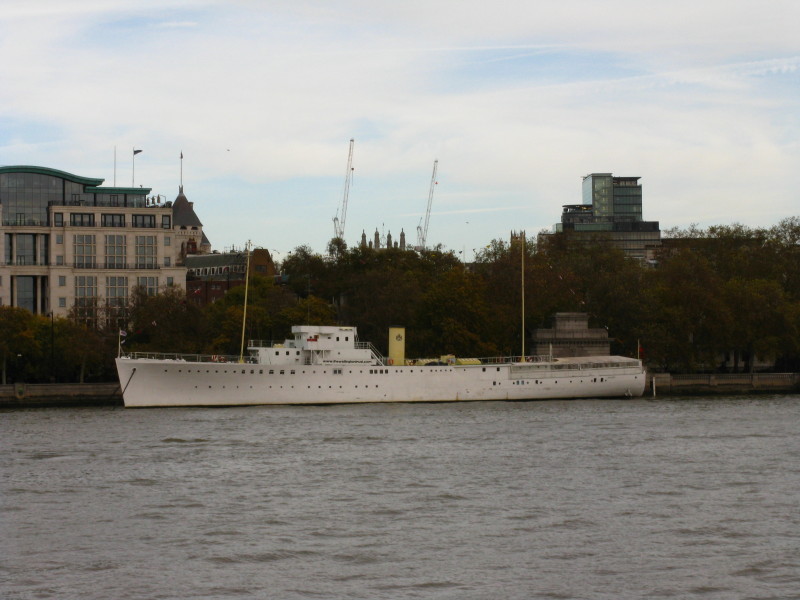
HQS Wellington - a Grimsby class sloop built in 1934, now serving as the
headquarters of the Honourable Company of Master Mariners.
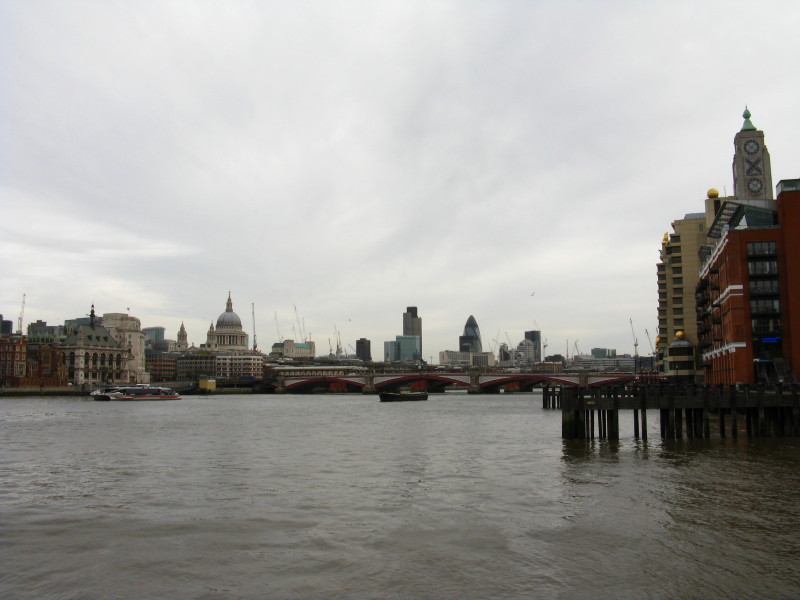
Looking downstream to Blackfriars Bridge (completed in 1869). The
skyline includes the dome of St Paul's Cathedral, Tower 42, 30 St Mary
Axe, and the Oxo Tower.
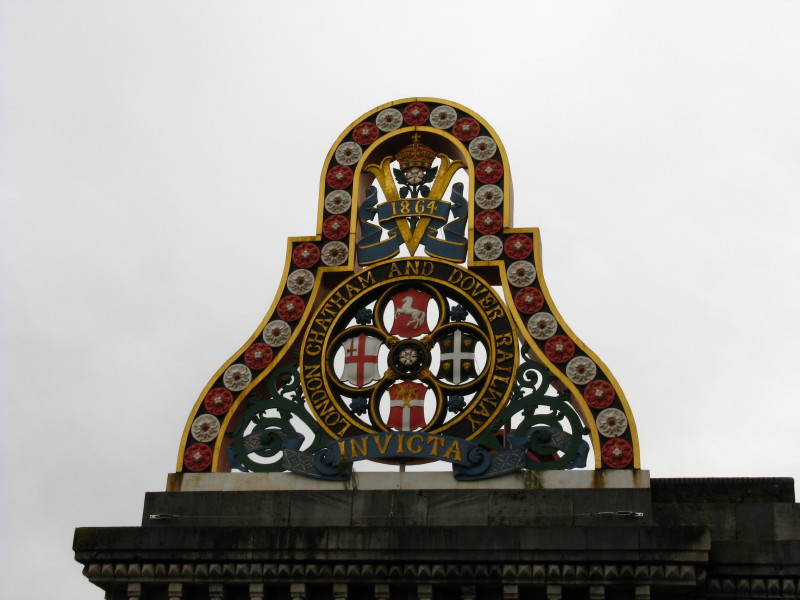
The crest of the London, Chatham and Dover Railway company on the
original abutments of the Blackfriars Railway Bridge
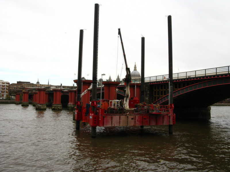
The red pillars from the 1864-bridge are now defunct next to the newer
bridge which dates from 1886 and was originally called St Paul's Railway
Bridge.
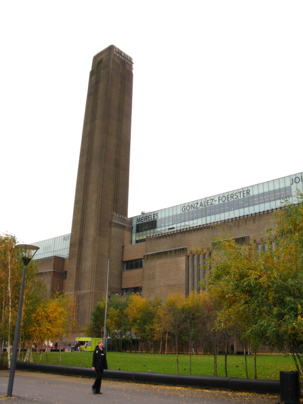
Bankside Power Station, which closed in 1981 and now houses the Tate
Modern gallery.
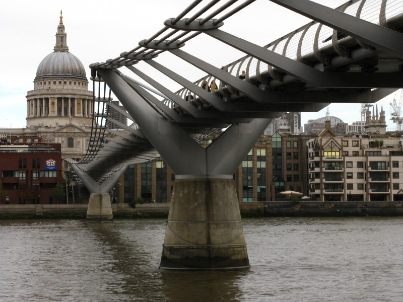
The dome of St Paul's Cathedral (built 1675 to 1708), with the
Millennium Bridge (opened in 2000).
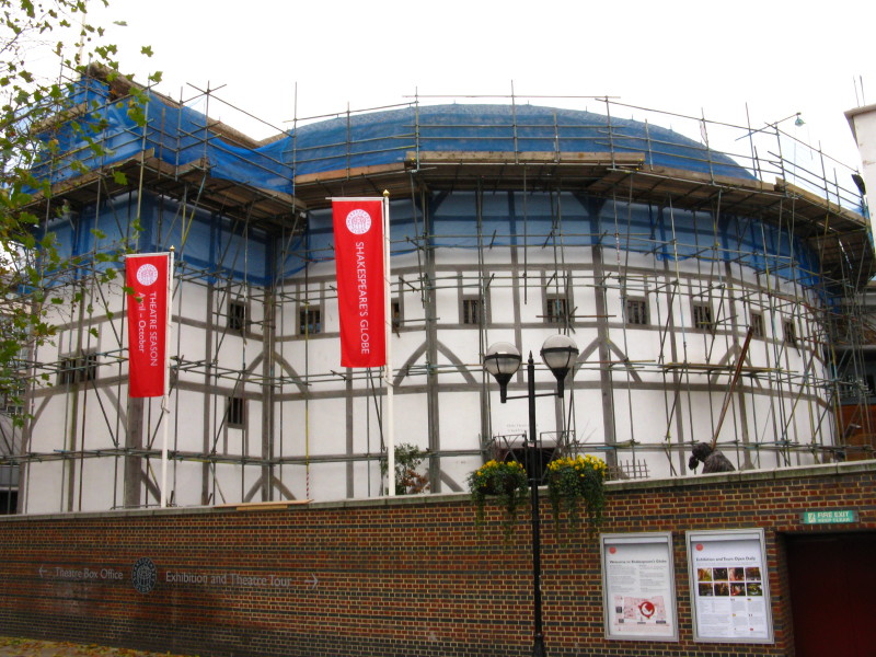
The Globe Theatre, sadly covered in scaffolding, is a close replica (on
a different site) of the Globe that Shakespeare used.
Southwark Bridge, designed by Ernest George and Basil Mott, it opened in
1921.
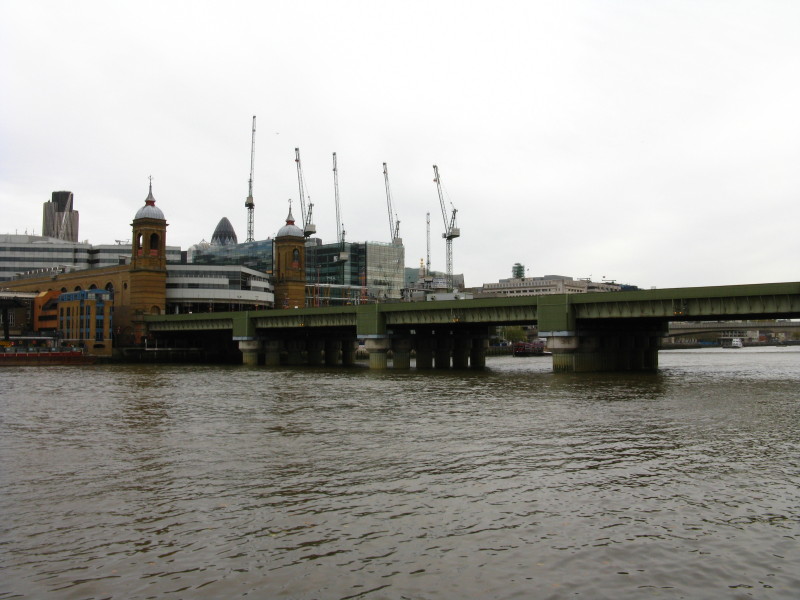
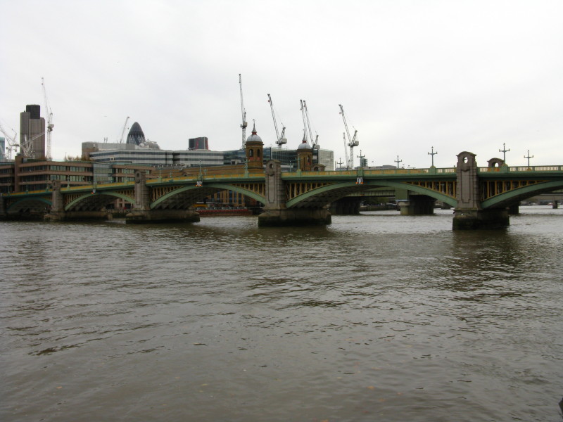
The next bridge is Canon Street Railway Bridge, and it carries trains to
Cannon Street station on the north bank. It was originally named
Alexandra Bridge after Alexandra of Denmark who was the wife of the
future King Edward VII. The bridge was designed by John Hawkshaw and
John Wolfe-Barry for the South Eastern Railway and opened in 1866.
Behind it can just be seen London Bridge, which opened in 1973.
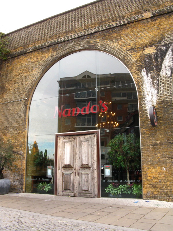
Under the Bridge, a modern restaurant has some beautiful reflective
glass and some impressive doors.
Walking under the bridge. This area on the south bank was known as the
Liberty of the Clink. Outside the City of London, it was administered by
the Bishops of Winchester, who (unlike the more restrictive City)
allowed the theatres such as the Globe, brothels, bull- and bear-baiting
rings, many taverns, and several prisons.
The single wall is the remains of the Bishops' Hall, with its superb
rose window, probably from the 14th century.
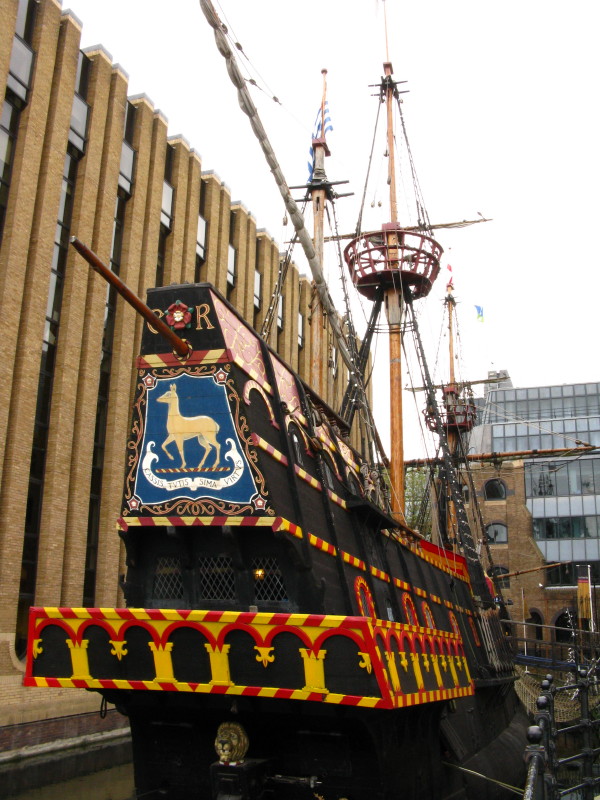
The dock of St Mary Overie, where sits the Golden Hinde, a full-sized
replica of the 16th-century ship in which Sir Francis Drake circled the
world. This replica has also circumnavigated.
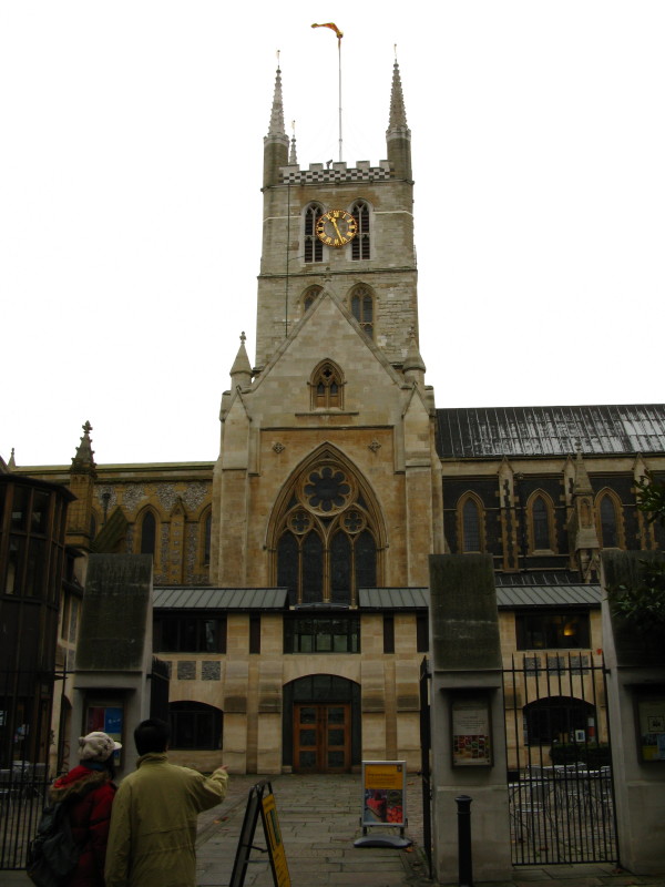
Southwark Cathedral. Although only a cathedral since 1905, most of the
building dates from between 1220 and 1420.
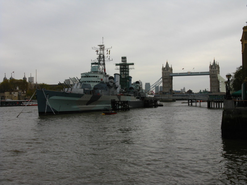
After passing under London Bridge, we now see HMS Belfast. Launched in
1938, the Town-class light cruiser of the Royal Navy served in World War
II and the Korean War. She was retired from active service in 1965,
saved for the nation in 1971 and towed to this berth at Symon's Wharf in
the Pool of London and opened to the public on Trafalgar Day that same
year. To the left is the Tower of London, and to the right Tower Bridge
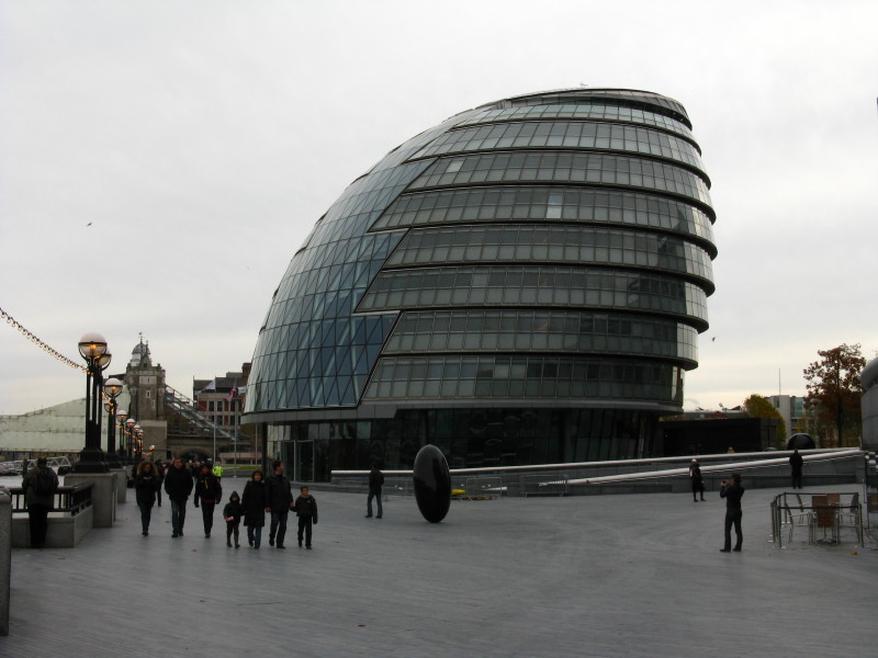
City Hall, headquarters of the Greater London Authority. Designed by
Norman Foster, it opened in July 2002. Of course, the building isn't in
a city nor does the GLA run a city, so the name is questionable.
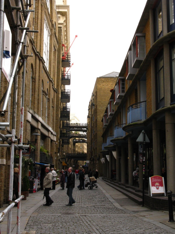
Past Tower Bridge, and we enter a narrow road called Shad Thames between old warehouses.
Butler's Wharf, once derelict (and the scene for a Doctor Who episode)
is now
thriving as a location for retail and food outlets.
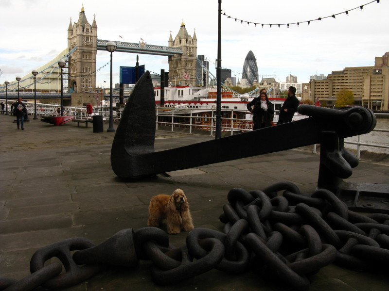
Returning to the river bank, George pauses by an anchor and chain. From
here on, the character of the walk changed - and the noise. From a
busy, bustling walk, it became much quieter.
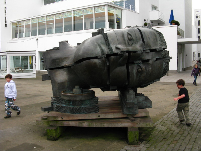
"Head of Invention" by Paolozzi, with the Design Museum behind it.
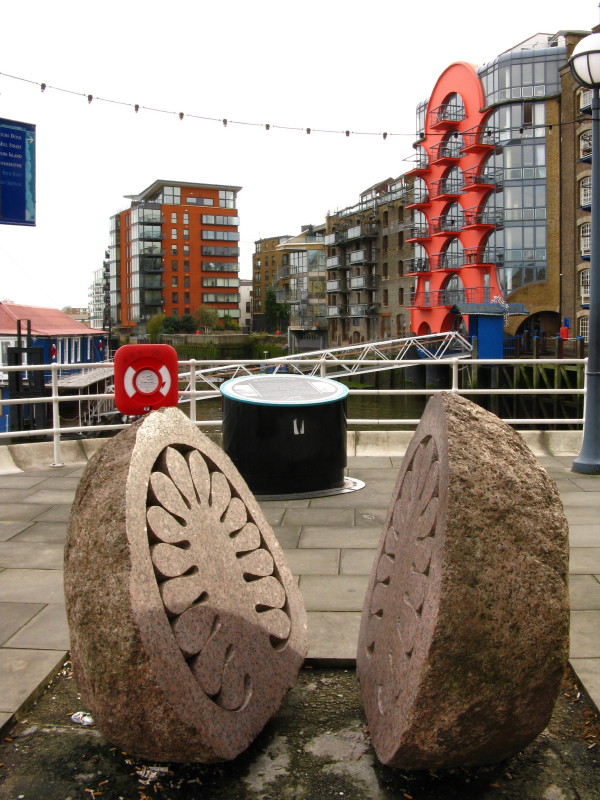
A beautiful split, carved and polished stone. I've seen something rather similar in the Lake District on the
edge of a lake.
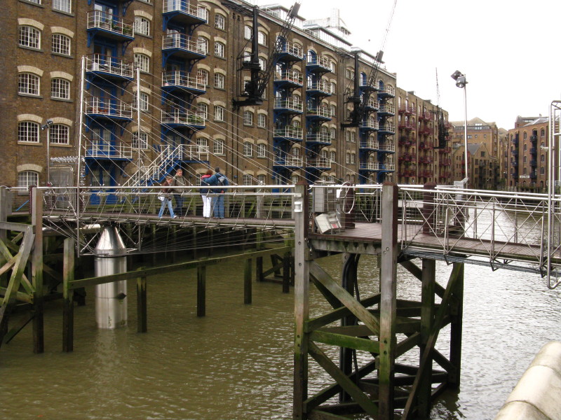
A modern cable-stayed bridge, opened in 1995, takes pedestrians over the entrance
to St Saviour's Dock. The combination of stainless steel and wood has
won design awards.
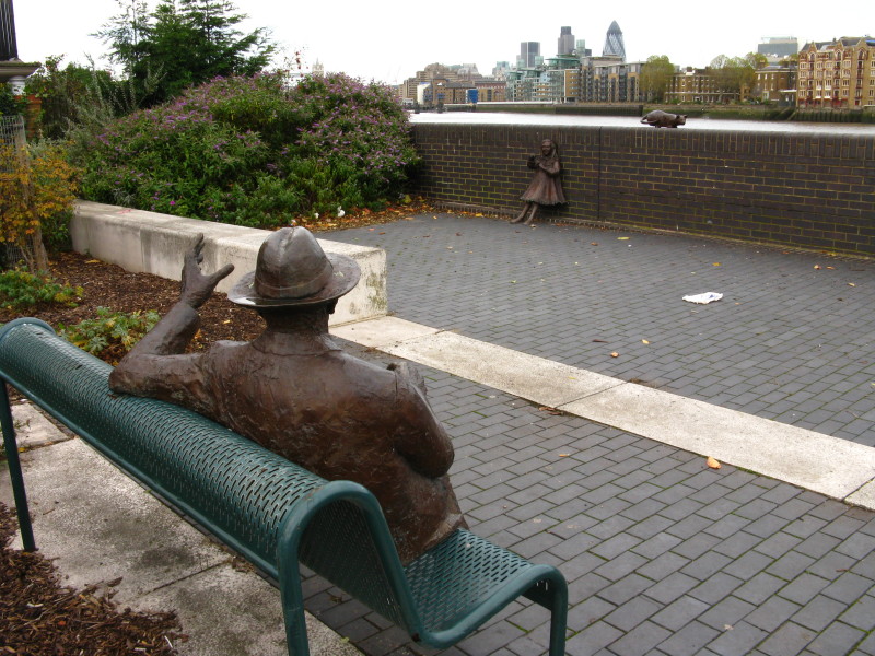
This sculpture by Diane Gorvin is a tribute to Doctor Salter, a local
benefactor, councillor and MP for the area, waving to his daughter Joyce
(and cat).
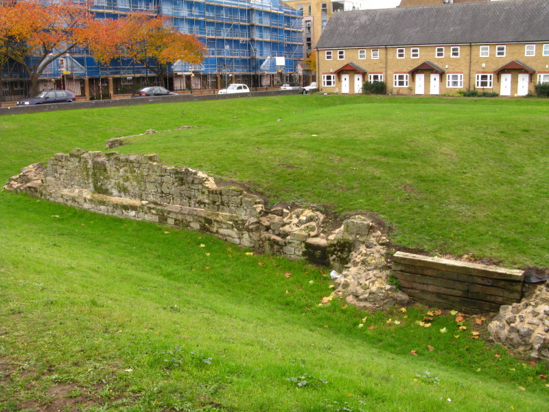
On the other side of the road are the remains of Edward III's moated
manor house built in 1353, which was unearthed from the foundations of a
warehouse.
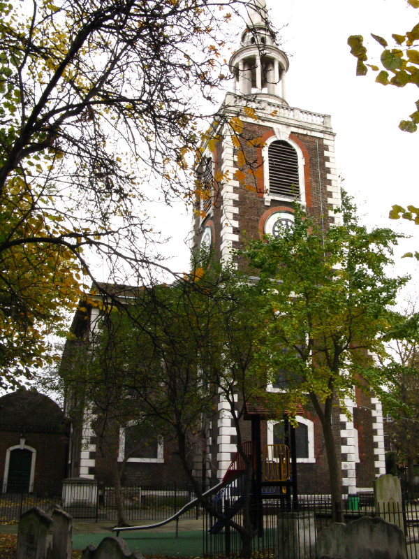
St Mary's church in Rotherhithe was rebuilt in 1747: the interior
includes a lot of ships' timber.
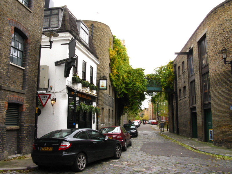
Continuing the highly varied nature of this walk as we make our way
through Rotherhithe village. The Mayflower pub here claims to stand on
the site of The Shippe, the spot from which the Pilgrim Fathers set out
in 1620.
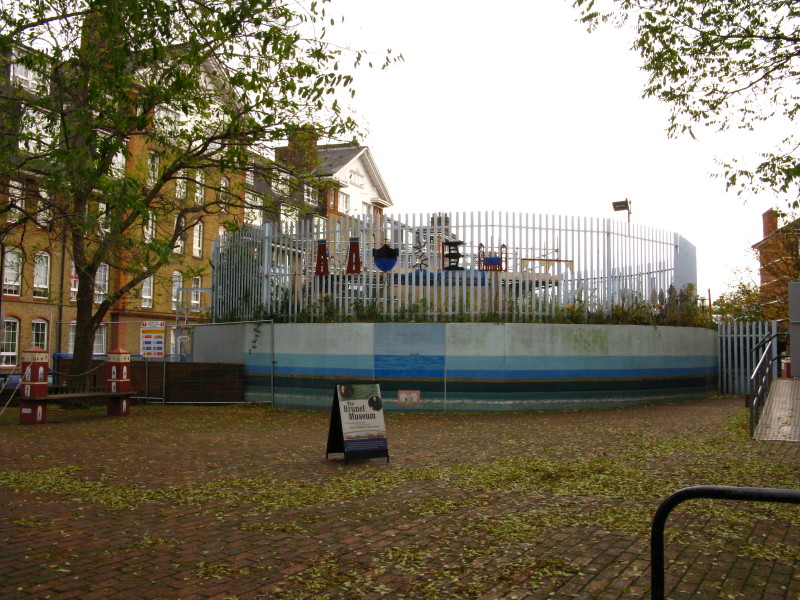
The southern ventilation shaft of Brunel's
Thames Tunnel, the first
underwater tunnel in the world, opened in 1843, and now being refurbished to carry the new Overground line.
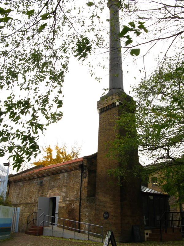
Brunel's pumping house for the Thames Tunnel
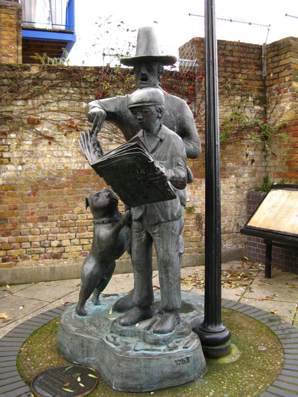
This sculpture by Peter McLean is called "Sunbeam Weekly and the
Pilgrim's Pocket". The boy is reading of the journey of the Mayflower
and all that followed after, with a pilgrim looking over his shoulder.
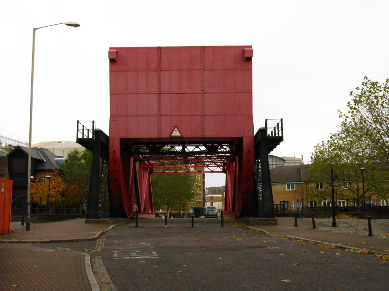
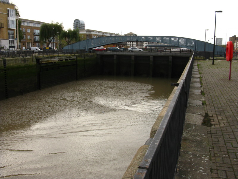
The red lift bridge allowed access to the Surrey Water docks complex
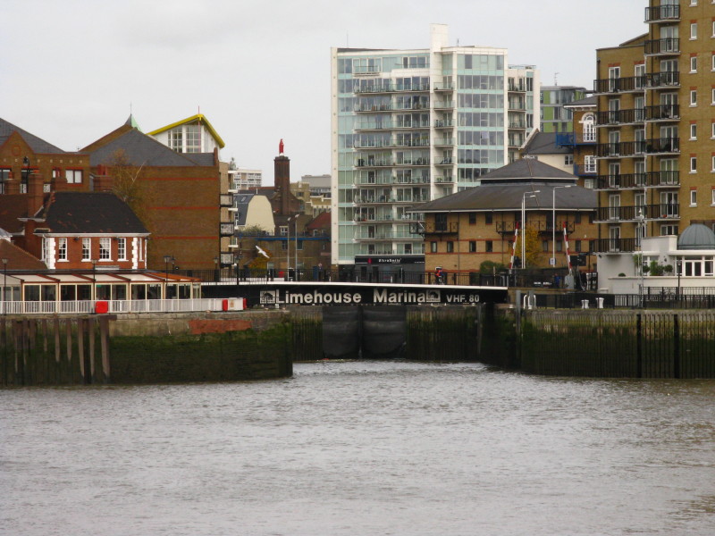
Across the river, the entrance to Limehouse Marina, the lock gates being
visible behind the lift bridge.
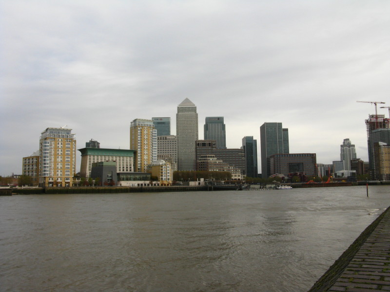
The towers of modern Docklands
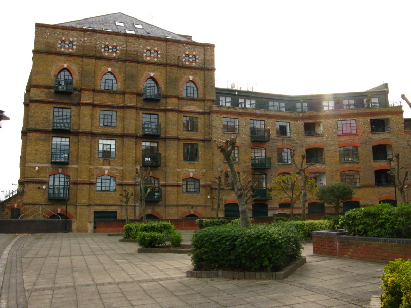
An old warehouse at Canada Wharf, now a Hilton Hotel
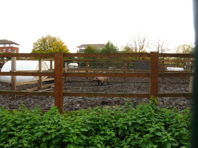
A pig, in the Surrey Docks Farm
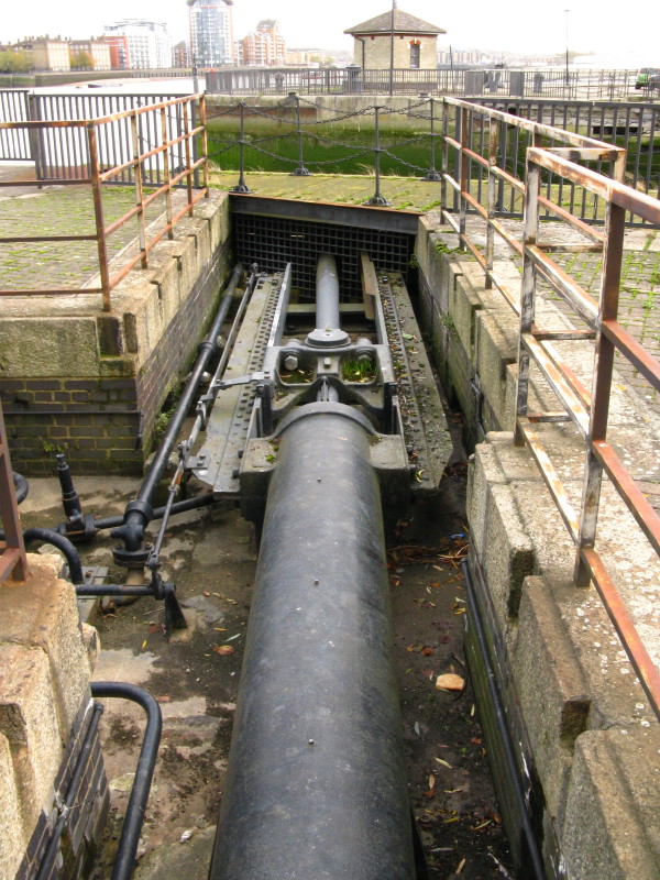
A hydraulic ram that used to open and close the lock gates
This entrance is no longer usable, a road having been built across it,
but the pedestrian swing bridge (like the lock gates, operated by
hydraulic power) is still there.
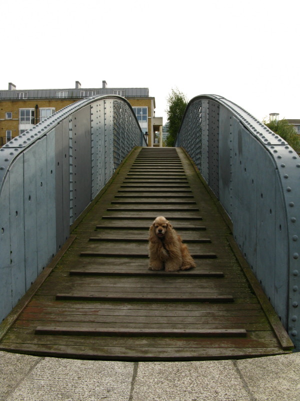
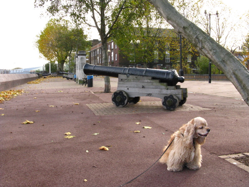
George on the swing bridge
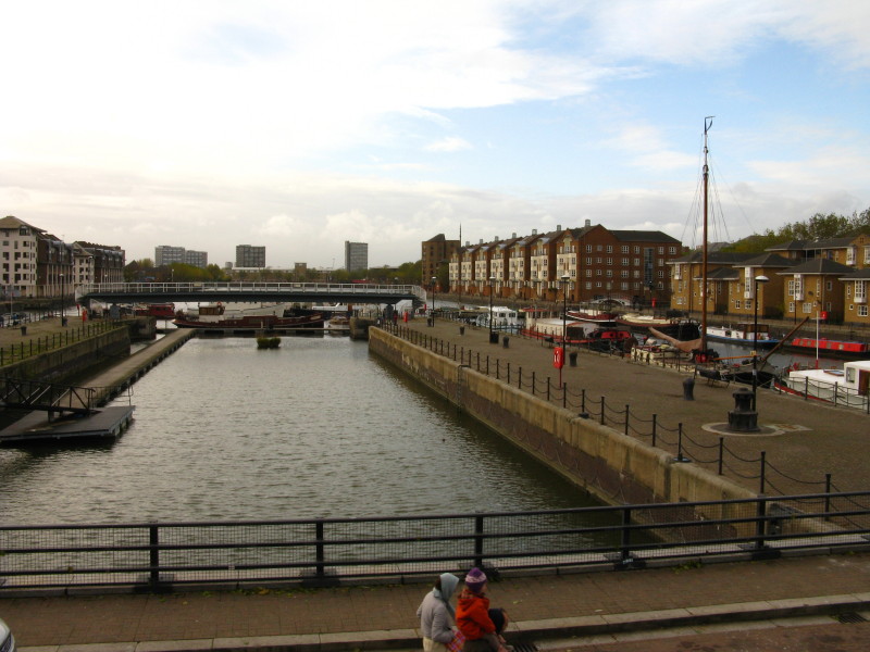
The view of Greenland Dock from the swingbridge, part of the small
remaining area in water of the old Surrey Commercial Docks
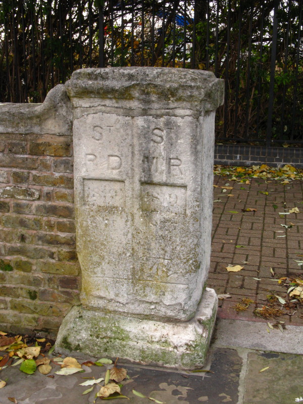
A boundary stone marking the boundary between St Mary's parish,
Rotherhithe, and St Paul's parish, Deptford. Until 1899 this was also
the Kent-Surrey border. The stone was on a bridge over the Early Creek
nearby, but was moved here in 1988.
Docklands - the new and the old
Deptford Strand, with its watergate and naval buildings are a small
remaining fragment of the great naval dockyard established here in the
16th century. The buildings are rum storehouses from around 1790. Most
of the site is now given over to high-rise housing.
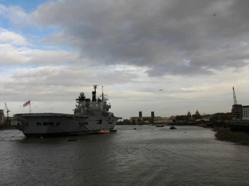
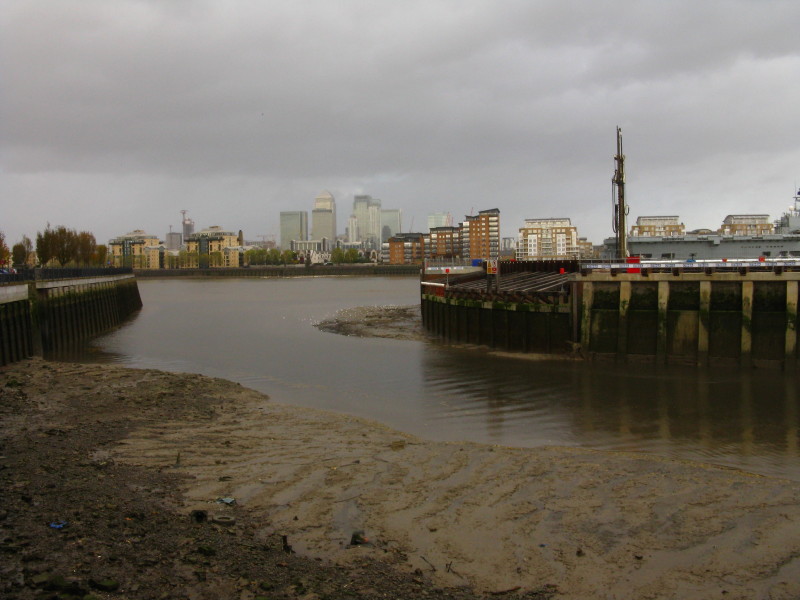
HMS Illustrious is moored in Greenwich for a week in connection with the
Royal Navy's Remembrance Day commemorations - and was also used for the
local fireworks display last weekend. HMS Illustrious is an
Invincible-class light aircraft carrier, launched in 1978 and still on
active service.
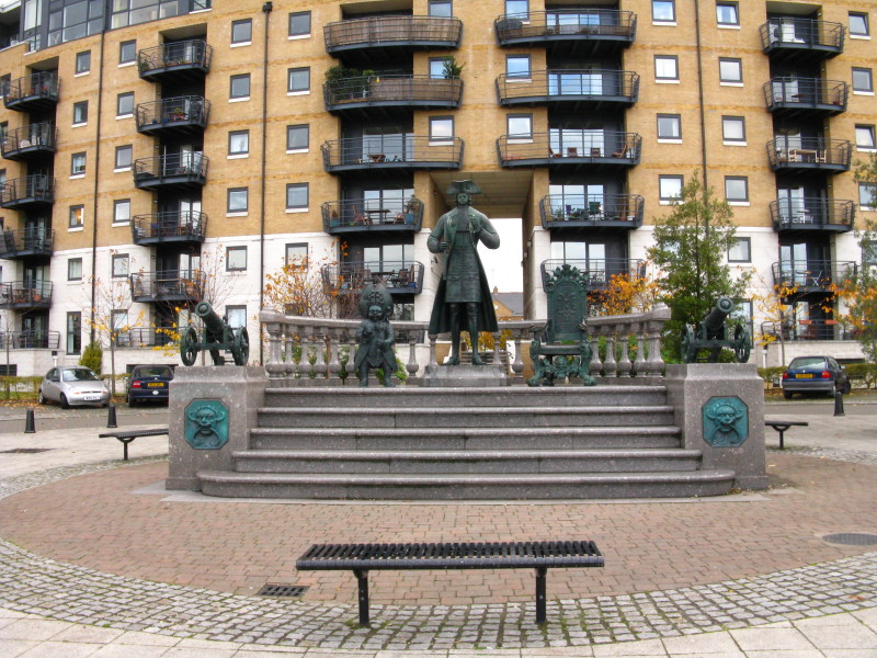
Peter The Great, otherwise known as Tsar Peter I of Russia, travelled to
Europe as a young man in 1697-98 to study new developments in
technology, especially shipbuilding. He lived near the Royal Dockyard in
Deptford for much of his four-month stay in England. This statue was
erected in 2001 to commemorate his visit.
The tidal section of the river flowing into the Thames is known as
Deptford Creek; the remainder is the River Ravensbourne
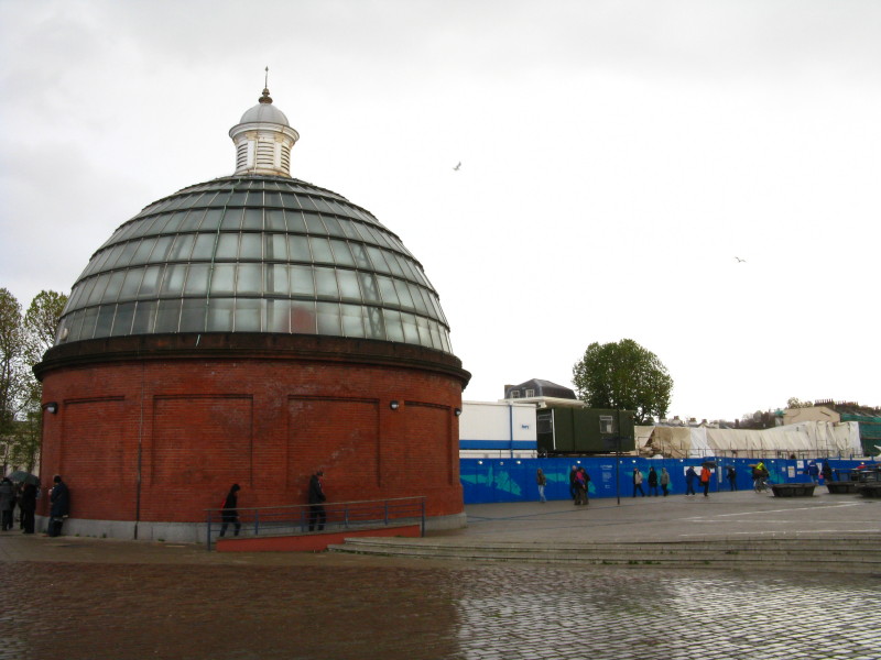
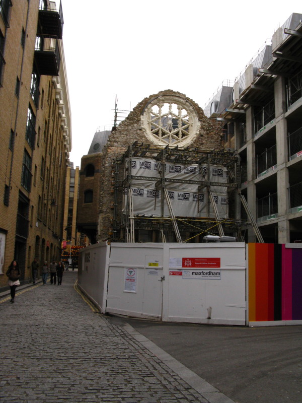
The southern portal of the Greenwich foot tunnel, together with the
hidden remains of the Cutty Sark, ravaged by fire since
my last visit
but hopefully to emerge renewed.
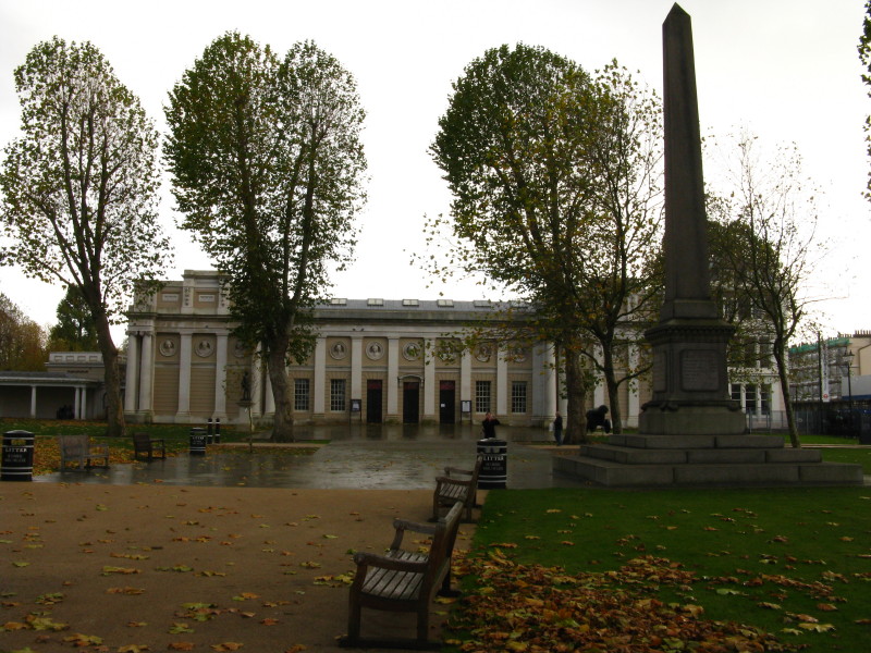
The Thames Path then squeezes along a narrow footway between the Thames
and the Royal Naval College
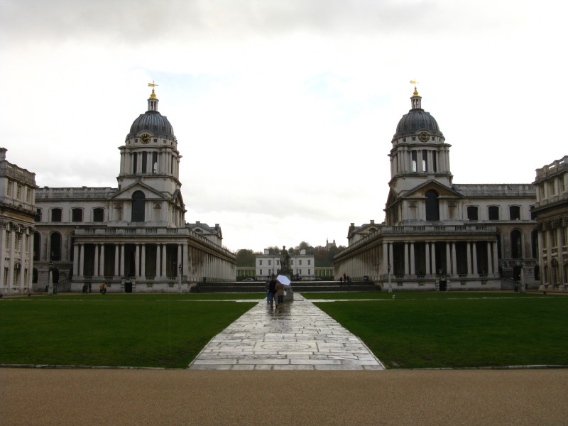
From the Water Gate, the two wings of the College are displayed to best
effect. They were built from 1696 as a hospital for disabled seamen, but
allowed a view through the gap between them from the Queen's House
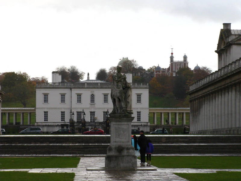
The Queen's House, built for James I by Inigo Jones, with behind it the
Royal Observatory
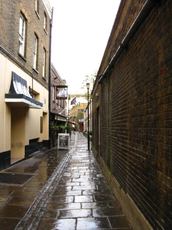
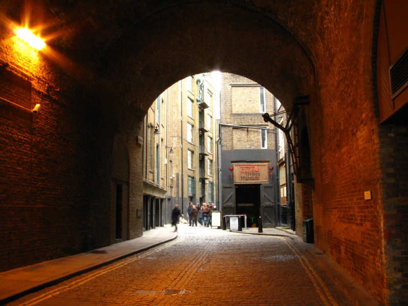
The Thames Path then takes to this alleyway through Greenwich - never a
dull moment on this highly varied walk.
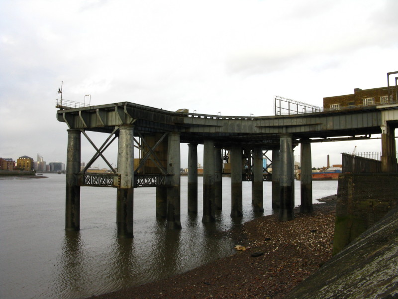
And then we emerge into the part of the river which remains industrial,
even if much of the industry is decaying.
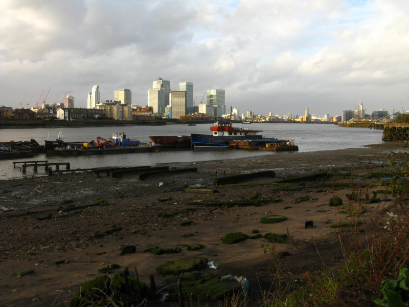
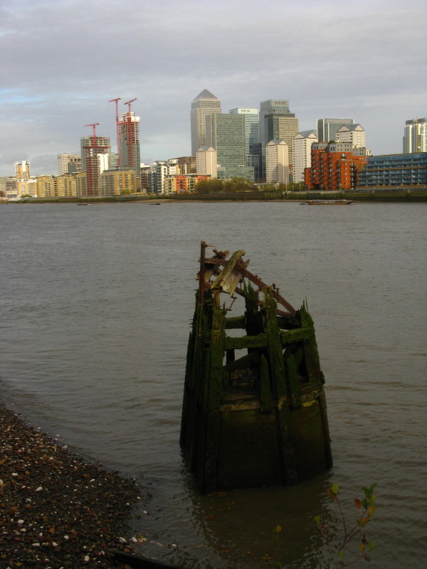
From semi-derelict land to the highly valuable land at Canary Wharf
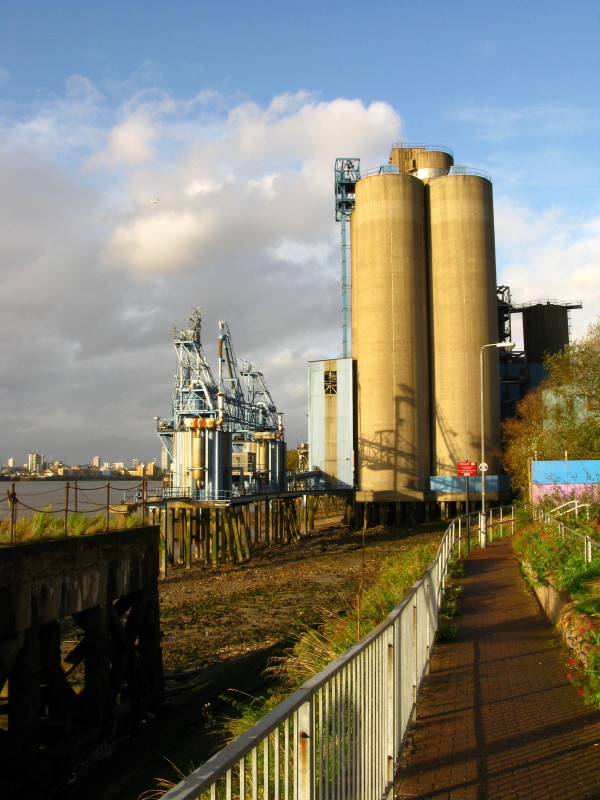
The path winds its way between rusting machinery, concrete silos, huge
piles of sand, rows of lorries and just empty space.
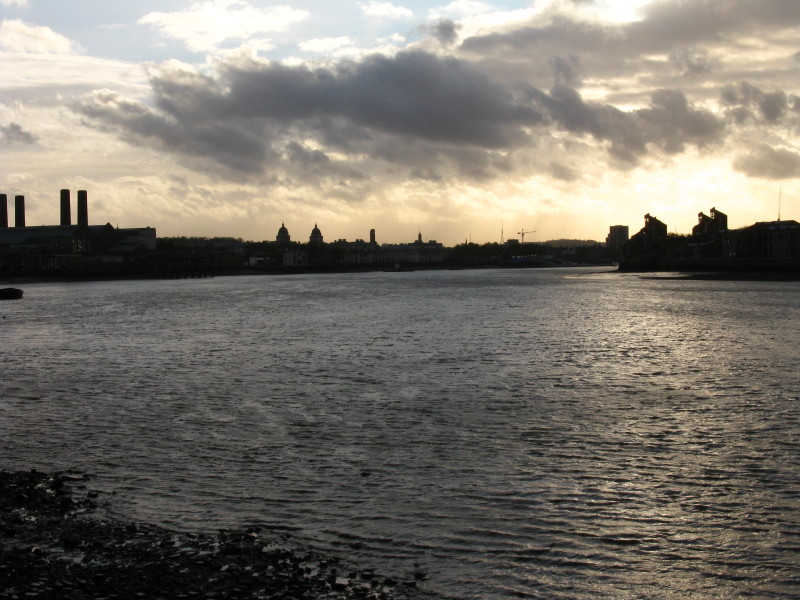
Looking back upriver
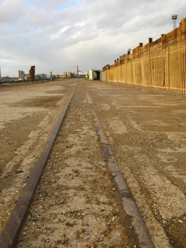
Old rails along the riverbank hint at past activities.
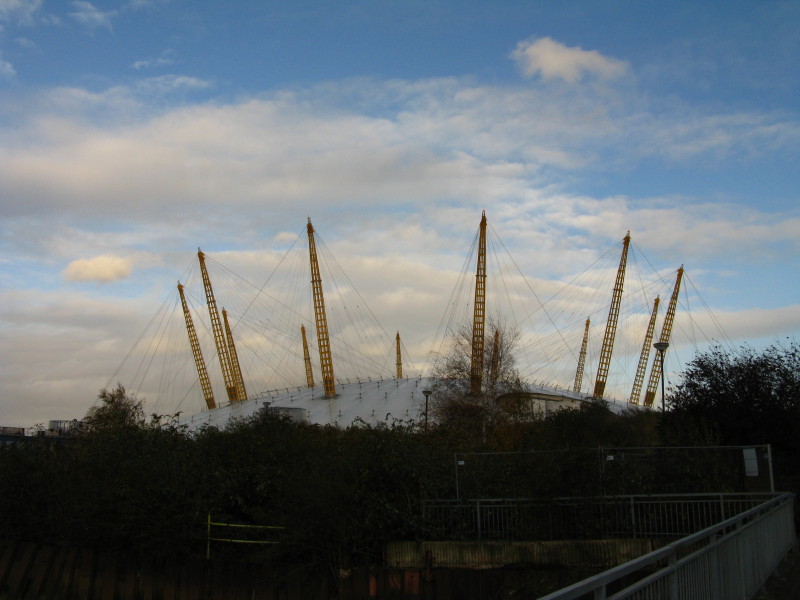
The Millennium Dome (now officially called The O2), and we
are nearing journey's end
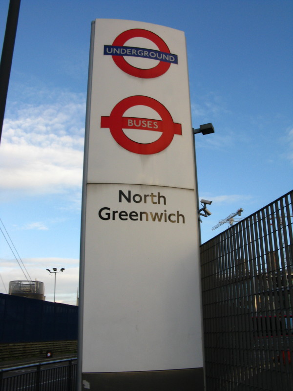
And here it is. Time to get an Underground train home.
There remains only a little more of the Thames Path
National Trail to reach the Thames Flood Barrier, and then the extension
of the route down to Erith. However, although I've walked the Thames
Path out of order, I've decided to keep the walk to the Barrier and
Erith for last, as it offers some sense of climax.
Total walk 20.9 km in 5 hours 16 mins including link walks to railway stations
and diversions, covering 20.6 km of the Thames Path.
 
|