Orford Ness
30 July 2011
Orford Ness is a rather unusual place - a large
shingle spit some 16 kilometres long, combining wild nature with
remains, mostly decaying of 20th century military usage. It is almost an
island, lying between the River Alde/Ore and the sea, and is one of the
most important shingle features in Europe and thus a Site of Special
Scientific Interest, a Special Protection Area, a candidate Special Area
for Conservation, a Ramsar site and a National Nature Reserve. It's
historic military significance results in is being classified as
nationally important under English Heritage's Monuments Protection
Programme. Definitely somewhere worth a visit.
Much of the site is owned by the National Trust, and
is accessible only by boat from Orford during the mornings of certain
days of the year.
So, having crossed the River Ore by the little National Trust ferry, a
walk across part of the site has already started to show the mixture of
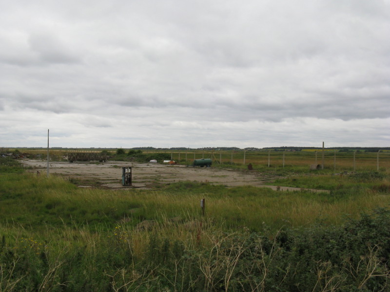
nature and human remains. We've crossed the airfield site on which two
airfields were build from 1913; the Armament Experimental Flight of the
Central Flying School transferred here in 1915, and research work was
carried out including new aircraft, parachutes, bomb and machine-gun
sights, aerial combat tactics, camouflage and navigation methods. By the
end of World War I over 600 people lived and worked here. This site here
is the remains of a 100-foot span hanger to house twin-engined craft.
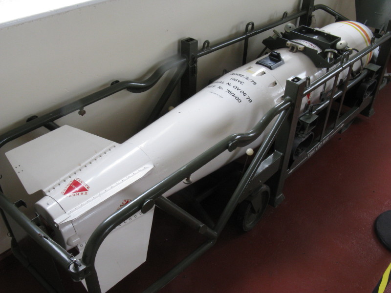
Inside the information hut nearby is a range of displays about the
history of Orford Ness. The site was used for development of Britain's
nuclear bombs, including this member of the WE177 family of parachute
retarted freefall nuclear weapons. It was designed to have a range of
delivery and fusing options and eventually replaced Yellow Sun Mark 2
and Red Beard weapons. This 'A' variant could be delivered by most UK
naval helicopters between 1971 and 1991. The last of the WE177 family
were withdrawn in 1998.
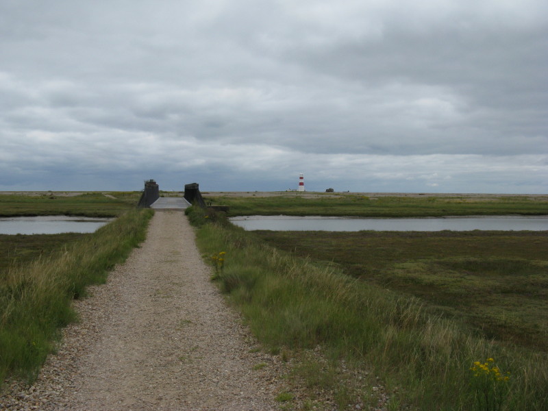
Approaching the bailey bridge across Stony Ditch. Bridges have been here
since the 17th century, but this one was erected in 2½ days in 1995.
Ahead you can see the lighthouse and other structures.
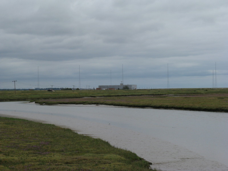
Looking upstream to the Cobra Mist site. Between the late 1960s and
1973, the large building housed System 441A, an over-the-horizon
backscatter radar system. The building now houses transmitters for the
BBC World Service.
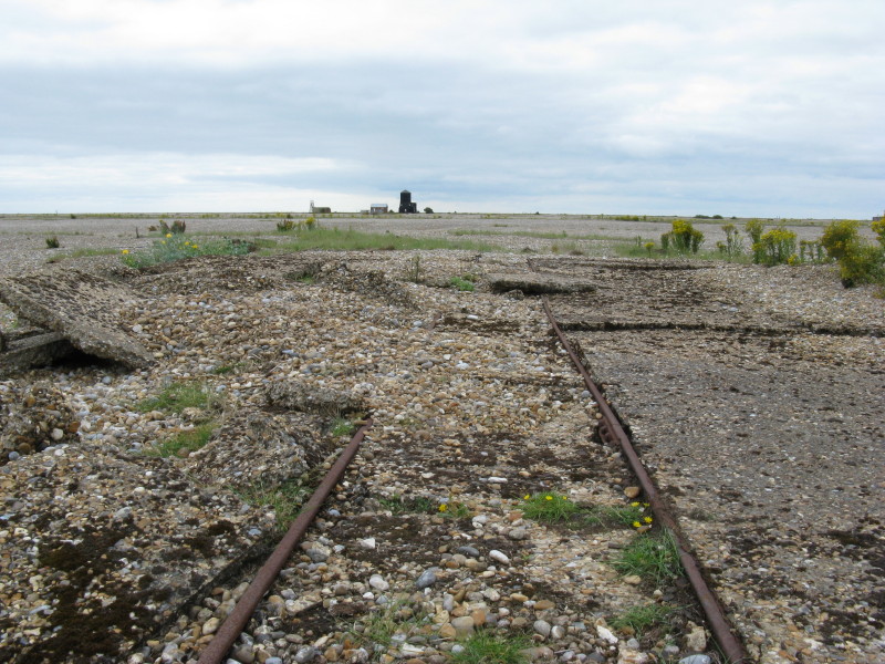
As we walk towards the Bomb Balistics Building, we cross remains of a
60cm-gauge railway built in World War I to carry stores, equipment and
personnel around the site. On a number of occasions the railway was
extended and used to carry shingle for flood defence work, but was
abandoned in 1971
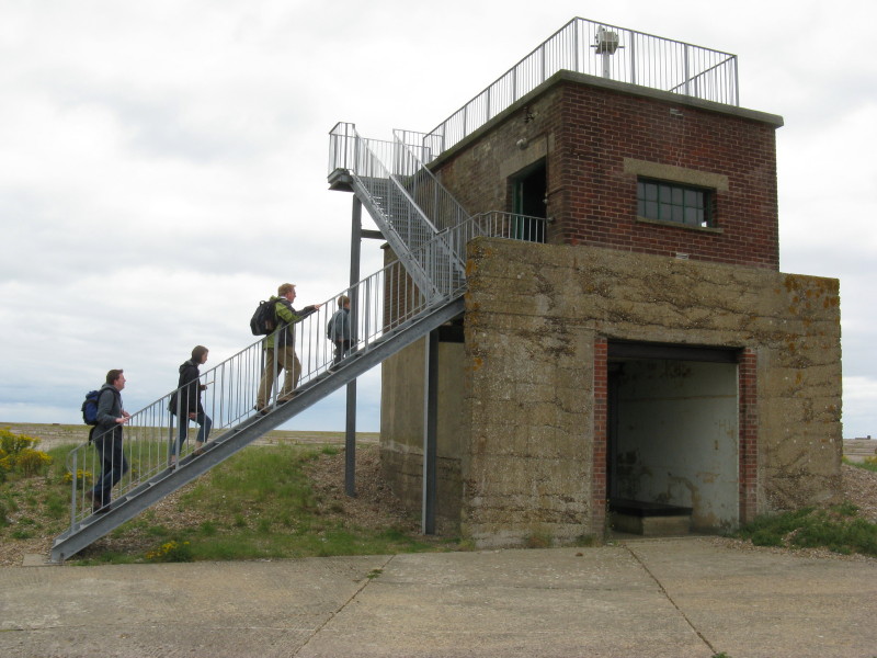
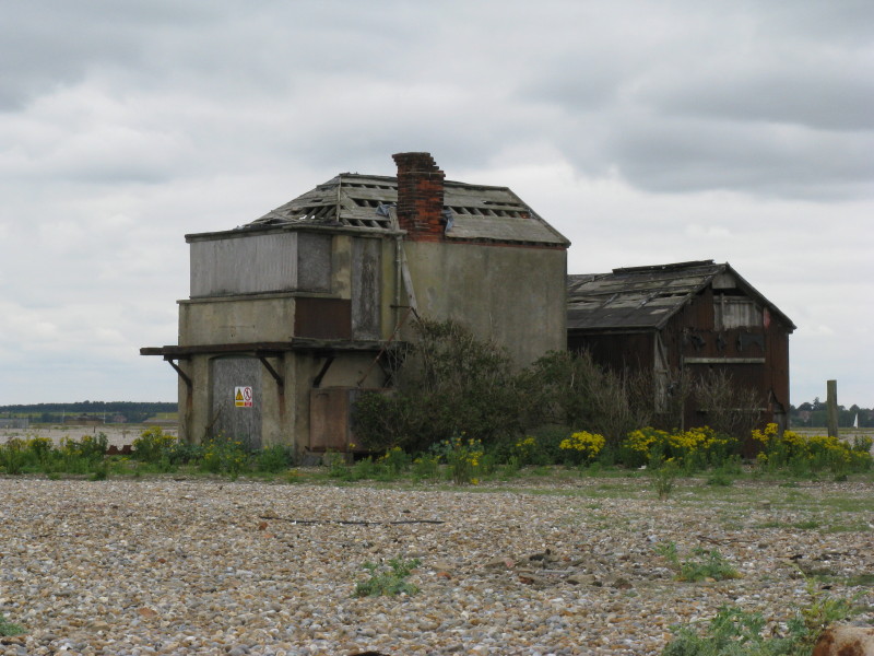
Mark, Debbie, Roger and Ben climbing to the first floor of the Bomb
Ballistics Building. Built in 1933 it was the nerve centre of the
experimental bombing range, used to monitor bombs and improve their
aerodynamics and aiming. Equipment was improved into the 1950s to help
in the development of the atomic bomb, dropped from 40,000 feet and
landing in the water to the north of the lighthouse.
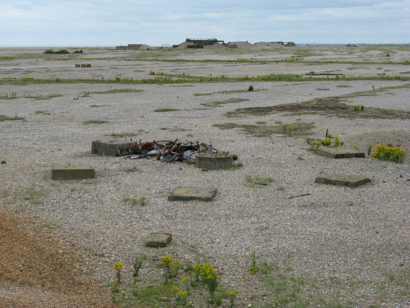
View from the Bomb Ballistics Building shows the remains of some of the
monitoring equipment.
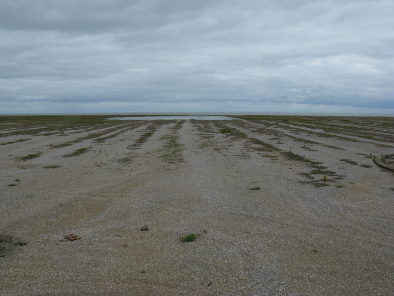
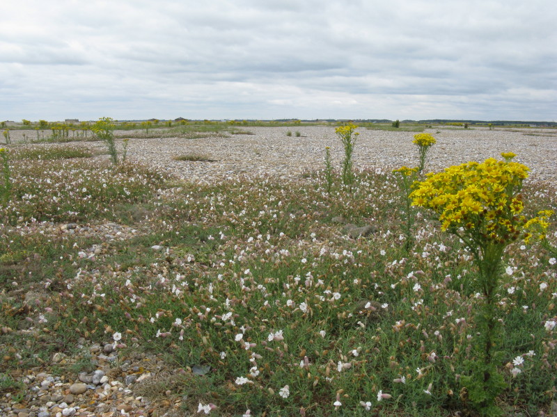
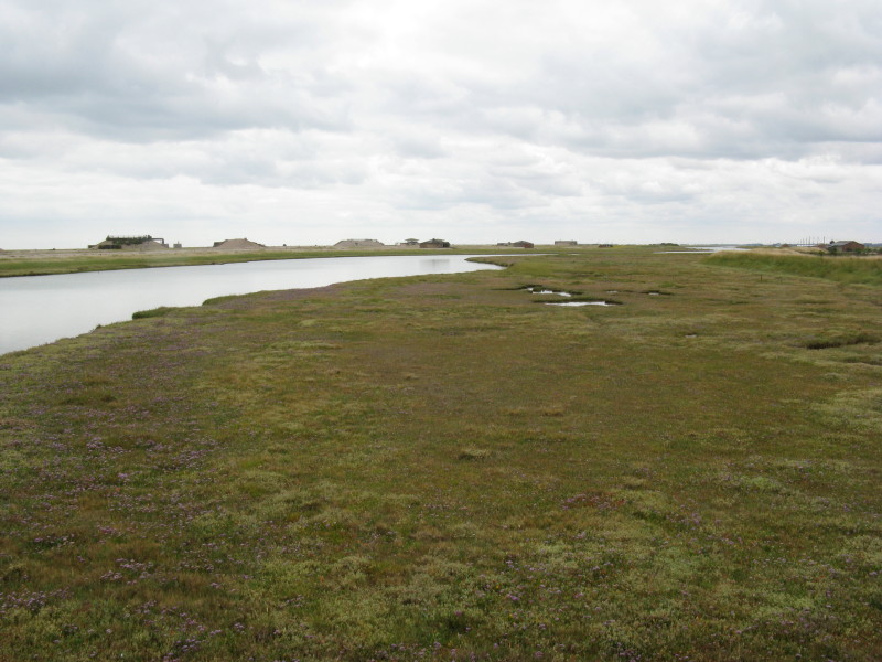
The ridges and swales of the vegetated shingle are formed by the action
of the sea moving material along the shore, with each ridge being the
position of an ancient shoreline. Large stones are in the swales and
smaller ones on the tops of the ridges; the smaller stones provide
smaller gaps which trap organic material and thus favour vegetation.
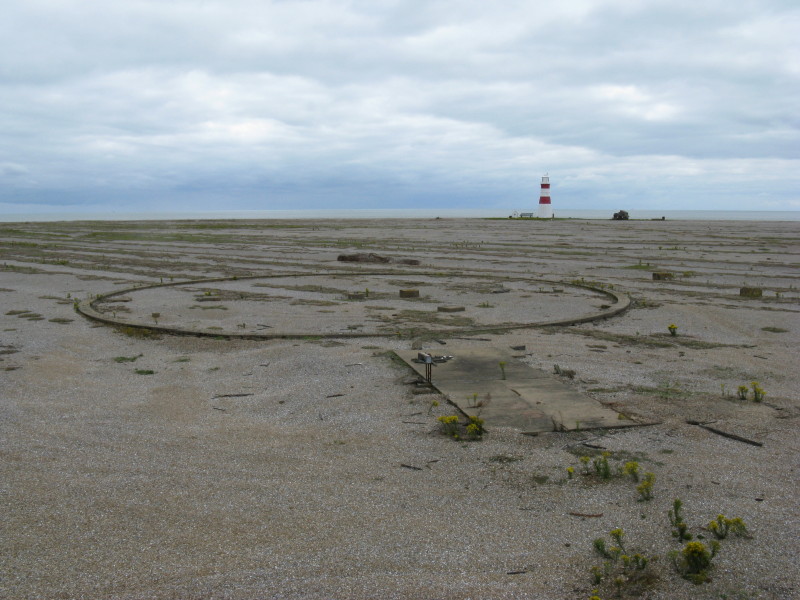
The remains of a timing beacon array from c. 1943. The central round
structure held a poweful lamp. A shutter rotating around the lamp
allowed light to shine on the mirrors on each of the surrounding
concrete blocks. A photograph taken by the aeroplane at the moment of
bomb release showed a particular pattern of lights which could later be
used to fix the time of release very precisely.
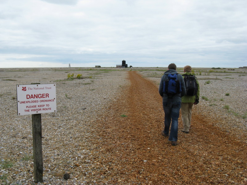
Keeping to the visitor route, we head briefly towards the Black Beacon
before turning left onto the lighthouse track.
Heading for the lighthouse
Next to the lighthouse is the Coastguard Watch House from the mid 19th
century, finally abandoned in the 1960s (though not by the stock doves
and wood pigeons).
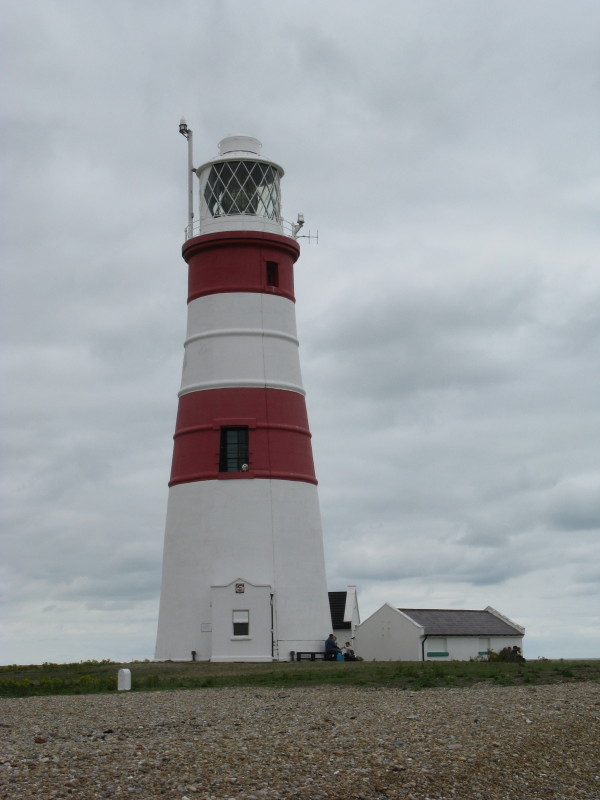
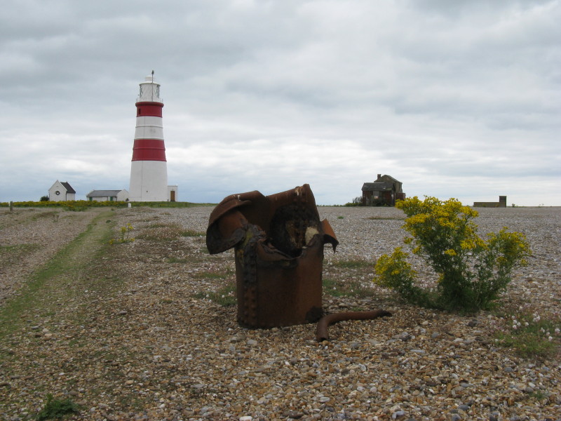
The lighthouse, at the base of which we had an early lunch. It was built
in 1792, and in combination with a lower lighthouse could guilde ships
through shingle and sandbacks. The lower lighthouse was lost to the sea
in 1887; this one here will go the same way in only a few years, with
erosion here being very rapid. The first submarine telegraph cable from
England to the Netherlands departed from near here in 1853.
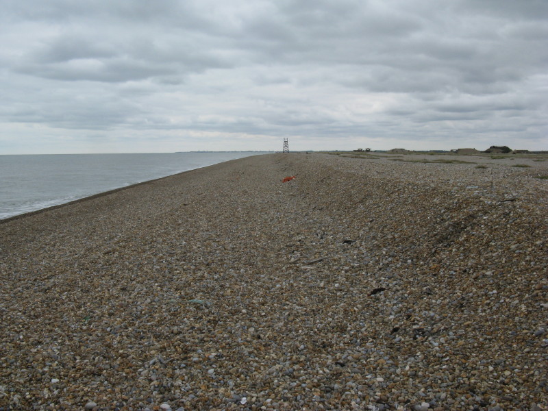
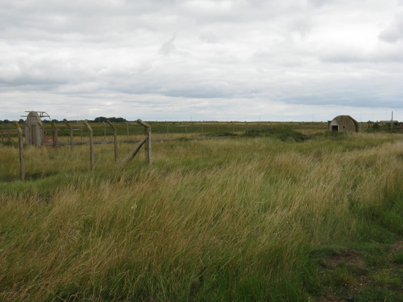
We walked along the beach towards the Police Tower
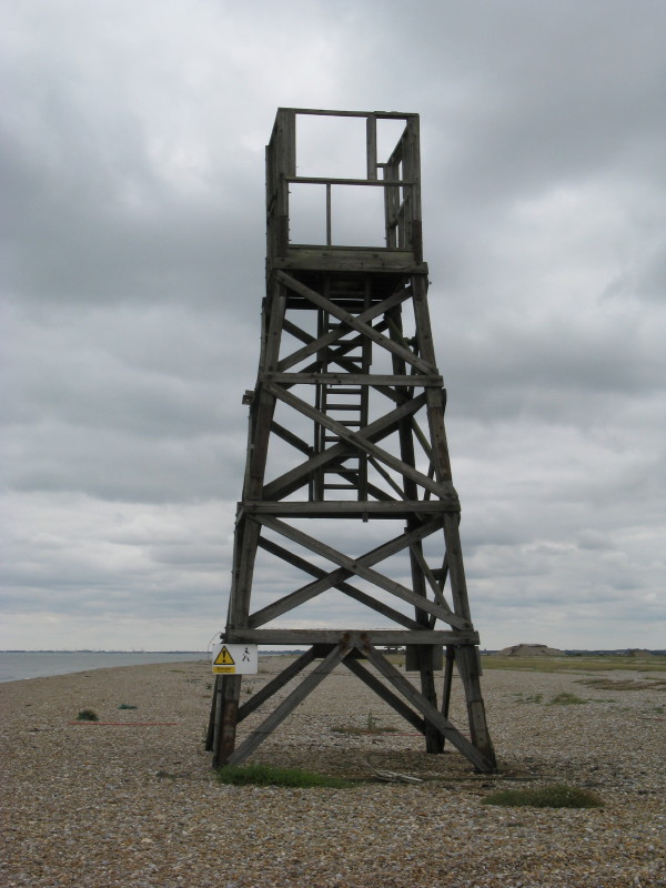
The security police of the Atomic Weapons Research Establishment used
this as an observation post, its position enabling them to scan the
length of the beach looking for potential intruders. The accompanying
security fence was removed in 1993.
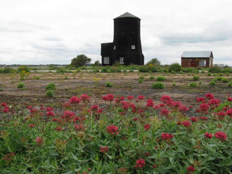
Black Beacon on the left was built in 1928 to house an experimental
"rotating loop" navigational beacon, and now contains more displays
about the area. On the right is the power house built in 1933; it now
houses displays on the geomorphology and natural history of the shingle.
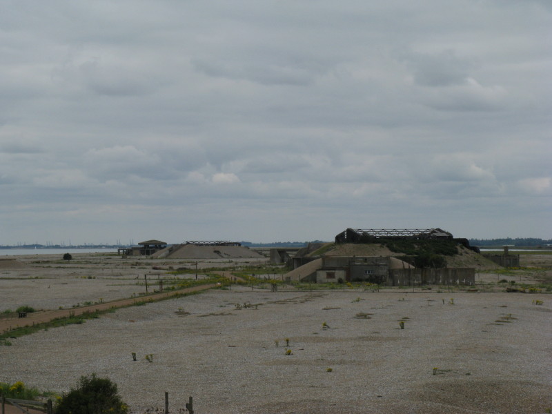
From the Black Beacon, looking south to the AWRE site, most of which is
still closed to general visits. In the distance are some of the later
laboratories with heavy reinforced concrete roofs designed to absorb a
vertical explosion, leading to the local nickname of the pagodas. In the
foreground is Laboratory 1 which had a lightweight roof.
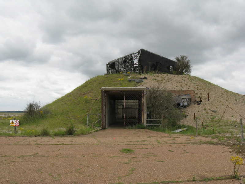
Laboratory 1, built in 1956, the first of six atomic weapons test cells,
used for mechanical and vibration testing and for drop tests.
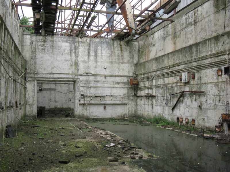
Inside Laboratory 1. The pit on the right was used for vibration tests
including on Britain's first atomic bomb, Blue Danube.
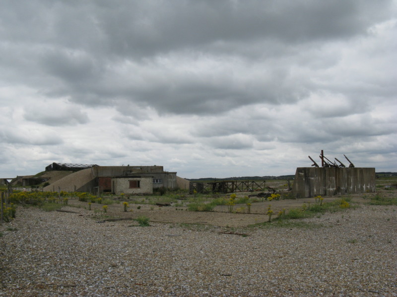
Next to Laboratory 1 are the remains of the impact facility - the test
subjects were accelerated to high speed on a rocket-propelled sledge,
colliding with the high density concrete wall to test delay fuses for
the atomic bombs. The lattice structure on the ground is the remains of
a tower which originally stood above the wall and housed high-speed cine
equipment to video the impact at 3000 frames per second.
Crossing Stony Ditch once more, a look back at the AWRE laboratories.
The two rounded structures are the end walls of the long model bombing
range built in 1954 to test the aerodynamics of atomic bombs and
missiles.
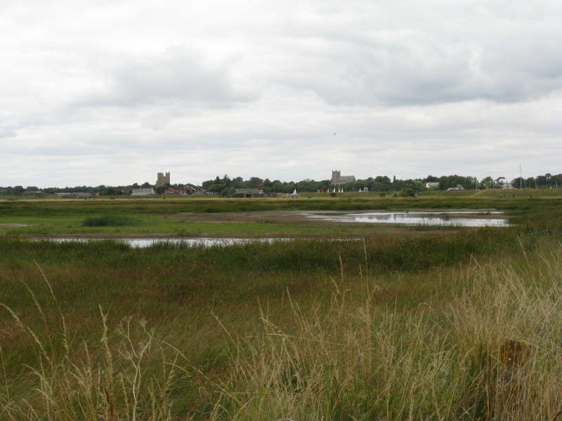
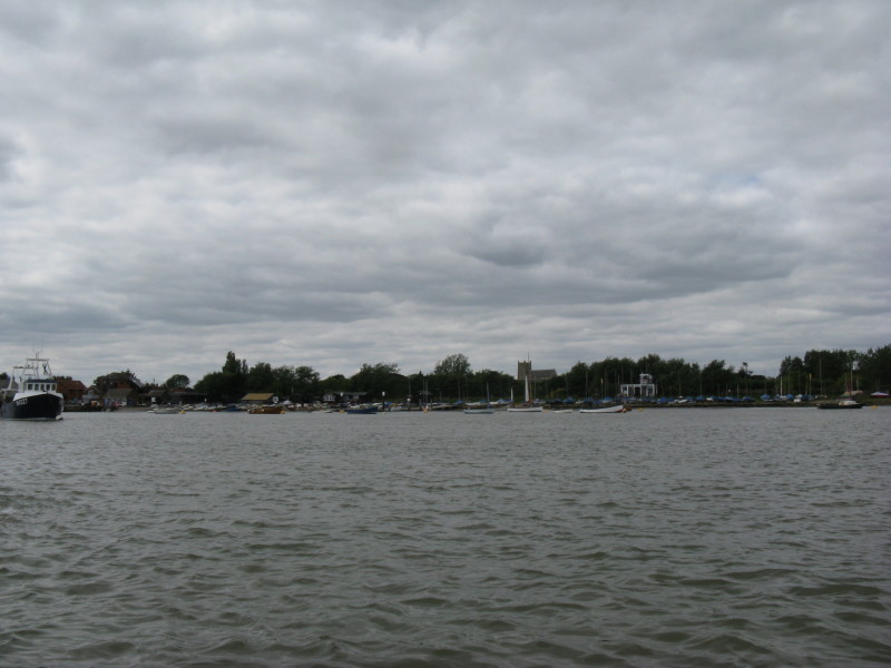
Crossing the old airfield site once again, we can see Orford Castle and
church on the other side of the river (the river being hidden by the sea
walls).
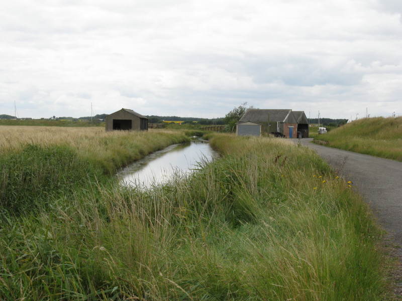
The ditch here was formed when clay was dug out to form the river walls
in the late 12th century to protect what at that time was rich grazing
land.
Crossing the Ore back to the mainland after a fascinating visit - but
plenty more to see and learn another time.
|