Dolomites Holiday:
Our walks
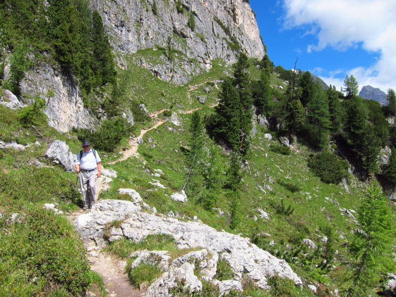
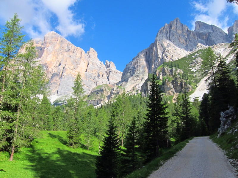
Sunday 3 July 2011: from the Rif. Faloria
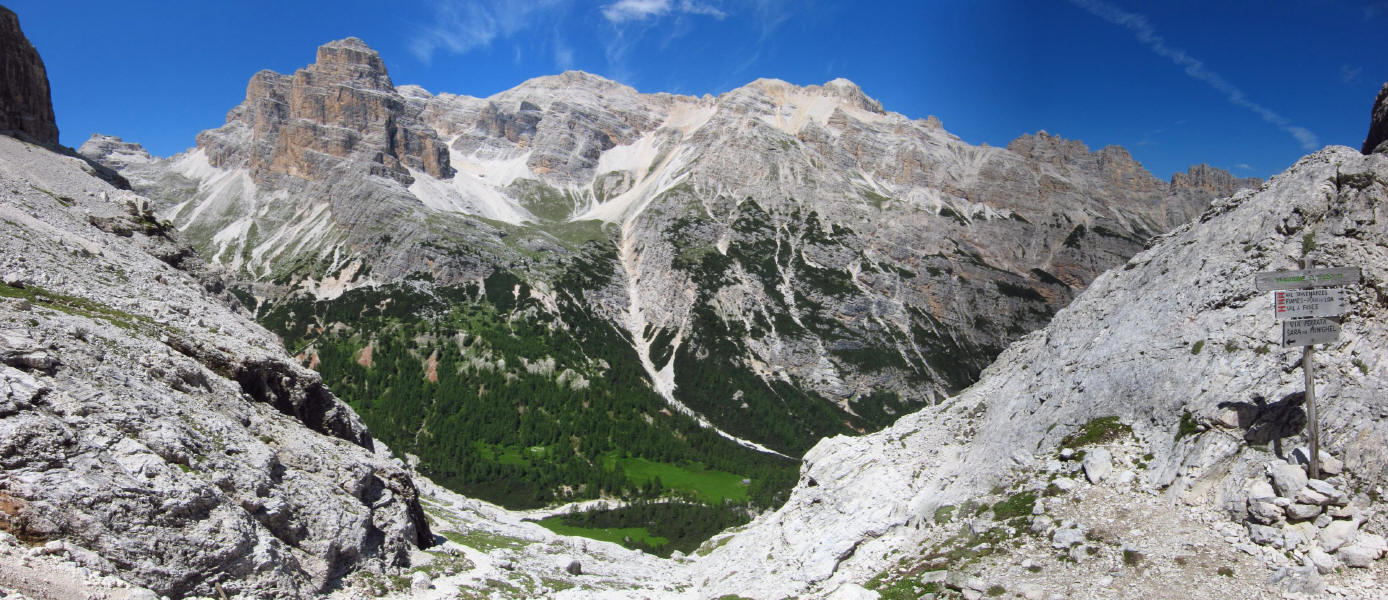
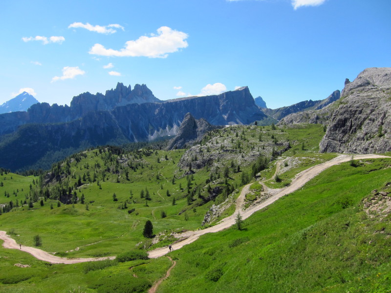
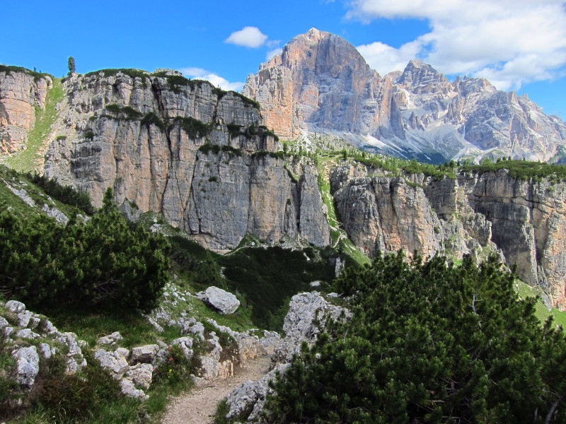
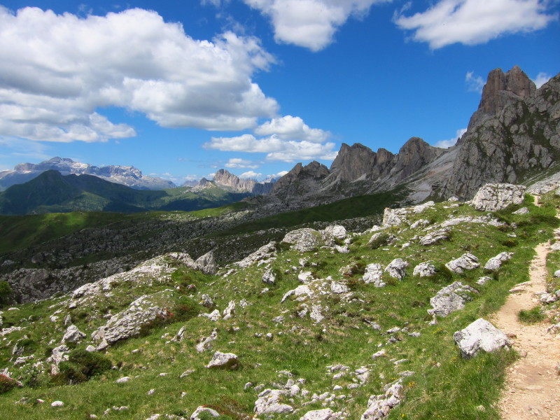
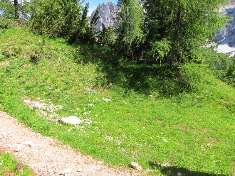
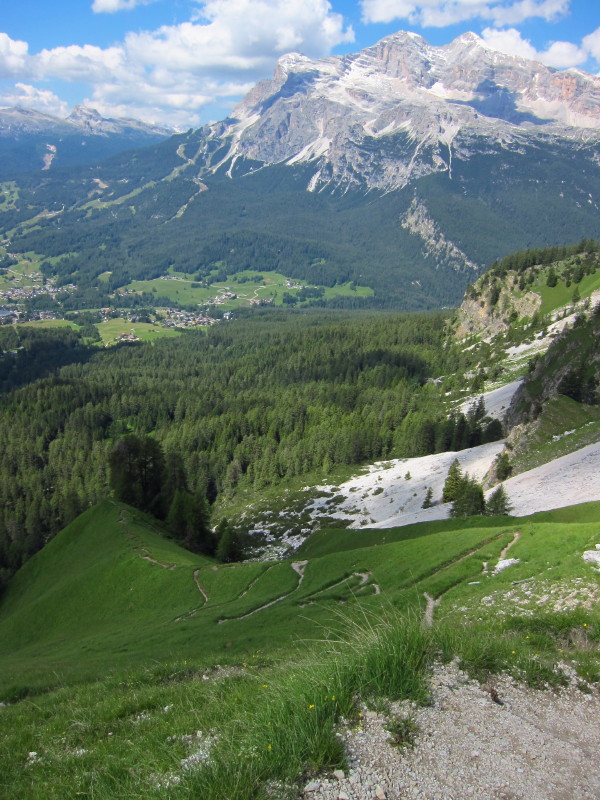
On a beautiful day whose blue skies contrast wonderfully with the whites
of the Dolomitic rocks, we climb gently away from the Rif. Faloria
We're roughly countouring along the side of this mountain, and will
return at a higher level
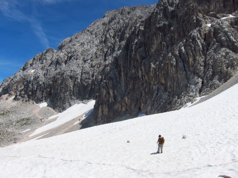
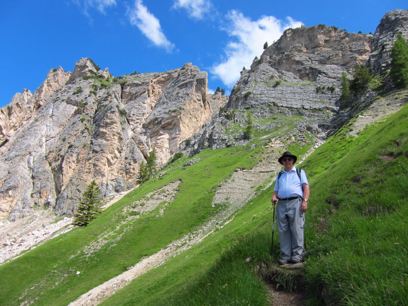
Dad ascends; behind him you can see the return route at the base of the
cliffs
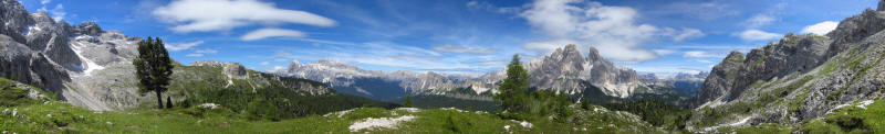
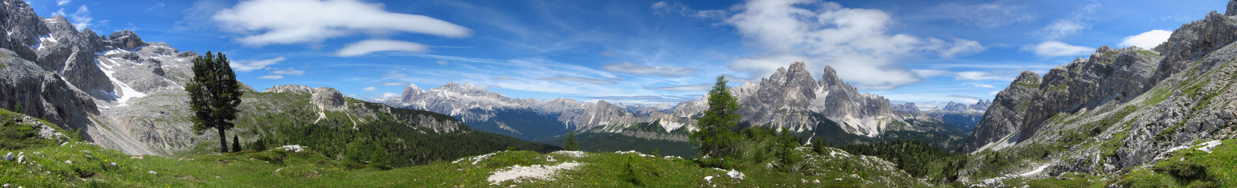
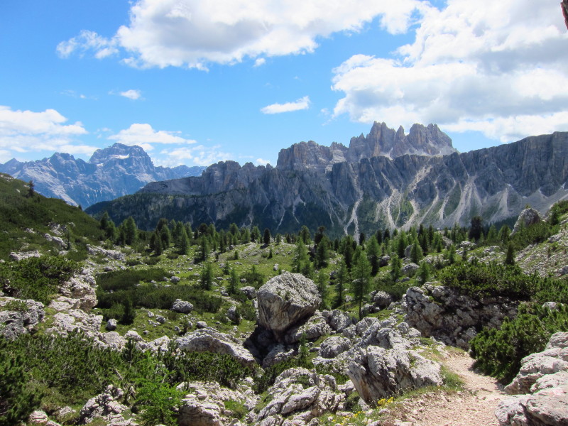
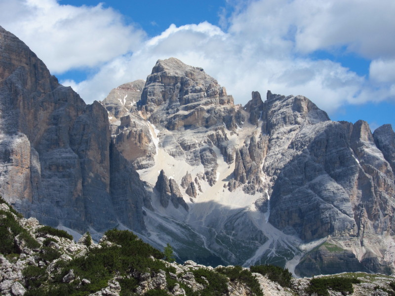
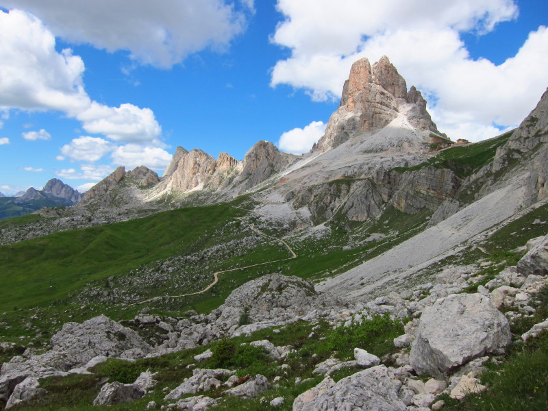
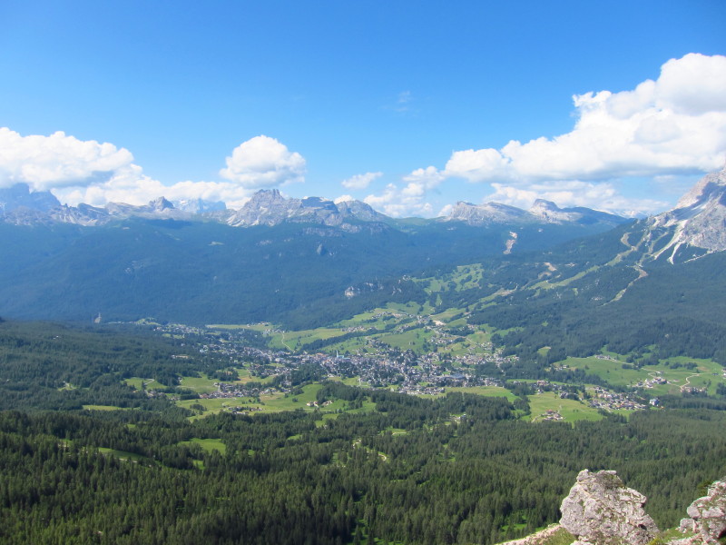
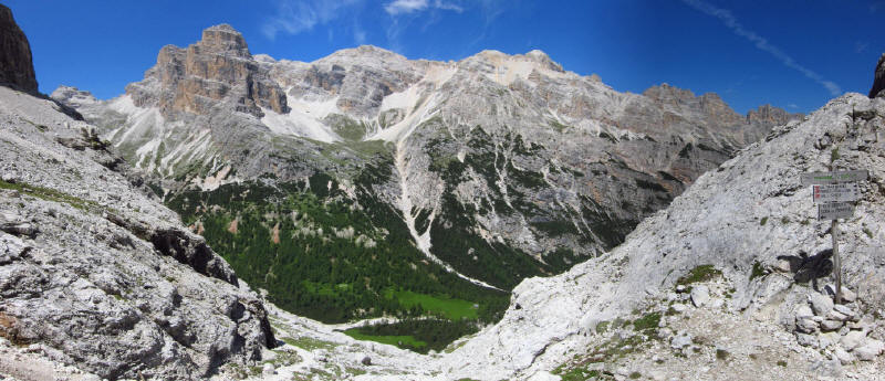
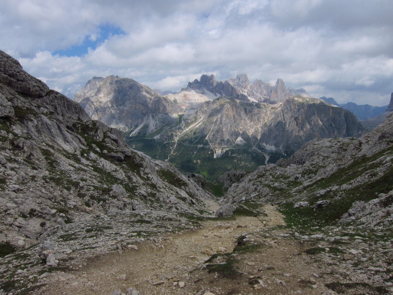
Panoramic view from our lunch spot - click on the photo for a larger
picture
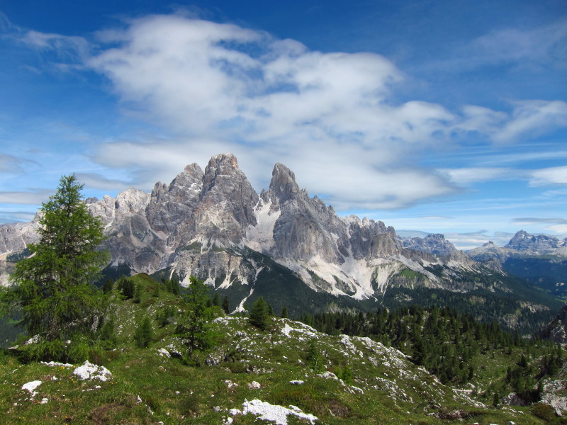
Across the valley to Monte Cristallo
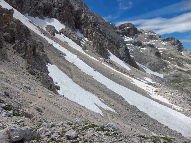
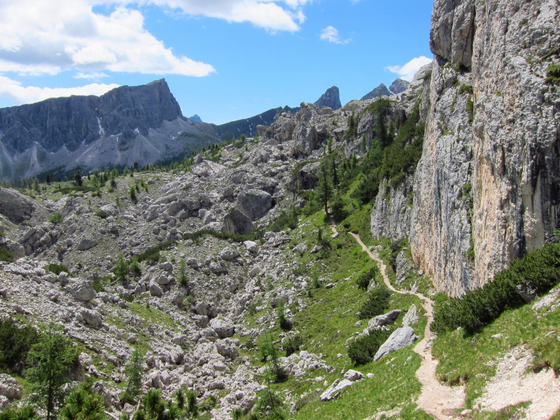
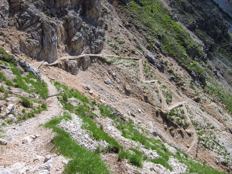
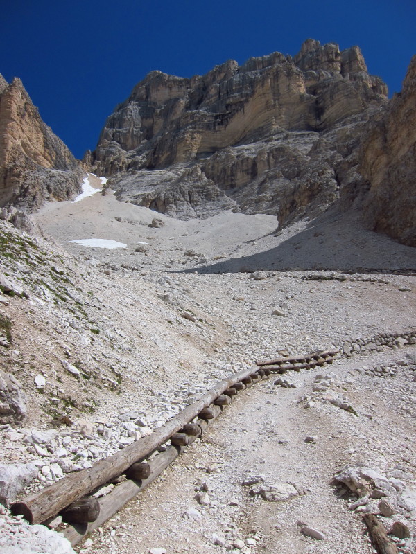
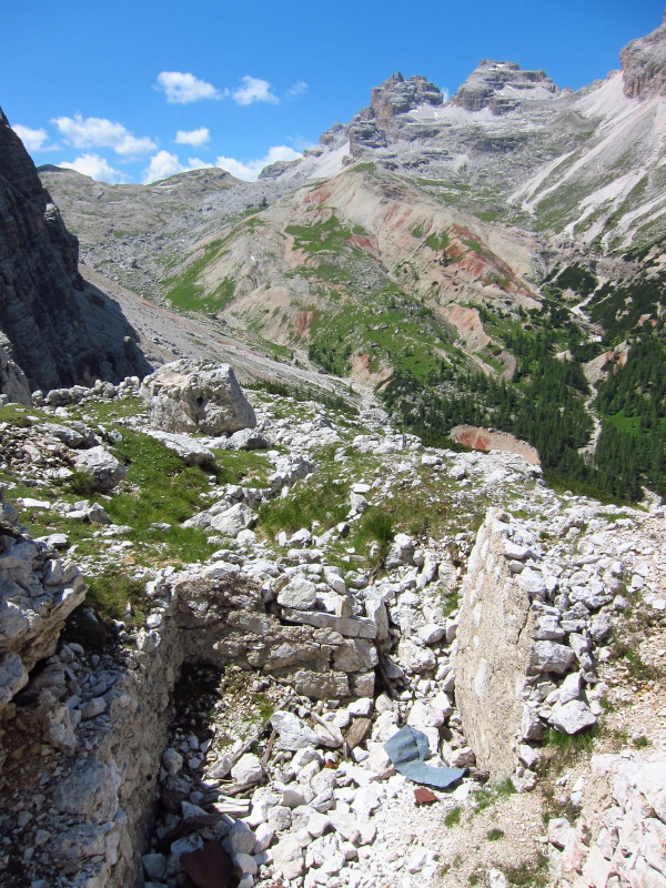
Our return route snakes across the scree and snow
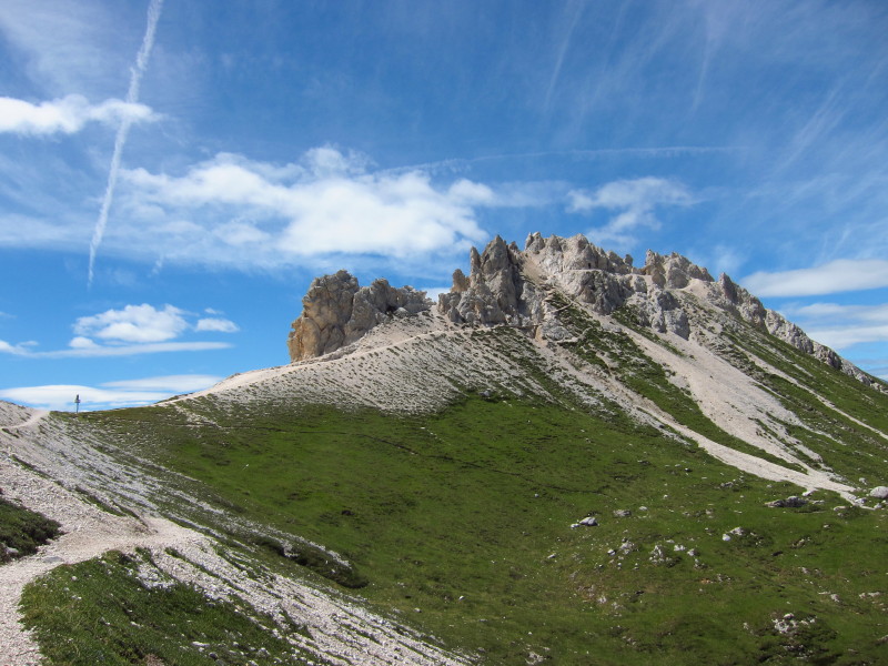
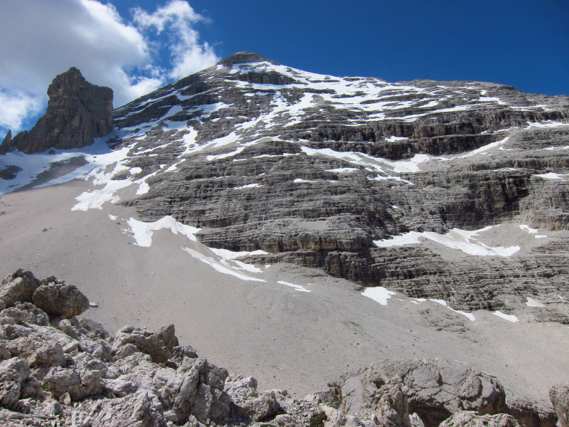
The last little ascent onto M. Ciasa Dio which peaks at 2362 metres
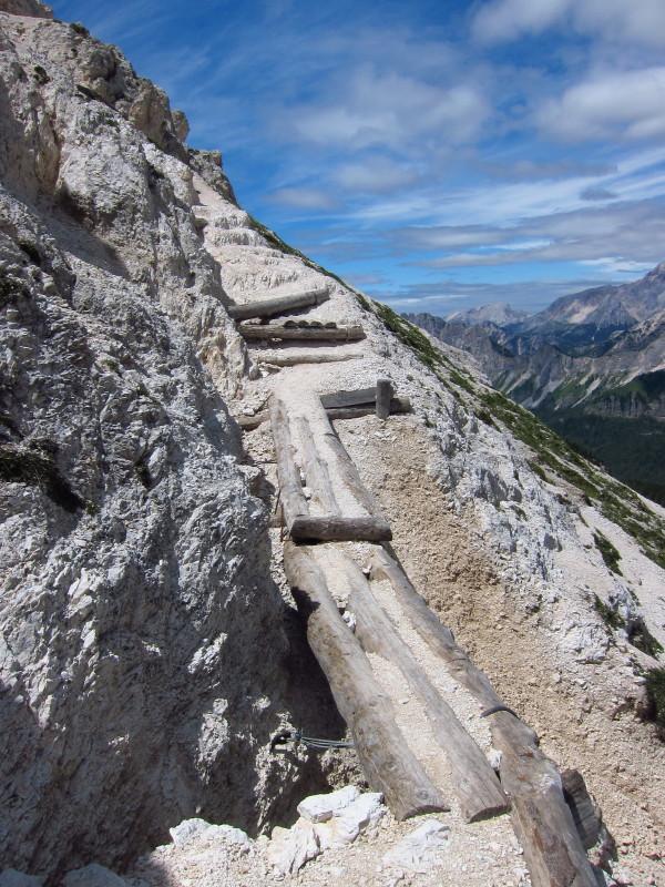
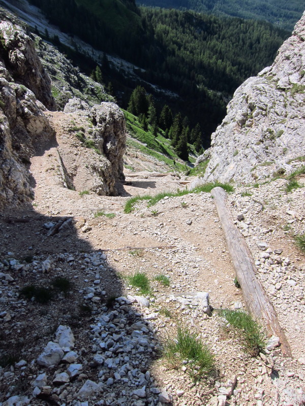
That nearest triple-log spans what seems quite a deep and steep gully -
best to stride confidently across without looking down.
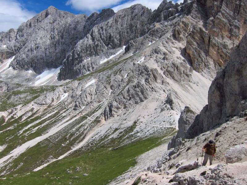
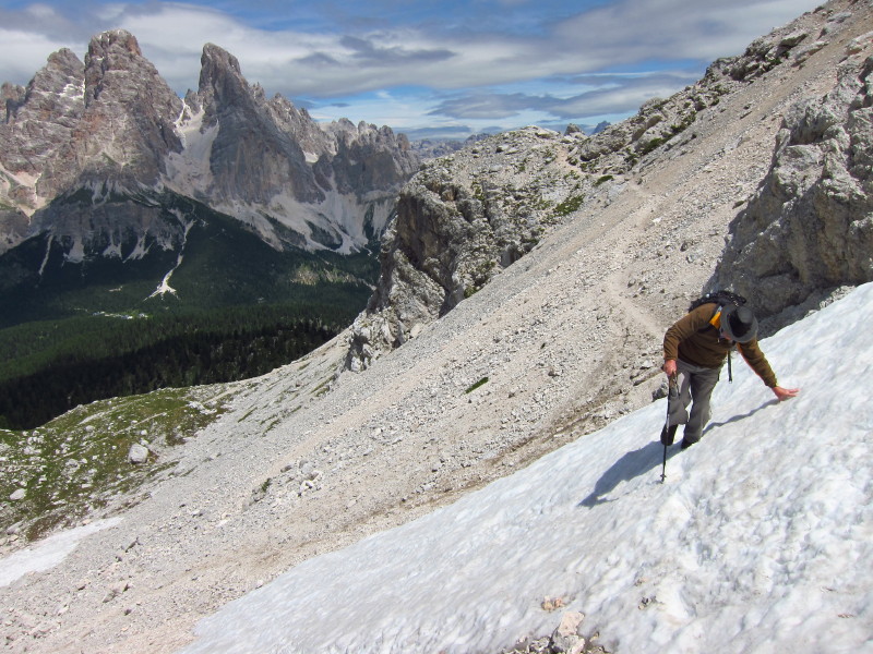
Looking back you can see our return route
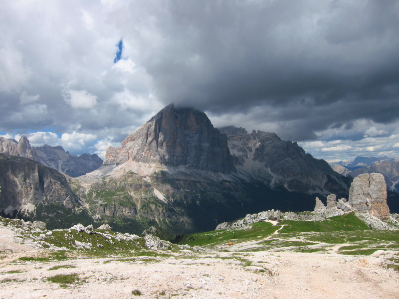
All that remains is the descent back to the restaurant and the top of
the cable car, with magnificent views ahead to Le Tofane
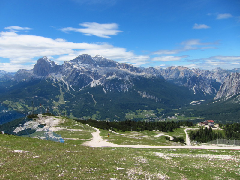
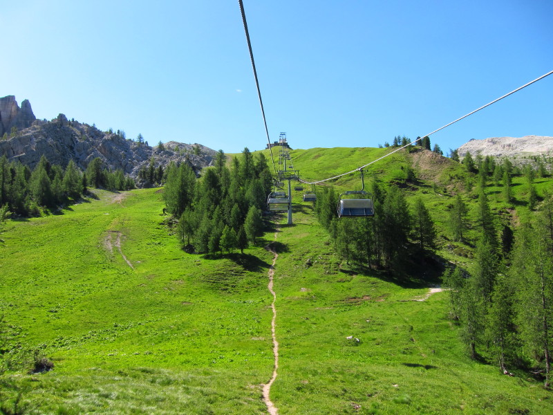
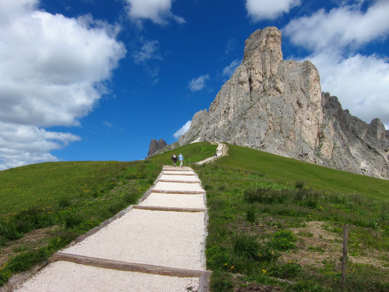
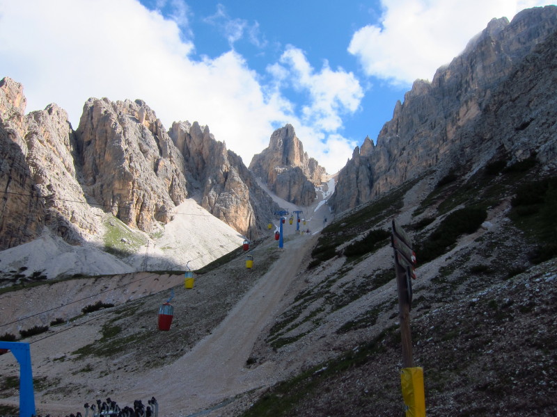
Monday 4 July 2011: Circuit of Nuvolao
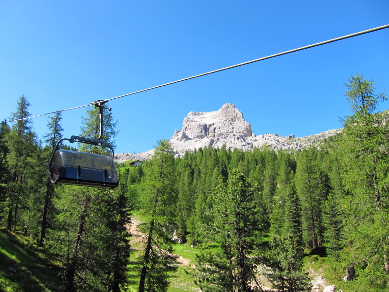
After a cable car yesterday, today's walk starts with a chair lift which
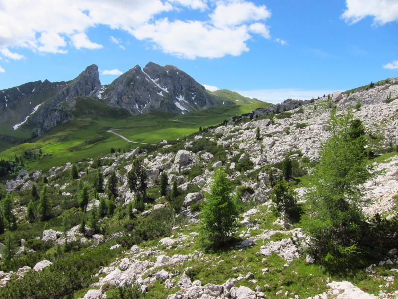
takes us from 1889m to 2255m.
That's Averau, and we will be coming over the col to its left later in
the day.
Our walk starts with a little descent, hearing along the trod which runs
up the picture just to the left of centre.
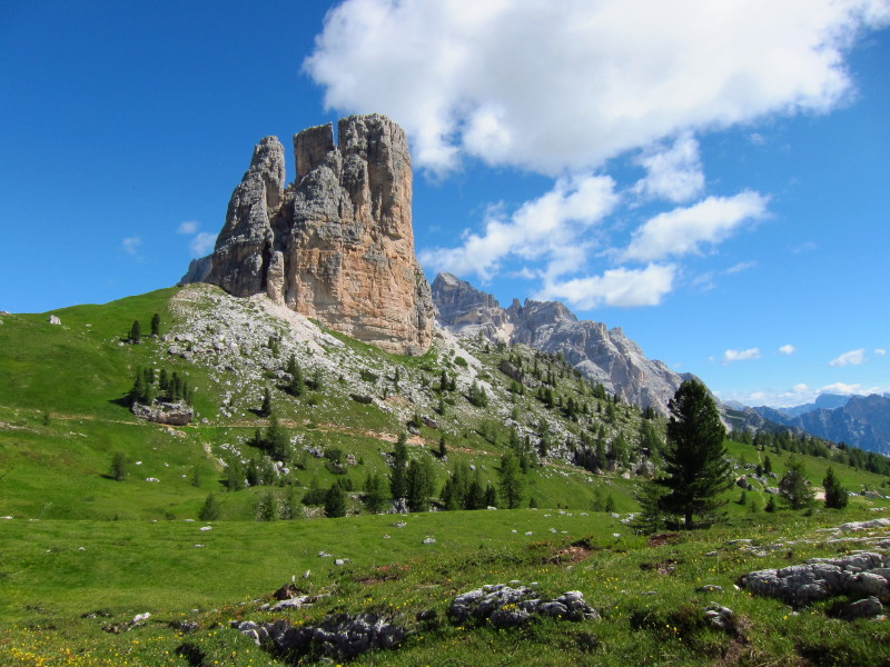
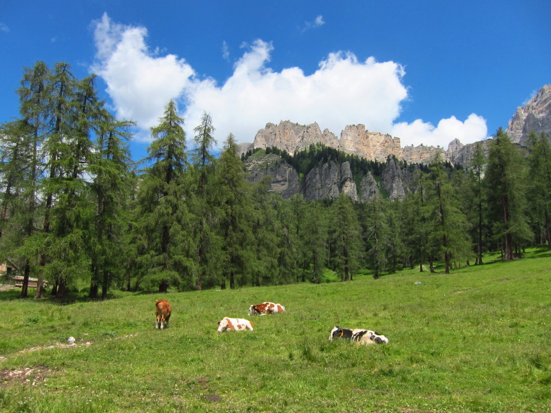
A look back at one of the Cinque Tori, which we'll visit later in the
week.
The little descent just mentioned is now followed by a bigger steep
descent down this gully. The path to be followed can just be seen
regaining height on the other side.
A bit closer
A look back at that gully with descent - some idea of scale can be
gained from the full-size trees at the top of the gully. In the
background, on the far side of an intervening valley, is Tofana de Rozes,
another objective for later in the week.
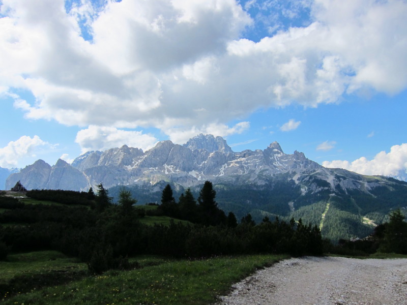
Dramatic scenery on another beautiful day.
Just visible here is the zigzagging path which rises between Tofana de
Rozes and Tofana de Pomedes, which I'll ascend later in the week
For today, we continue across this shattered limestone towards the next
road pass
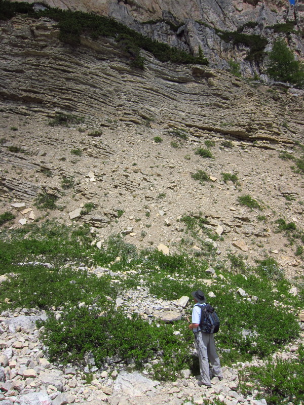
Inspecting the very friable sedimentary rock
After a narrow trod for the last couple of hours, it is something of a
shock to emerge near the road and find this veritable highway continuing
our route around the mountain.
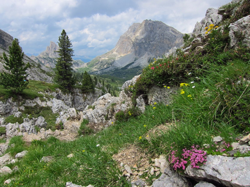
It didn't last long, and we returned to a more typical trod. There are
extensive distant views as well as the more immediate mountains.
That's the other side of Averau which we saw from the chair lift and
start of the walk. We contour across the scree and descend to that
track, and immediately regain height up to the col.
Passing under the chairlift on the southern side of the col. It's very
teasing as the chairs go past, as we regain height slowly.
Making progress. You can see our path along the base of the cliffs and
then down to the track.
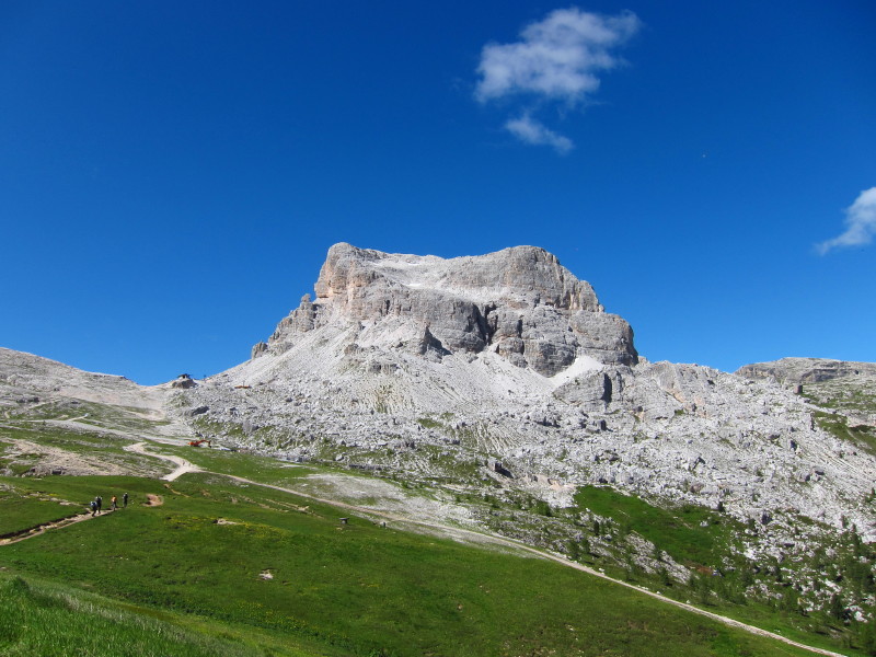
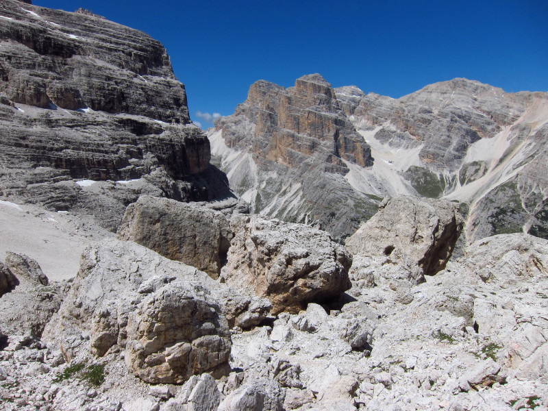
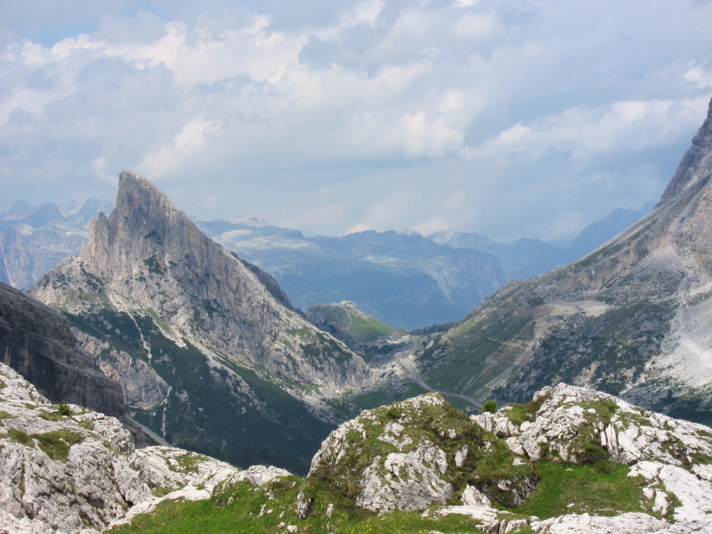
Safely up to the col, and ahead on the right are the Cinque Tori again,
and Tofana de Rozes - at 3225m with its head just in the clouds.
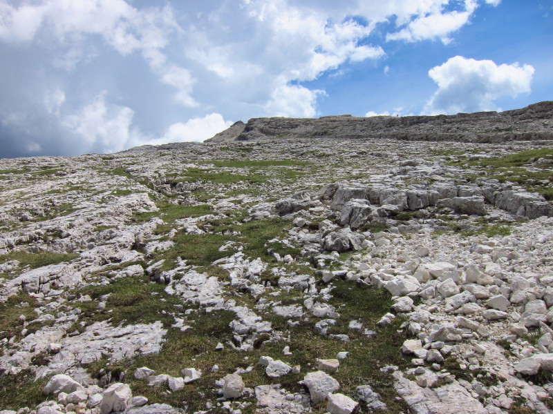
Shattered limestone pavement as we descend back to the chairlift.
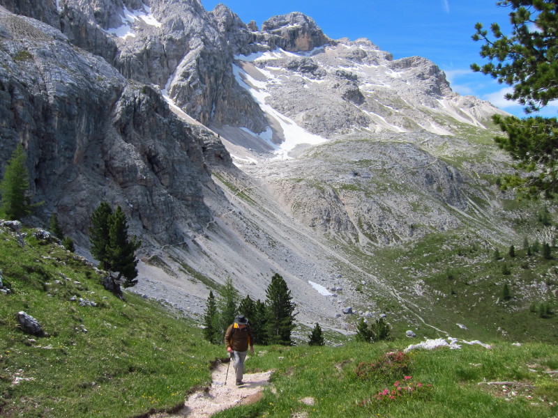
Tuesday 5 July 2011
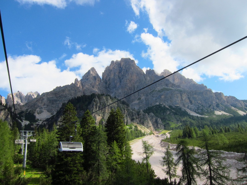
Today we've travelled east from Cortina towards the top of the Paso Tre
Croci, and are taking the chairlift part way up M. Cristallo
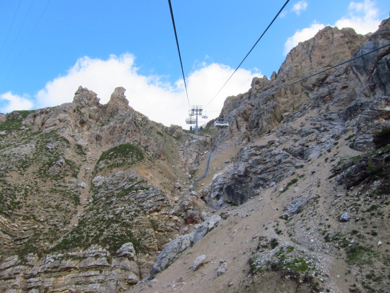
This chairlift takes us from 1698m to 2215m
A second lift continues to near the summit, but our way lies on foot,
making a 500-metre descent to the car at the base of the chairlift.
The right-hand side of this range is where we were walking on our first
walk, on Sunday.
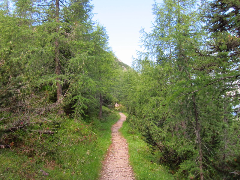
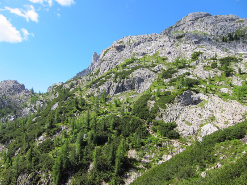
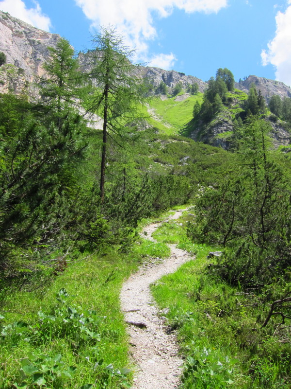
After a little descent, the next section of the walk is level, through
forest
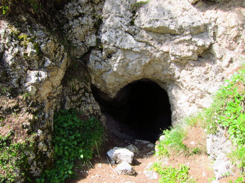
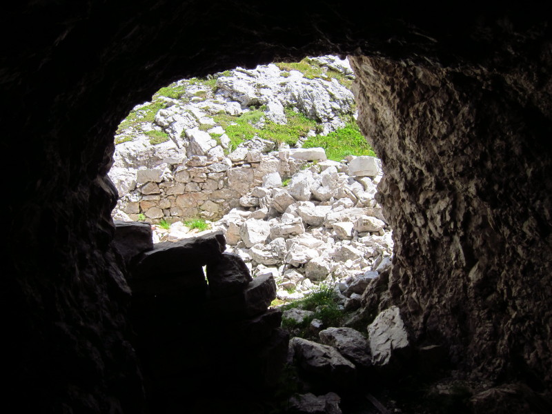
The path we've been following was probably created during World War I;
this hole was where soldiers lived
...and this flattened area probably the home for a gun
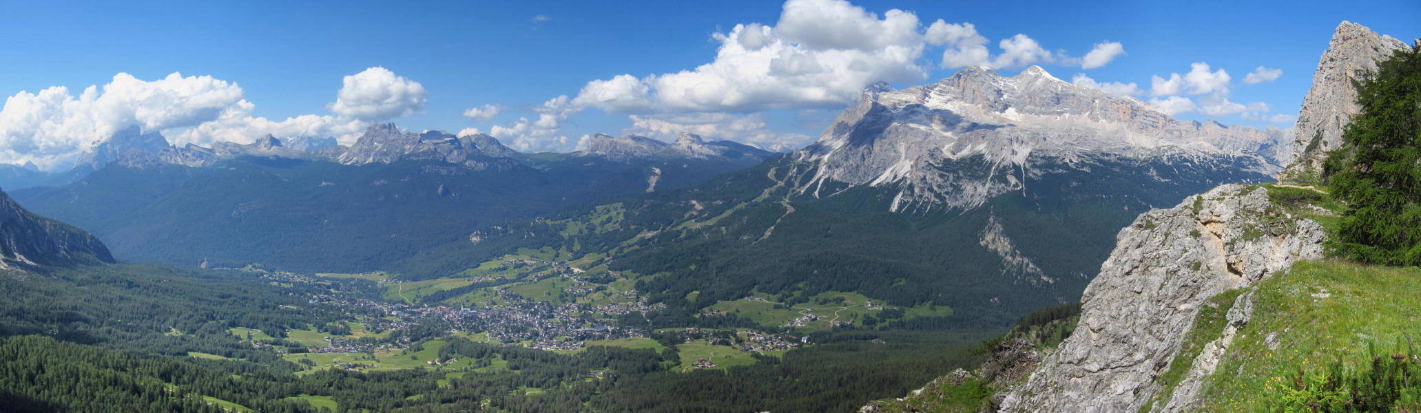
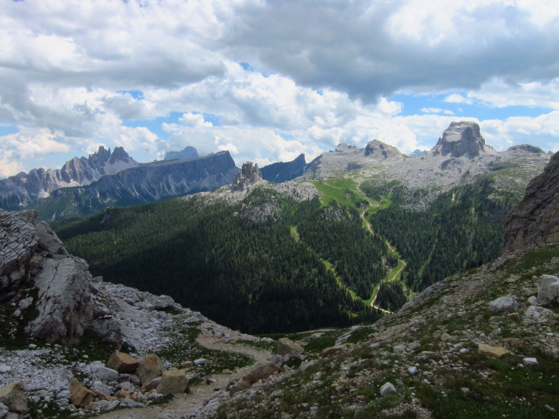
As we near the end of the level section, a look across Cortina. Towards
the right can be seen the elongated Nuvolao which we made a circuit of
yesterday, and to its right Averau which we saw from several angles.

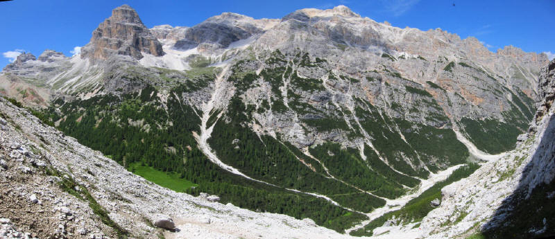
A panoramic shot (click on photo for a larger picture) extends the view
to include the Tofana massif
The way down was engineered but pretty steep and with potentially loose
footing almost the whole way. It felt a lot steeper than it looks in
this photo.
That section across the little cliff was unnerving as it was very narrow
with the rock pushing one out.
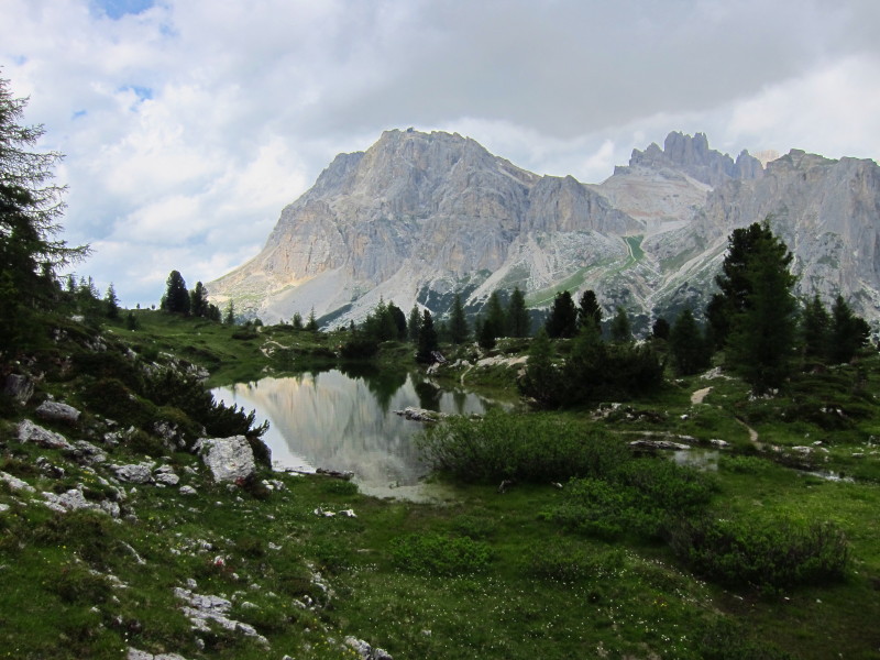
Eventually the rock turned to grass but the steepness was hardly
changed. The views remain a wonderful excuse to stop for a breather.
Past the steepest bit, and we're getting back into the forest.
An undulating forest walk, passing a farm, remained to take us back to
the car.
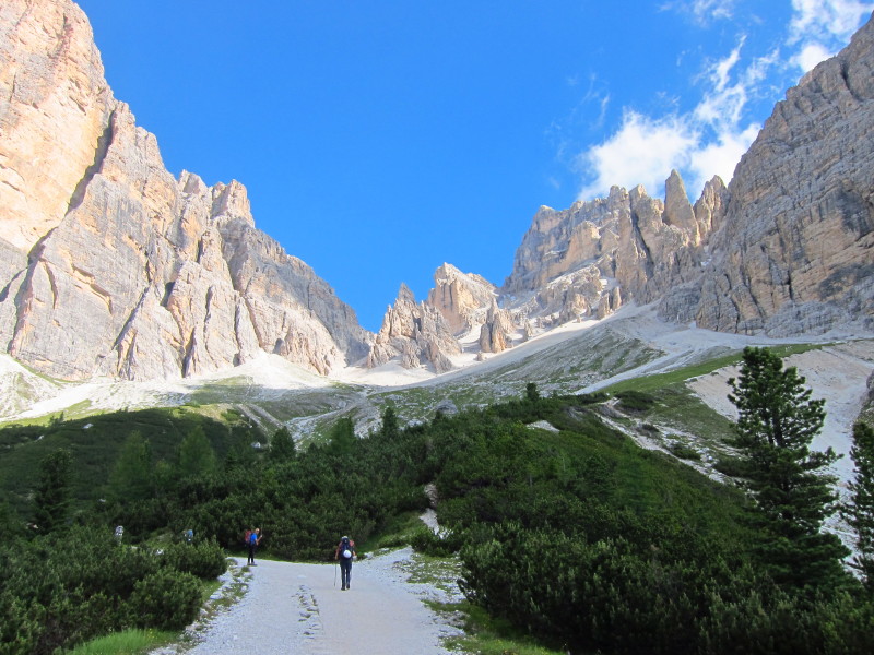
Wednesday 6 July 2011: Circuit of Tofana de Rozes
On Wednesday, Dad decided to have a quieter day, so dropped me off at
1923m at the end of the tarmac road. My route today is a circuit of
Tofana de Rozes, the mountain on the left of this picture.
The good quality gravel road seen in the previous picture took me to the
rifugio at 2037m, to where quite a few people had driven. A rougher
track continued to gain height from there, heading for wilder terrain.
The route lies up there to the col at the top.
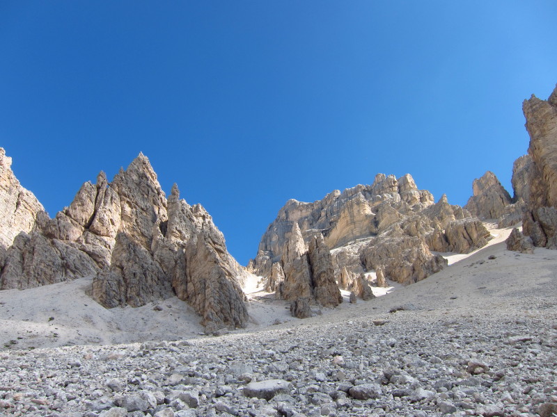
It doesn't look very inviting, but that gap is where I'm headed.
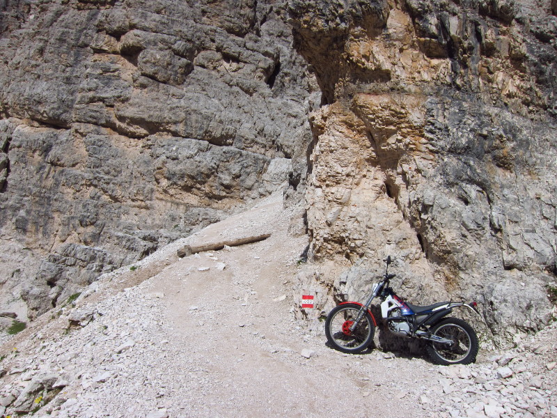
In fact, the going is very easy underfoot, being just about practicable
in extremis for a 4x4 up to this point, and (cue photo) for a
motorbike for some of the rest of the way.

A look back from that point shows the broad stony track that runs this
far; on the right of the photo is our old friend Averau and to its left
Nuvolao that we circuited on Monday.
Continuing upwards, showing the engineering that has gone into making
this a relatively easy ascent.
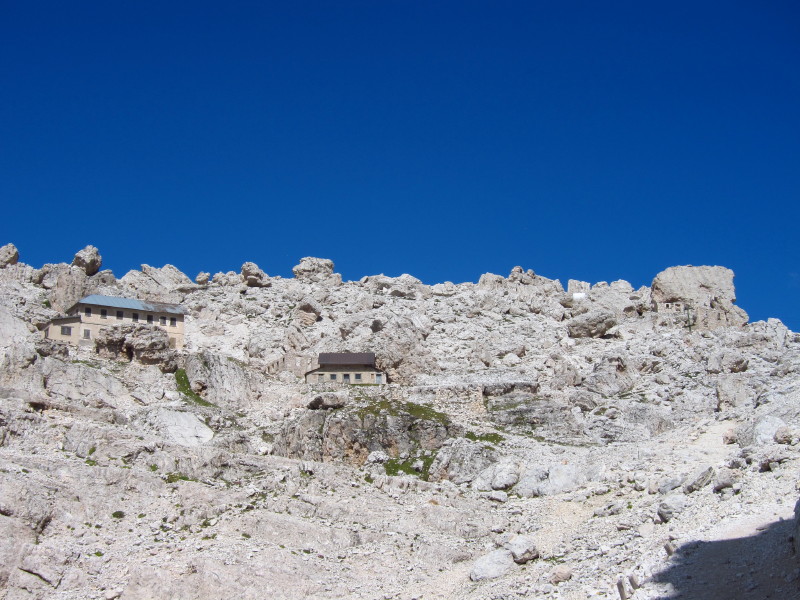
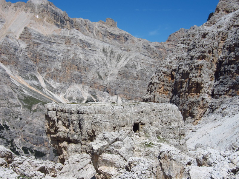
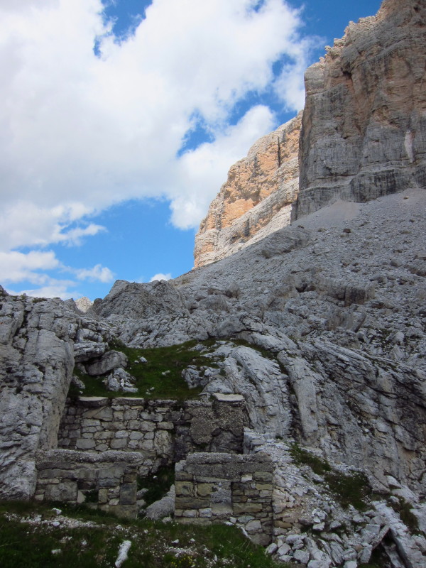
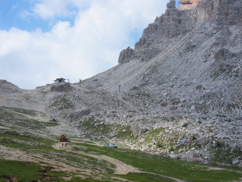
As I near the top, there are several buildings, including the old
Rifugio Cantore
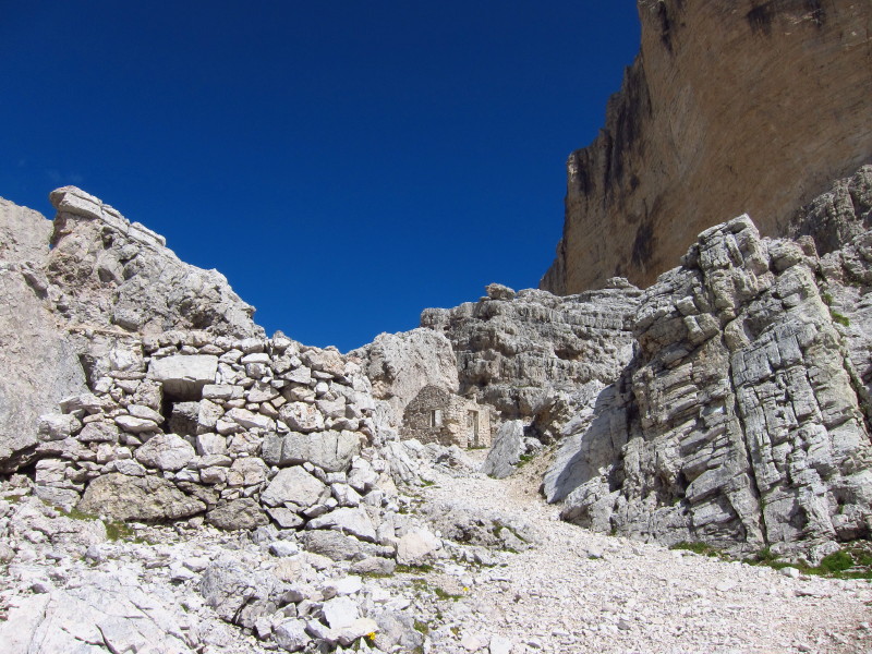
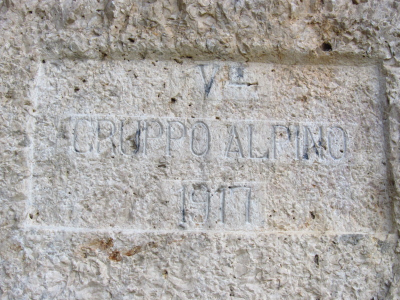
There are also relics of World War I
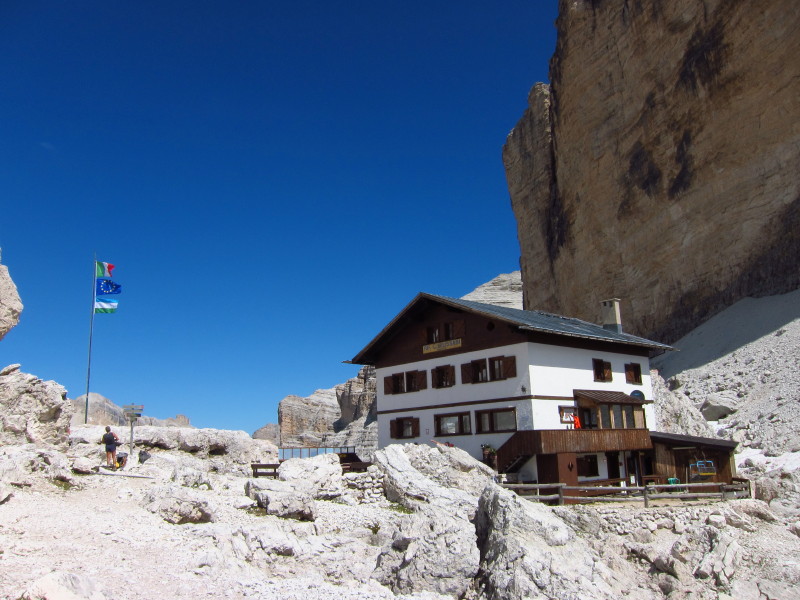
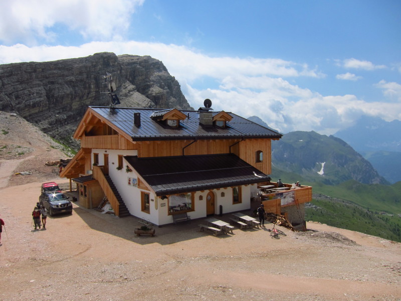
At 2580m according to my map, and 2600m according to the sign on the
building, this is the modern Rifugio Giussani.
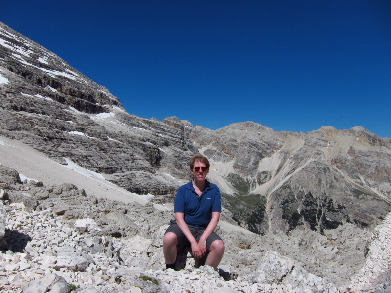
Me at around 2590m, the highest I reached on this holiday.
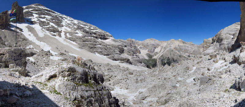
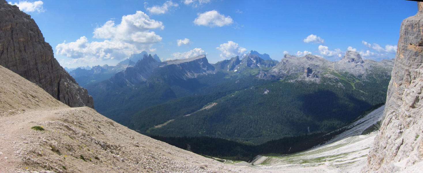
Click on the panoramic shot for a larger picture. To the left is the
Tofana de Rozes (3225m), and ahead, weaving among the shattered boulders
is my route which lies down into the valley before regaining height onto
the next col on the far side of Tofana de Rozes.
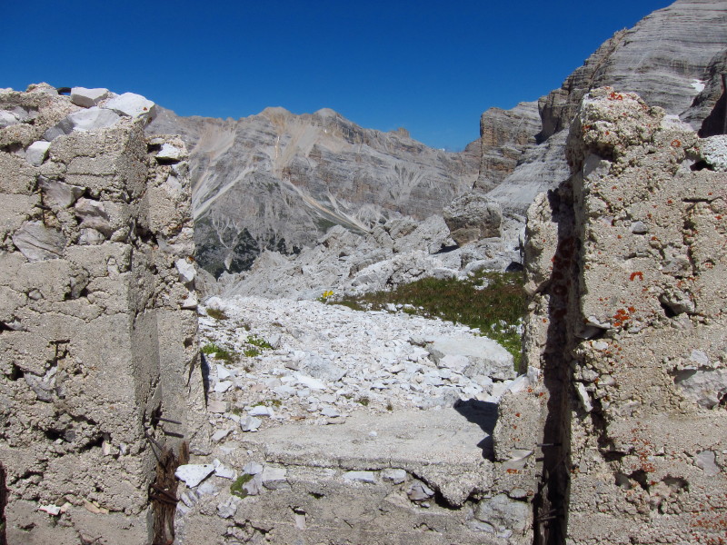
Looking through the window of a World War I hut
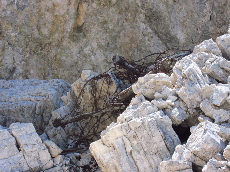
Tangled barbed wire has lain here for over 90 years
A look back at Tofana de Rozes as I gradually descend.
The route on this side is nothing like the constructed track on the
south side, and although not difficult at first, becomes more demanding
as the hanging valley I'm in steepens in opening out into the main
valley.
More war works
Looking back up along my line of descent
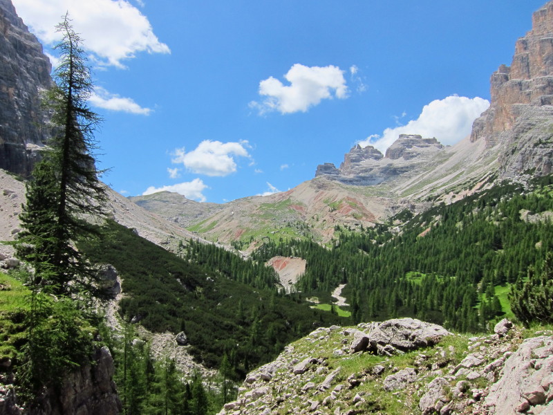
The valley ahead. Eventually my way will lie to the left to the col
still hidden from here.
More war remains, and the view into the valley is now becoming more
open, with my route still around to the left.
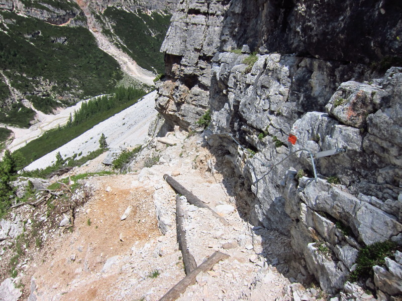
The way starts to get more difficult with steep drops to the side under
loose stones. Here there is a wire in the rock to hold on to, so this
section was not difficult, but unfortunately there weren't many wires.
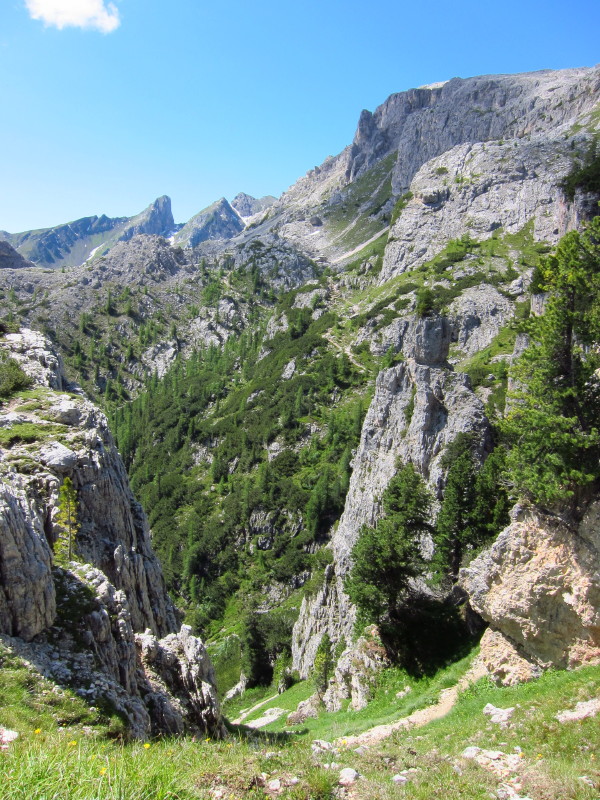
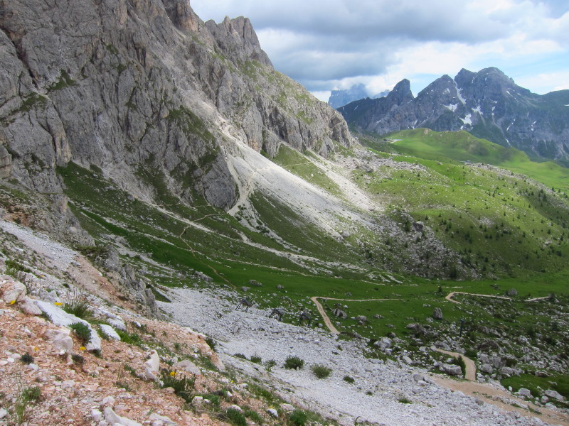
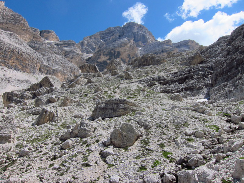
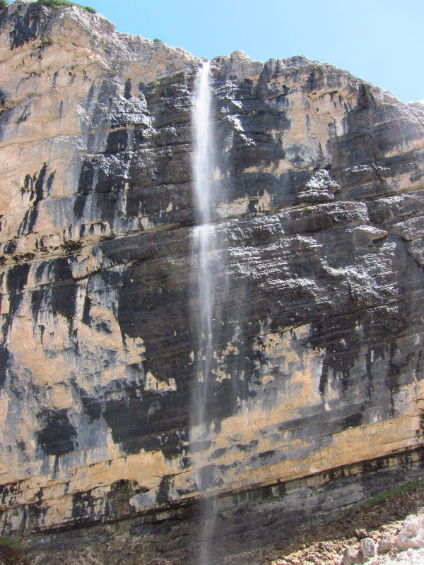
At last, on the valley route, though not yet clear of the difficulties.
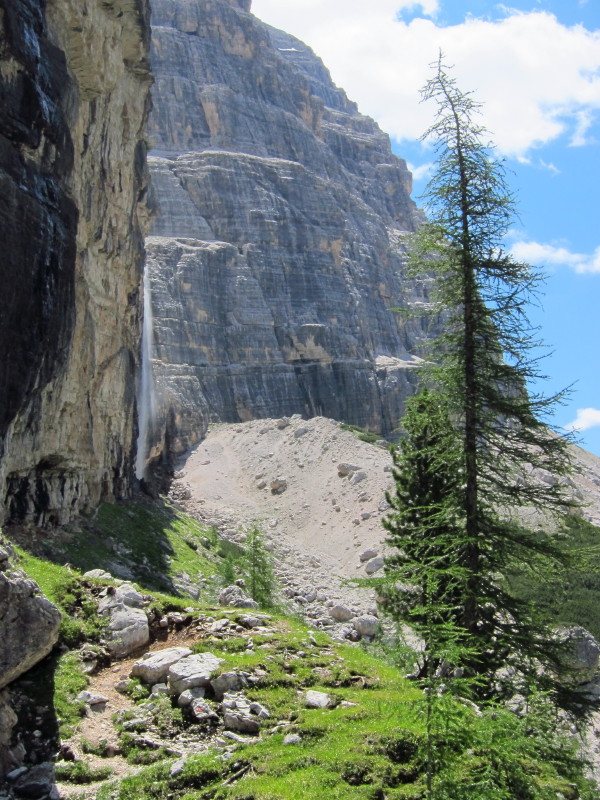
Note the waterfall plunging down the cliff face. In places the path went
behind a very diffuse waterfall
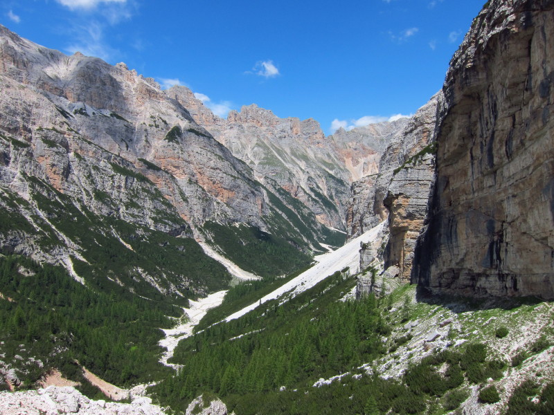
Making progress up towards the col, a look back along the Travenanzes
valley
More war remains - they really are everywhere
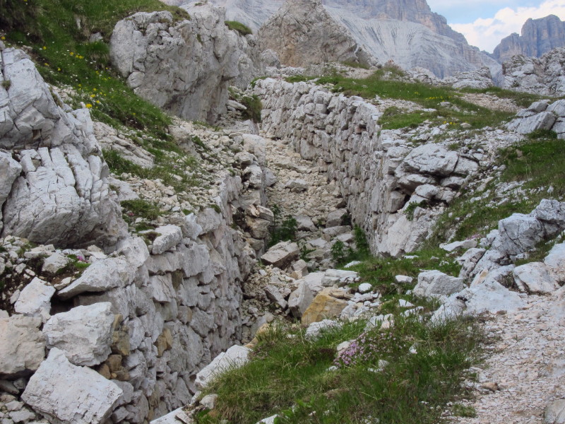
At the col, with the height gain all done for the day, there are
trenches cut out of the mountain. When I 'd previously thought of World
War I trenches, I'd thought of mud in France and the Low Countries, but
this is something rather different, 2330 metres up in the mountains.
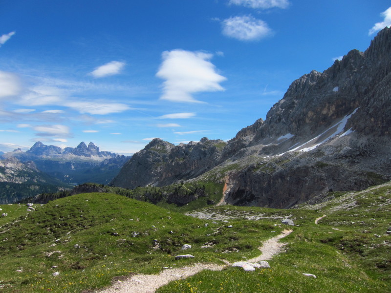
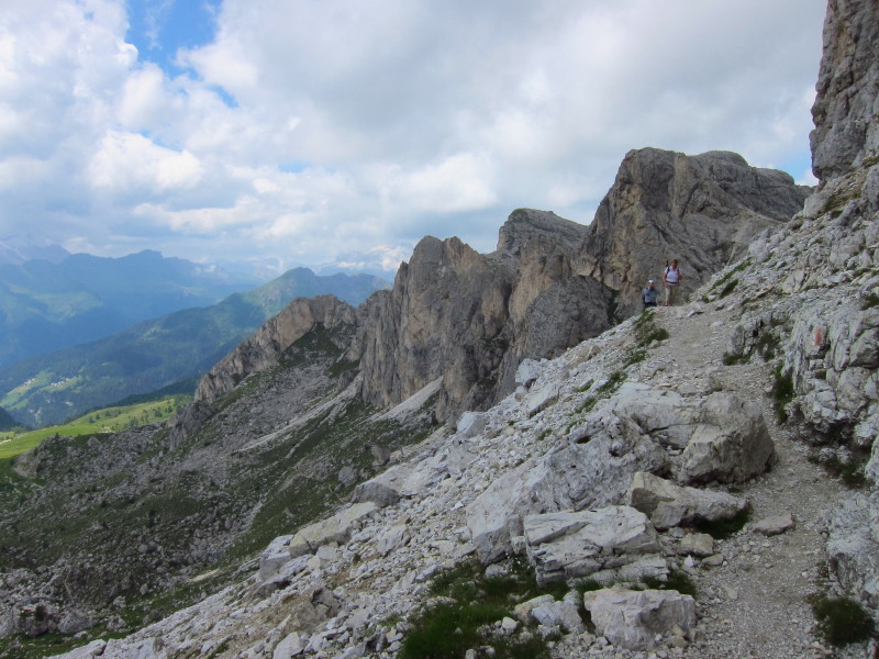
Beginning the descent, ahead are the Cinque Tori, Nuvolao and Averau
A thin path traces its way on a short route down the hillside, but I
chose to take the longer zigzagging track which was easy underfoot and
allowed for a great pace in descent.
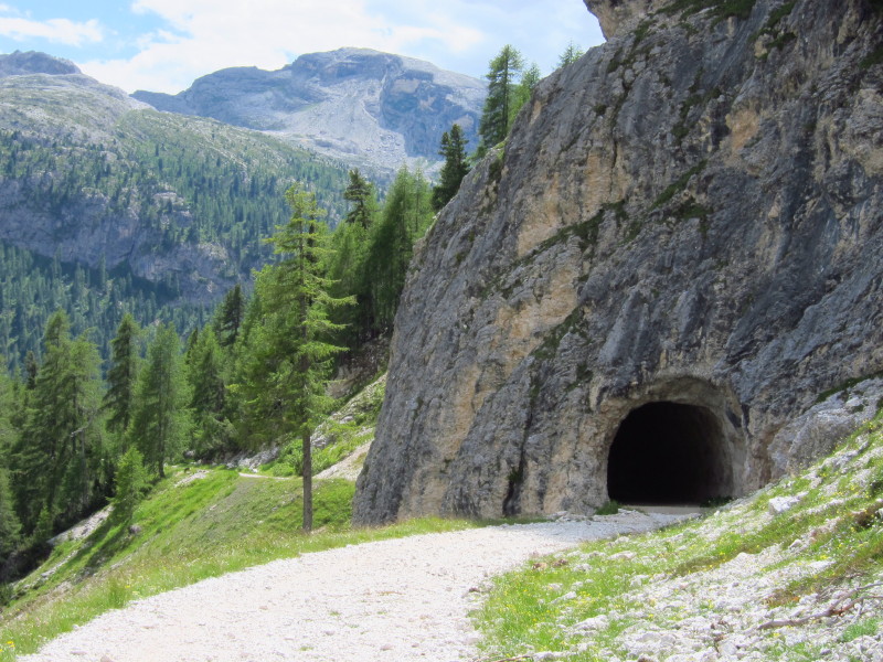
The track and this tunnel on it are useful relics of the war
The last section was through woodland, dodging Italian Army trucks on a
track.
Thursday 7 July 2011: Dürrensee / Lago di Landro
On Thursday we spent the morning exploring the fort and open war remains
at Sas de Stria, after which we drove north and east towards Austria.
Once over a key road pass, despite being still in Italy all the signs
were in German first and Italian second.
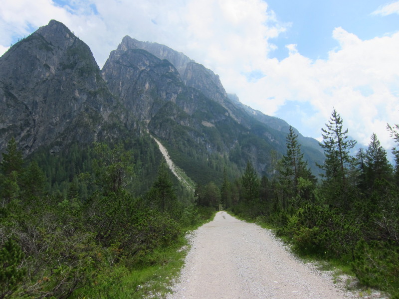
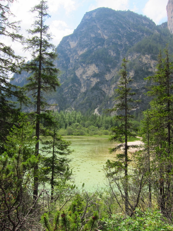
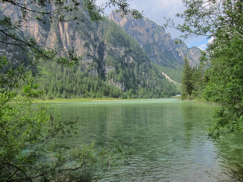
Our objective was a walk in the Drei Zinnen Natural Park around the lake
known as Dürrensee in German or Lago di Landro in Italian
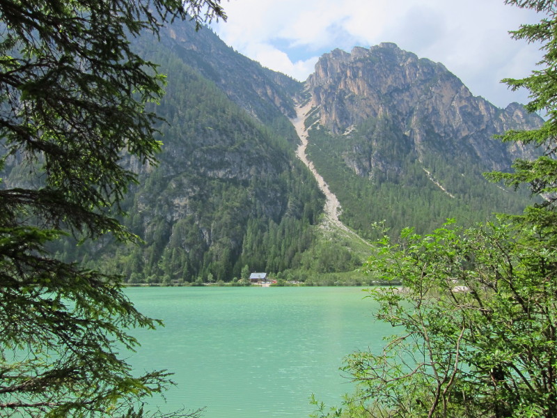
The lake is shallow and has a lovely colour to it
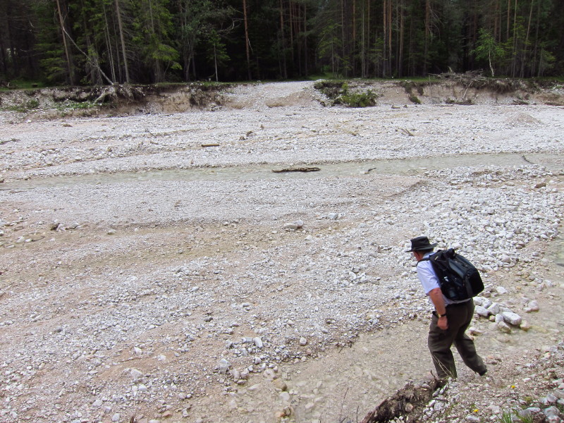
The narrow blue line on my map, which I'd assumed to be a stream turned
out to be this broad river with no bridge, but fortunately also very
little water in July.
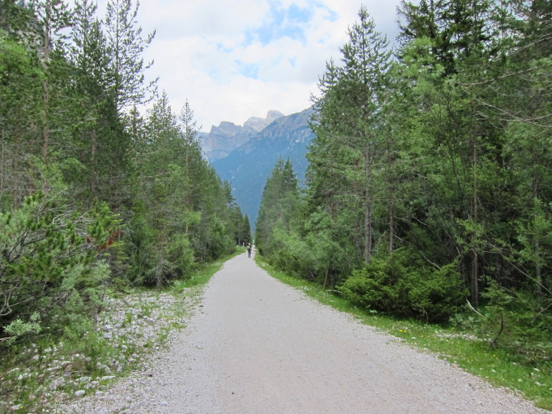
Having walked the eastern half of the route on forest paths and tracks,
the route back is along the line of the old railway, which makes for a
very easy stroll (except where damaged by flood water), cycle ride, or
in winter is said to be great for cross-country skiing.
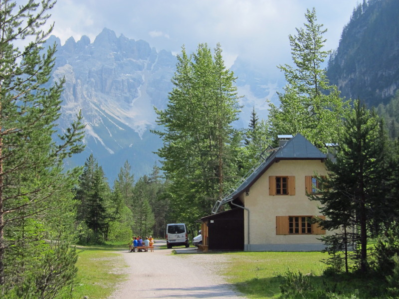
At one point this group had moved their table into the middle of the
railway line.
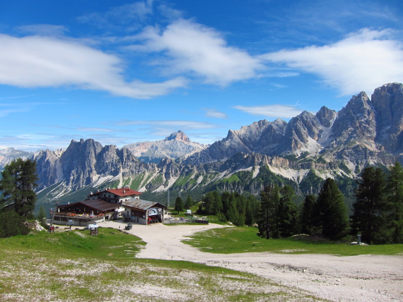
Friday 8 July 2011: Circuit of Averau
We spent the first part of the morning exploring the open-air museum of
Cinque Tori, then stopped at the Rifugio Scoiattoli for refreshments
before the main part of our walk.
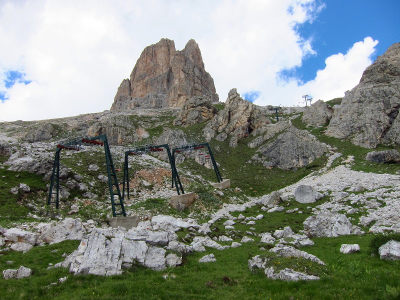
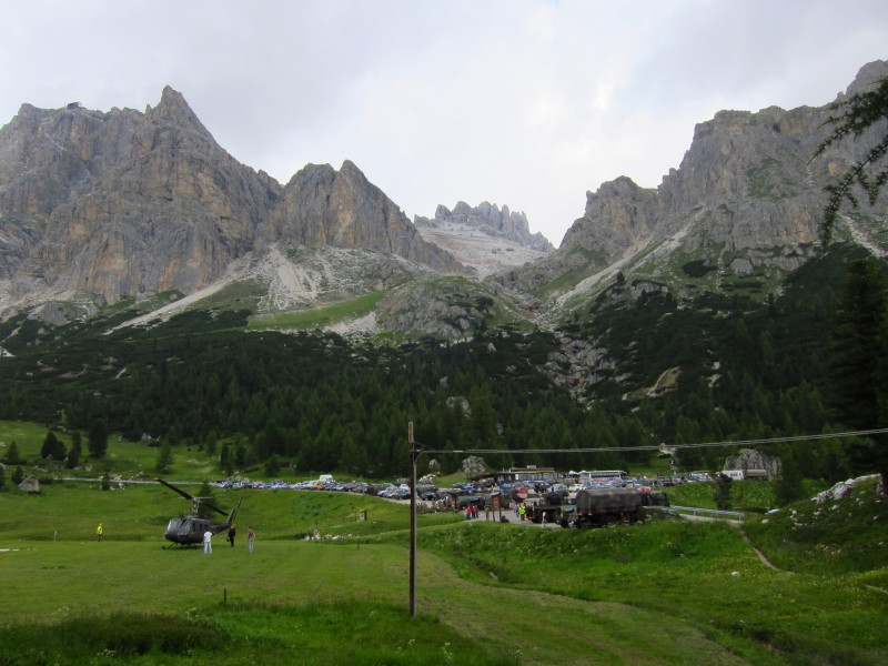
We retraced old ground for a short way, making our way up to Rifugio
Averau at 2413 metres, this section of the walk being somewhat plagued
by the noise of the concrete mixer lorries and particularly the
helicopter (lower right), all being involved in building or rebuilding a
chairlift.
Rifugio Averau, and we are on new ground again, having ascended from the
right to here on Monday.
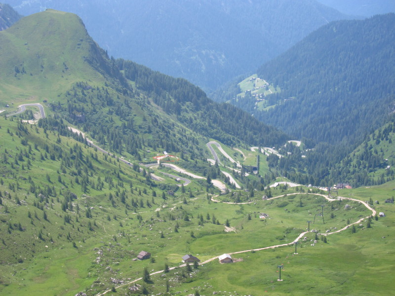
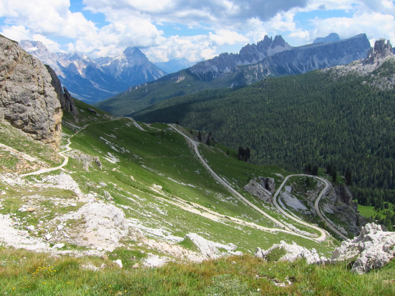
Looking down into the valley with its impressive winding road
Our way lies around the side of Averau
We reach the col of Forc. Averau at 2435 metres, after which it's
downhill to the car at 1889 metres.
In the col ahead is the fort we visited on Thursday morning, and the
sharp peak of Sas de Stria we climbed part way up to explore the war
remains.
The peak of Lagazuoi Pizo was prominent in views during our descent.
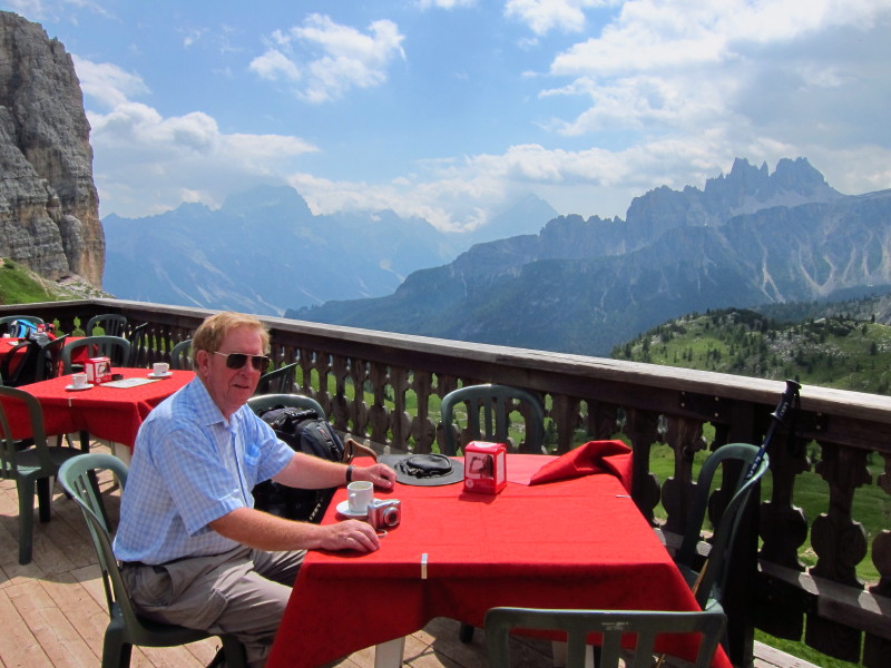
This is the view from our lunch spot.
Back in the valley, we have a descending path through the forest and
meadows, passing the Italian Army still on manoeuvres
Almost back at the car, and so completes our last walk.
Carry on to the next page for our explorations of the Alpine war
remains.
Dolomites holiday, July 2011
|
|