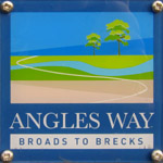
Angles WayThe Angles Way is a footpath which is branded "From Broads to Brecks", running from Great Yarmouth along the routes of the Rivers Yare, Waveney and Little Ouse (and thus broadly the Norfolk/Suffolk border). Originally it went to Knettishall Heath (making its length 125 km), near where the Icknield Way Path and the Peddars Way meet: on its way it passes the start of the Mid-Suffolk Footpath. In January 2012 the information board at Knettishall Heath recorded that as one end of the walk, and in April 2013 the information board at Great Yarmouth still showed the route as going from/to Knettishall Heath. However in April 2013 I also noticed that the Norfolk County Council website recorded that "Originally, the start point for Angles Way was at Knettishall Heath. A few years ago this was extended by approximately 15 miles through the beautiful Breckland countryside to link to Barnham Cross Common on the edge of Thetford." That makes the full length of the route about 148 km. The route was voted the best waterside walk in Britain by waterscape.com in 2003. That seems an odd vote since though the walk roughly follows the River Waveney for much of its length, I would estimate only about a quarter of the walk is alongside the river. Having said that, bits of the route, notably Beccles to Oulton Broad and Belton to Great Yarmouth, are delightful along the river.
Although now "officially" described as running from Great Yarmouth, on the whole I prefer to walk from west to east, and although Knettishall Heath is a fine place, hopefully to get better in the care of Suffolk Wildlife Trust rather than the County Council who've abandoned it, I thought that the Heath would serve just as well as an inspiring start and The Broads (and, with a short extension, the sea) would be a good finale - old style waymarkers that I found en route showed, for those going west-to-east, the description "Brecks to Broads", but in replacing them with uniform waymarkers, a single brand has been adopted. Additionally, as the first two long distance paths I mentioned above meet on the western side of Knettishall Heath, it seemed to me that it was therefore much more satisfying for the Angles Way to connect with them rather than finishing on the eastern side of the Heath, and so I started from the west with a short extension to the official route. My walks on the Angles Way
Total walked so far: 148 km. Complete including the "new" section from Thetford to Knettishall Heath. The Angles Way links
|