|
An early start saw George and Stephen at Mardale Head before 8 o'clock. Having
walked alongside Haweswater to The Rigg, we now prepare to climb the long ridge
which leads directly to the summit of High Street

Looking across the (unseen) Small Water to Nan Bield Pass, with Harter Fell on
the left and Mardale Ill Bell on the right
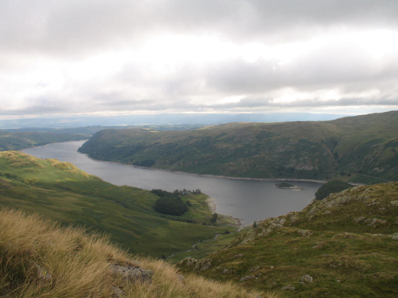
As we ascend the ridge, a look back along Haweswater

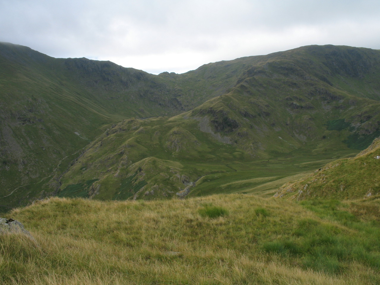
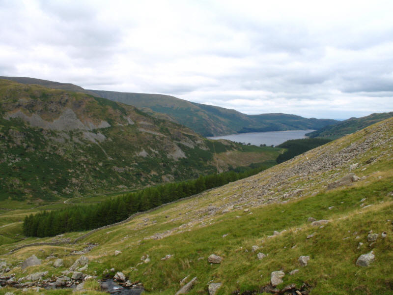
Gatesgarth Pass between Branstree and Harter Fell, with Tarn Crag appearing over
the col.

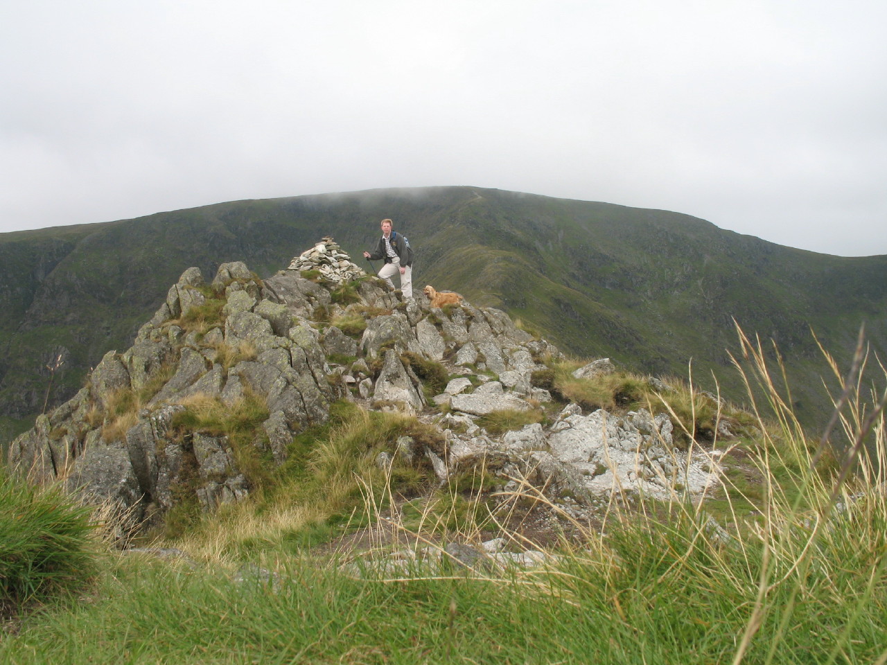
George takes a breather on our ascent of Rough Crag
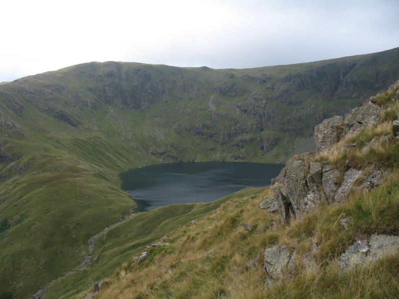
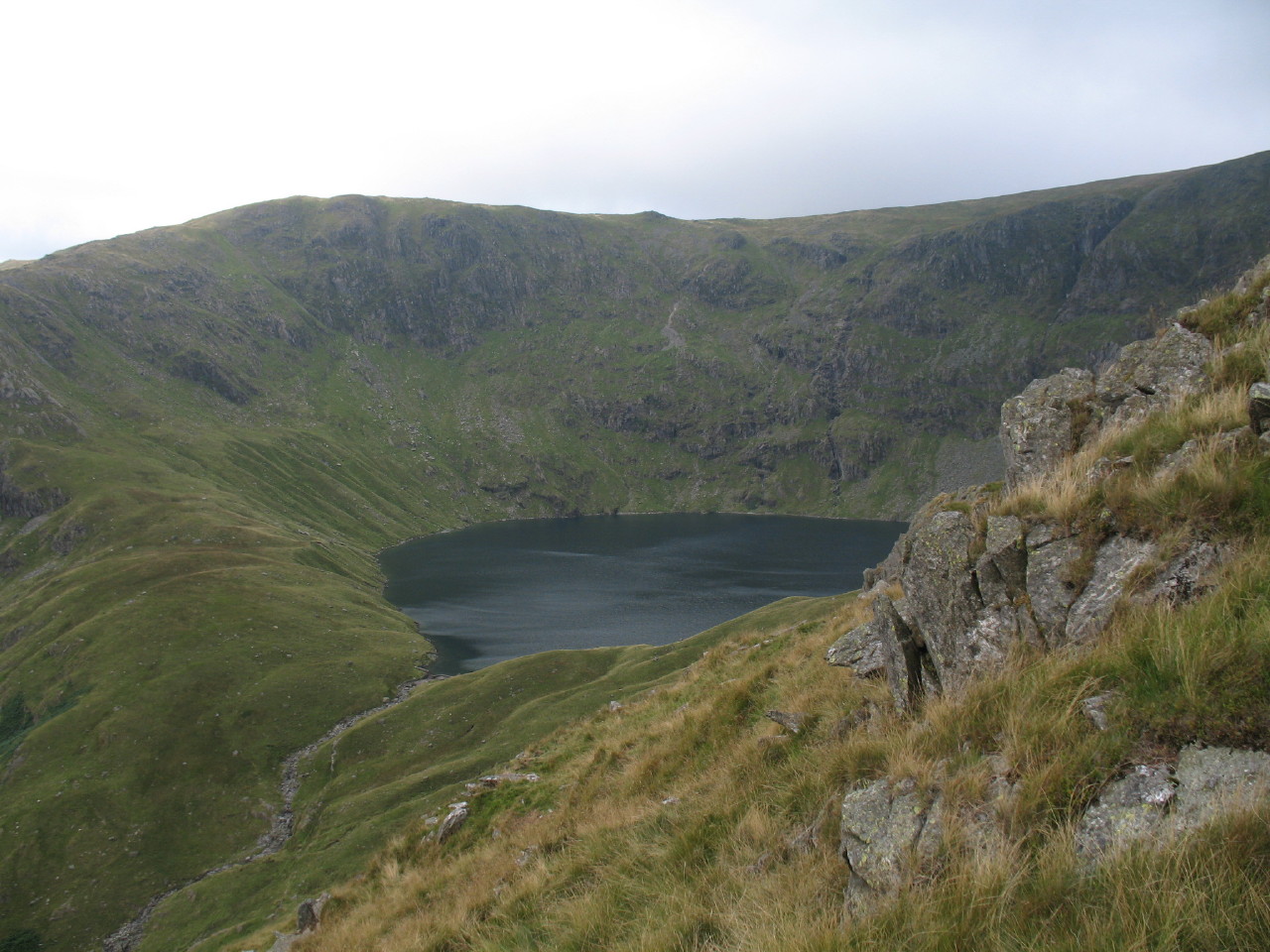
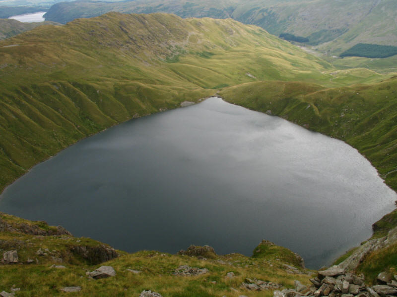
The impressive Blea Water comes into view - we last saw
Blea Water in winter.

Stephen and George on the summit of Rough Crag (628 metres above sea level) with
High Street Behind, its summit gradually emerging as the cloud lifts during our
ascent.
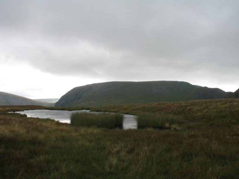
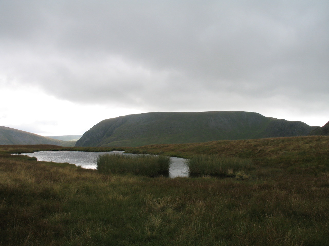
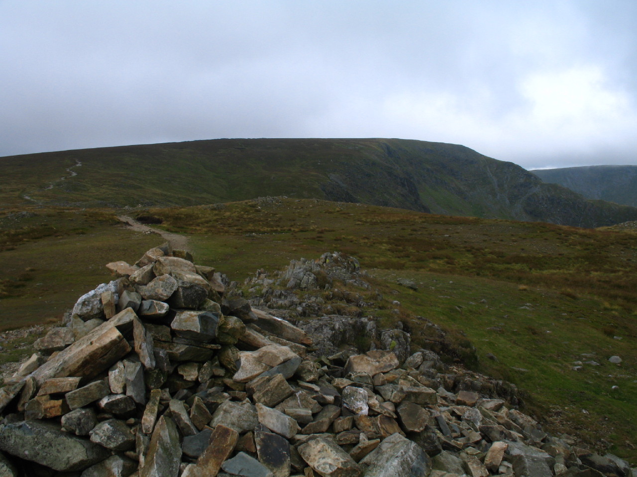
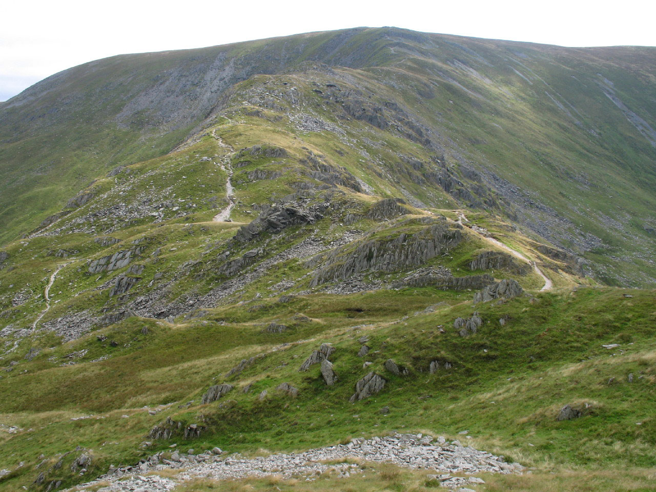
Beyond the summit of Rough Crag, the ridge descends slightly before the final
pull to High Street; the col is named Caspel Gate, and contains this tarn,
pictured with Harter Fell beyond.
Almost at the summit of High Street, a retrospective view, with Riggindale
leading to Haweswater, and the ridge of Long Stile leading to that tarn at
Caspel Gate and then the summit of Rough Crag, behind which the declining ridge
runs to wooded promentary of The Nab, which can be seen jutting out into the
lake.
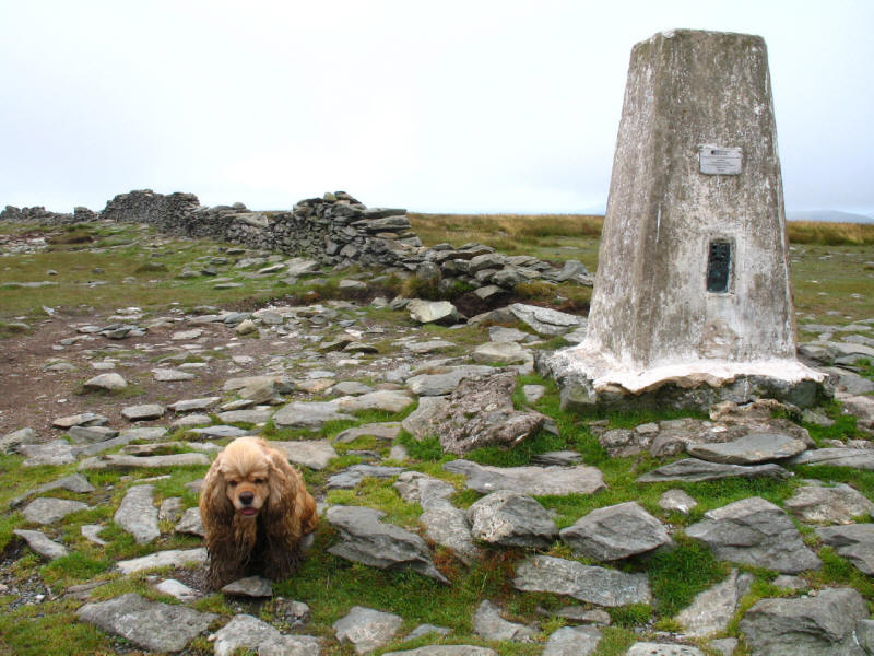
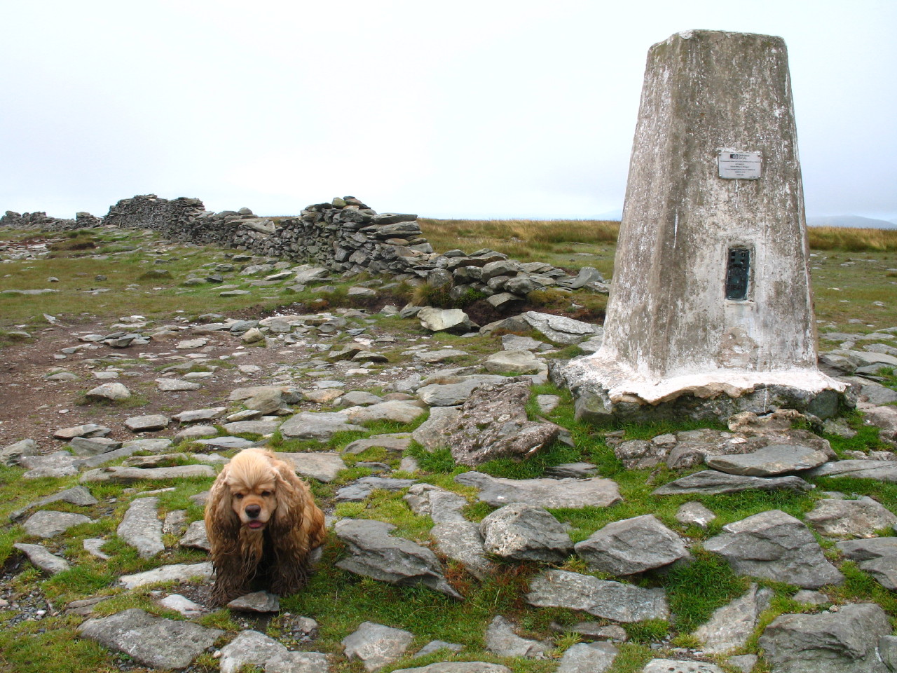
A muddy George on top of High Street (828 metres above sea level). The summit
itself is unexciting, the rounded dome curtailing views into the neighbouring
valleys.
A short distance to the west is the High Street itself, route
of a Roman road across the fells between the forts of Brocavum near Penrith and
Galava at Ambleside. Here we see it running north across the pass named
Straights of Riggindale before turning right to cross near the summit of
Rampsgill Head. Its antiquity is suggested by the fact that this "road", now
kept alive by walkers, doesn't visit the fell summits, but merely keeps to the
high ground.
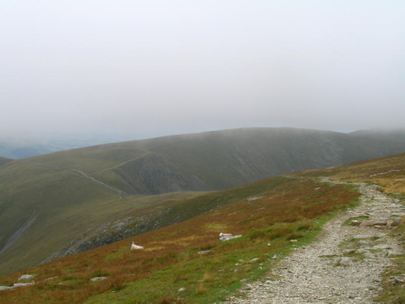
Windermere peeks into view through the bottom of the clouds
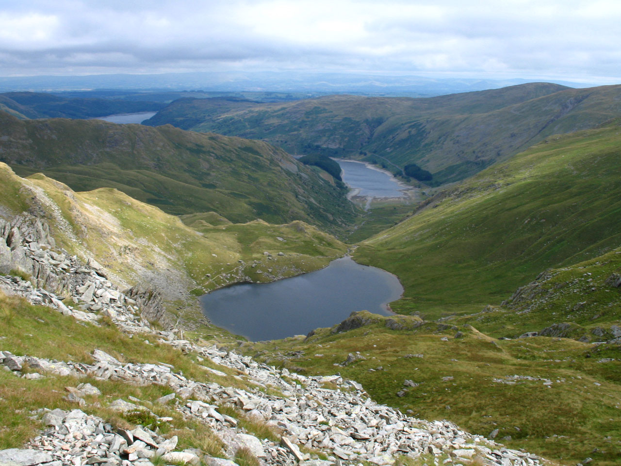
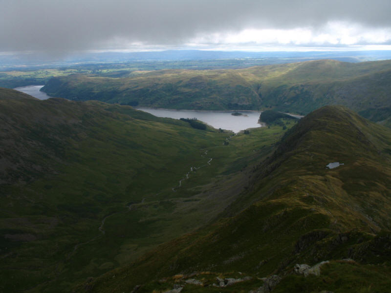
Taking the route along the edge of the escarpment to Mardale Ill Bell, we get a
dramatic look down onto Blea Water. Behind, running from the left across the top
of the picture, is the long ridge we climbed along the top of earlier this
morning to reach High Street. The scene made me yearn for the wide angle lens on
my previous camera.
The summit of Mardale Ill Bell. Although raised little from the col that links
it with High Street, it has a distinct presence.
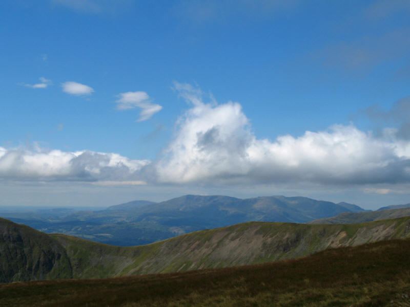
Looking across the ridge of Thornthwaite Crag, the Coniston Fells come into
view, with Black Combe peeking into view on the left of the Dow Crag ridge.
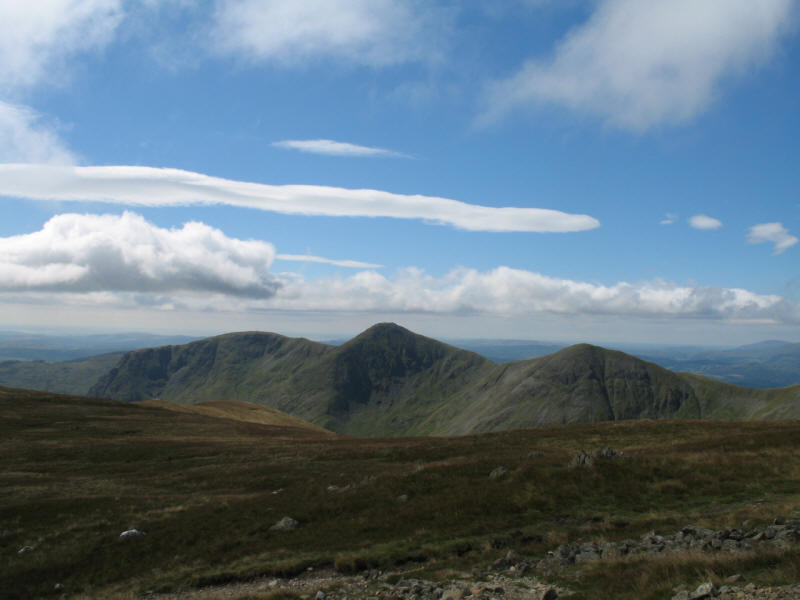
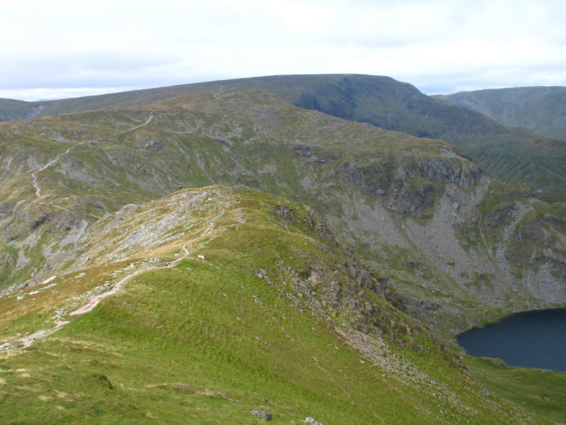
As we descend towards the Nan Bield Pass, the triple-summits of Yoke, Froswick
and Ill Bell are prominent.

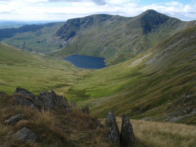
A stop for a rest and reflection, as we look down on Nan Bield Pass with Harter
Fell beyond. The original plan had been to descend from Nan Bield, but with such
good time having been made, and with the legs bearing up very well, and George
still full of boundless energy, a decision was made to visit Harter Fell too,
and descend via Gatesgarth Pass.
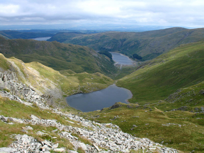
As we near Nan Bield, a look across Small Water down to Haweswater
Kentmere Reservoir with Yoke and Froswick behind.
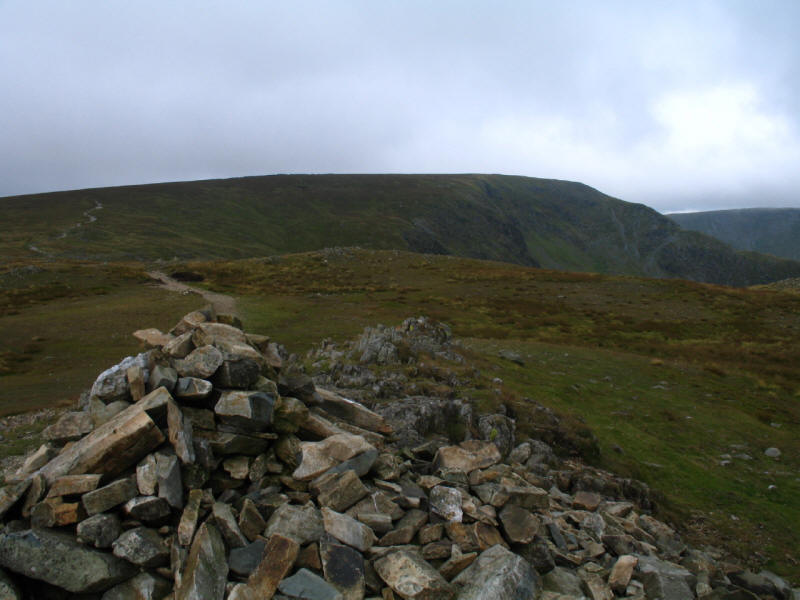
The wall shelter sits on the crest of Nan Bield Pass - a very tidy pass, with
the two ascents from Mardale and Kentmere meeting with the two paths from
Mardale Ill Bell and Harter Fell at a definite point with hardly a square metre
of level ground - a true saddle.
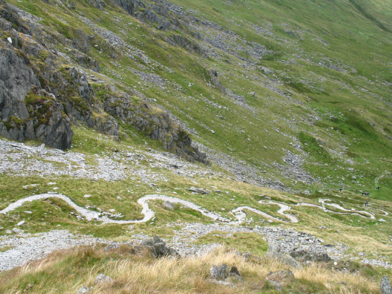
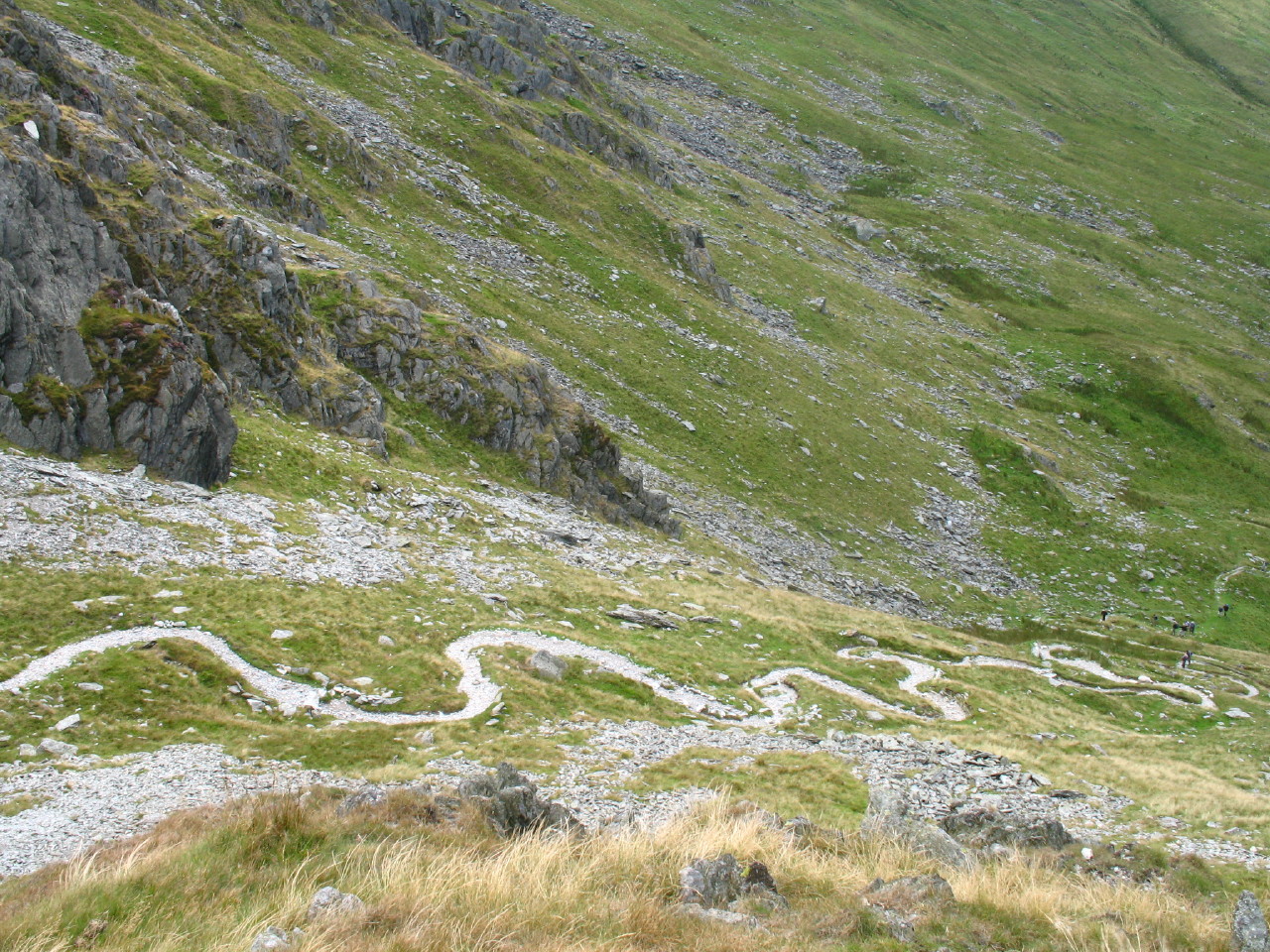
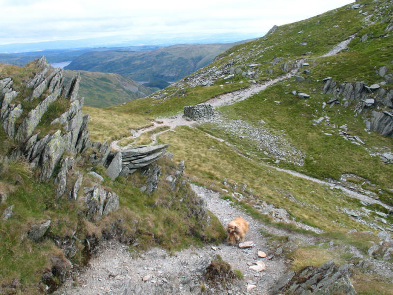
Looking down the path from Nan Bield into Kentmere, there is a beautiful set of
zig-zags. It is remarkable that so few paths have developed like this - when
faced with a stiff climb with no path, I tend to zig-zag naturally, but it seems
that so many people tend to take the most direct course, but happily not here.
As we near the summit of Harter Fell, a look back along the ridge from Nan Bield,
then across Mardale Ill Bell to High Street.
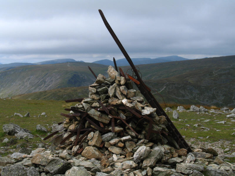
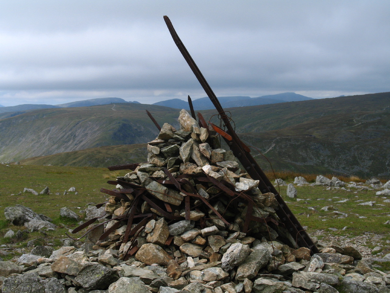
The summit cairn on Harter Fell is an odd affair, being a mixture of stones and
the rusting remains of old fence posts.

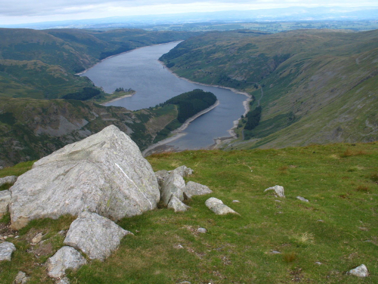
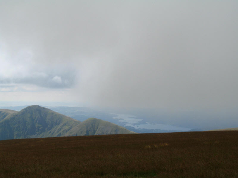
From near the corner in the fence on the descent towards Gatesgarth, a look
along Haweswatere. It was here that A. Wainright was pictured in his Guide and
which was used in the TV programmes from the 1980s.
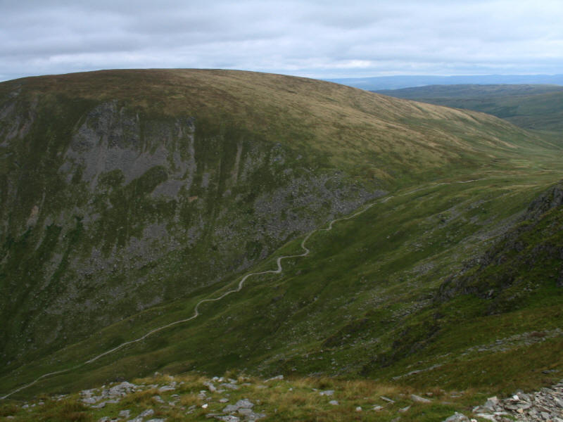
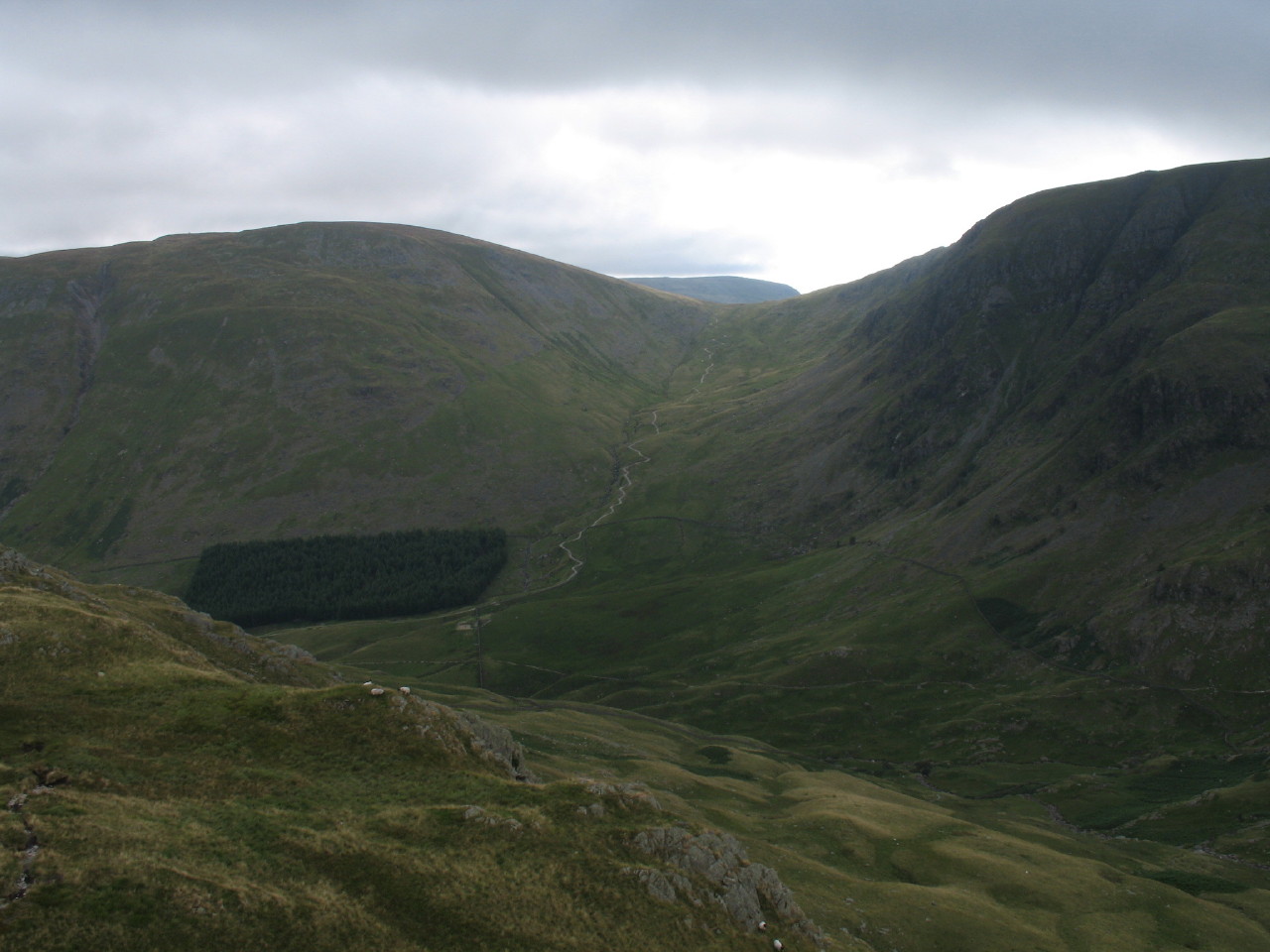
A look from Harter Fell to Gatesgarth Pass, with more zigzags, with Branstree
beyond. The path from Harter Fell to the top of the pass has been repaired, but
unlike some repaired paths with their large stones, this was very easy to walk,
and we were at the top of the pass in no time at all. After a short rest we
continued along the route down to Mardale: this section is a byway, but
fortunately a Traffic Regulation Order prevents motorised vehicles from using it
except for access to agricultural land, and the path remains in good condition.
The valley bottom nears, and the walk is nearly over - an excellent expedition.
Total distance 12.7km, taking 5 hours 50 minutes (including 2 hours stopped).
Lake District holiday, August 2006
|
|